Landhaura
| Landhaura लन्दौरा | |
|---|---|
| city | |
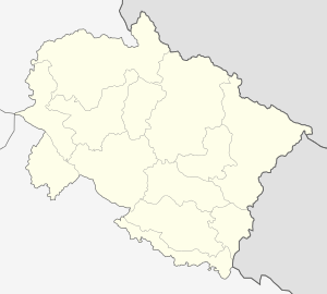 Landhaura  Landhaura Location in Uttarakhand, India | |
| Coordinates: 29°49′N 77°56′E / 29.82°N 77.93°ECoordinates: 29°49′N 77°56′E / 29.82°N 77.93°E | |
| Country |
|
| State | Uttarakhand |
| District | Haridwar |
| Population (2011) | |
| • Total | 28,786 |
| Languages | |
| • Official | Hindi |
| Time zone | IST (UTC+5:30) |
| PIN | 247664 |
| Vehicle registration | UK |
| Website |
uk |
Landhaura is a town and a nagar panchayat in Haridwar district in the Indian state of Uttarakhand.
Geography
Landhaura is located at 29°49′N 77°56′E / 29.82°N 77.93°E.[1]
Demographics
As of 2011 India census,[2] Landhaura had a population of 28786. Males constitute 54% of the population and females 46%. Landhaura has an average literacy rate of 72%, lower than the national average of 73%: male literacy is 82%, and female literacy is 62%. In Landhaura, 22% of the population is under 6 years of age.
History
The Landhaura state was formed by a Gurjar chief in the 18th century, and when the area came under British occupation in 1803, it was ruled by Gurjar king Ramdayal Singh. His descendant Kunwar Pranav Singh "Champion" is M.L.A. (3rd term consecutively) in Khanpur Constituency and is having Cabinet Minister Status in the ongoing State Government of Uttarakhand. Kranti Film based on Landhaura Riyasat of Gurjars directed by Manoj Kumar . [3]
Politics
It is an electoral constituency of Uttarakhand State Legislative Assembly of Haridwar district,[4] and the current MLA (3rd term consecutively) from Landhaura is Kunwar Pranav Singh "Champion" and is having Cabinet Minister Status in the ongoing State Government of Uttarakhand. [5]
References
- ↑ Wikimapia page for Landhaura
- ↑ "Census of India 2011: Data from the 2001 Census, including cities, villages and towns (Provisional)". Census Commission of India. Archived from the original on 2004-06-16. Retrieved 2008-11-01.
- ↑ Raheja, Gloria Goodwin (1988). The poison in the gift: ritual, prestation, and the dominant caste in a north Indian village. University of Chicago Press. pp. 1–2. ISBN 0226707288, ISBN 978-0-226-70728-0.
- ↑ List of Public Representatives from Haridwar Official website of the Haridwar.
- ↑ Landhaura- Uttarakhand Election Commission of India, State Elections 2007.
External links
- Official website of Landhaura
- A song about the king of Landhaura
- History of Landhora
- Landhaura on wikimapia