Landfall Island
| Native name: <span class="nickname" ">Talrichiro, Taramikhu and Tanmoker [1] | |
|---|---|
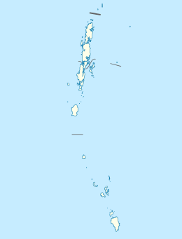 Landfall Island Location of East Island | |
| Geography | |
| Location | Bay of Bengal |
| Coordinates | 13°39′N 93°00′E / 13.65°N 93.00°ECoordinates: 13°39′N 93°00′E / 13.65°N 93.00°E |
| Archipelago | Andaman Islands |
| Adjacent bodies of water | Indian Ocean |
| Total islands | 1 |
| Major islands |
|
| Area | 14.70 km2 (5.68 sq mi)[2] |
| Length | 4.7 km (2.92 mi) |
| Width | 5.3 km (3.29 mi) |
| Coastline | 20.00 km (12.427 mi) |
| Highest elevation | 79 m (259 ft)[3] |
| Highest point | north hill |
| Administration | |
| District | North and Middle Andaman |
| Island group | Andaman Islands |
| Island sub-group | Cleugh Passage Group |
| Taluk | Diglipur Taluk |
Largest settlement |
Landfall village (population 6) |
| Demographics | |
| Demonym | Hindi |
| Population | 6 (2016) |
| Pop. density | 0.4 /km2 (1 /sq mi) |
| Ethnic groups | Hindu, Andamanese |
| Additional information | |
| Time zone | |
| PIN | 744202[4] |
| Telephone code | 031927 [5] |
| Official website |
www |
| ISO Code | IN-AN-00[6] |
| Literacy | 100.0% |
| Avg. summer temperature | 30.2 °C (86.4 °F) |
| Avg. winter temperature | 23.0 °C (73.4 °F) |
| Sex ratio | 15.0♂/♀ |
| unit_pref | Metric |
| Census Code | 35.639.0004 |
| Official Languages | Hindi, English |
Landfall Island is northern most island of Andaman and Nicobar Islands.[7][8] It belongs to the North and Middle Andaman administrative district, part of the Indian union territory of Andaman and Nicobar Islands.[9] the island is lying 220 km (137 mi) north from Port Blair, and 300 km (186 mi) km from Burma.[8]
History
The island was severely affected by the tsunami that was caused by the 2004 Indian Ocean earthquake, which led to damaged infrastructure. The island's coral reefs were exposed in bulk. It is home to aka-chari tribe.[10]
Geography
The island falls in between Coco Islands and North Andaman Island. It belongs to the Cleugh Passage Group and lies immediately north of the passage. The island is small, having an area of 3.1 km2 (1.2 sq mi).
Administration
Politically, Landfall Island, along neighboring Cleugh Passage Group Islands, is part of Diglipur Taluk.[11] The village is near the Police station.
Transportation
Ferries connect this island to Diglipur.[10]
Demographics
There is only 1 village. According to the 2011 census of India, the Island has xxx households. The effective literacy rate (i.e. the literacy rate of population excluding children aged 6 and below) is 100%.[12]
| Total | Male | Female | |
|---|---|---|---|
| Population | 6 | 0 | 0 |
| Children aged below 6 years | 0 | 0 | 0 |
| Scheduled caste | 0 | 0 | 0 |
| Scheduled tribe | 6 | 0 | 0 |
| Literates | 6 | 0 | 0 |
| Workers (all) | 6 | 0 | 0 |
| Main workers (total) | 6 | 0 | 0 |
Tourism
Surrounded by beach on all sides, it gives exciting opportunities to indulge in sun bathing and snorkeling. Refreshing coconut palm groves, emerald waters and smooth silvery sandy beaches send you a tempting and an invigorating invite. It houses natural beauty in its pristine shape, immaculate and untouched by any human intervention. Owing to these reasons, Landfall Island has managed to maintain its maiden grace and gorgeousness. While exploring Landfall Island, be careful not to enter the tribal areas as aboriginal tribes reside here. It is not very evident whether staying at night on this island is allowed or not, so it is safe to return during the day. In a nut shell, it can be said without a doubt that Landfall Island in Andaman and Nicobar is a small yet sumptuous treat to your eyes. So, spare some time to navigate to this exotic island.
References
- ↑
- ↑ "Islandwise Area and Population - 2011 Census" (PDF). Government of Andaman.
- ↑ Pro Star
- ↑ "A&N Islands - Pincodes". 2016-09-22. Retrieved 2016-09-22.
- ↑ code
- ↑ Registration Plate Numbers added to ISO Code
- ↑ Ghosh, G.K. (1998). Tourism perspective in Andaman & Nicobar islands. New Delhi: APH. p. 26. ISBN 8170249783.
- 1 2 Bansal, Sunita Pant (2005). Encyclopaedia of India. New Delhi, India: Smriti Books. p. 54. ISBN 8187967714.
- ↑ "Village Code Directory: Andaman & Nicobar Islands" (PDF). Census of India. Retrieved January 16, 2011.
- 1 2 "Landfall Island in Andaman and Nicobar, Info of Landfall Island Andaman". Indiatravelnext.com. 2004-12-26. Retrieved 2016-09-22.
- ↑ Tehsils
- 1 2 "District Census Handbook - Andaman & Nicobar Islands" (PDF). 2011 Census of India. Directorate of Census Operations, Andaman & Nicobar Islands. Retrieved 2015-07-21.
- Geological Survey of India
-
 Andaman and Nicobar Islands travel guide from Wikivoyage