Lake Park, Minnesota
| Lake Park, Minnesota | |
|---|---|
| City | |
|
Logo | |
| Motto: Gateway to the Lakes | |
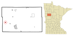 Location of Lake Park, Minnesota | |
| Coordinates: 46°53′9″N 96°5′44″W / 46.88583°N 96.09556°W | |
| Country | United States |
| State | Minnesota |
| County | Becker |
| Area[1] | |
| • Total | 0.97 sq mi (2.51 km2) |
| • Land | 0.97 sq mi (2.51 km2) |
| • Water | 0 sq mi (0 km2) |
| Elevation | 1,345 ft (410 m) |
| Population (2010)[2] | |
| • Total | 881 |
| • Estimate (2012[3]) | 881 |
| • Density | 807.2/sq mi (311.7/km2) |
| Time zone | Central (CST) (UTC-6) |
| • Summer (DST) | CDT (UTC-5) |
| ZIP code | 56554 |
| Area code(s) | 218 |
| FIPS code | 27-34784[4] |
| GNIS feature ID | 0646380[5] |

Lake Park is a city in Becker County, Minnesota, United States. The population was 881 at the 2010 census.[6]
History
Lake Park had its start in 1871 when the railroad was extended to that point.[7] The city was originally built up chiefly by Scandinavians.[8]
Geography
According to the United States Census Bureau, the city has a total area of 0.97 square miles (2.51 km2), all of it land.[1]
Lake Park is located on U.S. Route 10, five miles east of the county line and is southwest of Labelle Lake. The only school in Lake Park is the Lake Park/Audubon high school.
Demographics
| Historical population | |||
|---|---|---|---|
| Census | Pop. | %± | |
| 1890 | 349 | — | |
| 1900 | 570 | 63.3% | |
| 1910 | 740 | 29.8% | |
| 1920 | 700 | −5.4% | |
| 1930 | 624 | −10.9% | |
| 1940 | 654 | 4.8% | |
| 1950 | 689 | 5.4% | |
| 1960 | 730 | 6.0% | |
| 1970 | 658 | −9.9% | |
| 1980 | 716 | 8.8% | |
| 1990 | 638 | −10.9% | |
| 2000 | 782 | 22.6% | |
| 2010 | 783 | 0.1% | |
| Est. 2015 | 779 | [9] | −0.5% |
2010 census
As of the census[2] of 2010, there were 881 people, 316 households, and 216 families residing in the city. The population density was 807.2 inhabitants per square mile (311.7/km2). There were 350 housing units at an average density of 360.8 per square mile (139.3/km2). The racial makeup of the city was 96.3% White, 0.1% African American, 1.9% Native American, 0.3% Asian, and 1.4% from two or more races. Hispanic or Latino of any race were 0.8% of the population.
There were 316 households of which 39.2% had children under the age of 18 living with them, 47.2% were married couples living together, 13.9% had a female householder with no husband present, 7.3% had a male householder with no wife present, and 31.6% were non-families. 26.3% of all households were made up of individuals and 12.4% had someone living alone who was 65 years of age or older. The average household size was 2.48 and the average family size was 2.94.
The median age in the city was 35.6 years. 28.6% of residents were under the age of 18; 7.1% were between the ages of 18 and 24; 26.6% were from 25 to 44; 24.9% were from 45 to 64; and 12.9% were 65 years of age or older. The gender makeup of the city was 49.4% male and 50.6% female.
2000 census
At the 2000 census,[4] there were 782 people, 308 households and 198 families residing in the city. The population density was 799.4 per square mile (308.1/km²). There were 326 housing units at an average density of 333.2 per square mile (128.4/km²). The racial makeup of the city was 95.91% White, 0.26% African American, 1.28% Native American, 0.38% Asian, and 2.17% from two or more races. Hispanic or Latino of any race were 0.38% of the population.
There were 308 households of which 38.3% had children under the age of 18 living with them, 48.7% were married couples living together, 10.4% had a female householder with no husband present, and 35.7% were non-families. 31.5% of all households were made up of individuals and 17.5% had someone living alone who was 65 years of age or older. The average household size was 2.54 and the average family size was 3.22.
Age distribution was 32.0% under the age of 18, 7.4% from 18 to 24, 30.8% from 25 to 44, 15.2% from 45 to 64, and 14.6% who were 65 years of age or older. The median age was 32 years. For every 100 females there were 98.5 males. For every 100 females age 18 and over, there were 92.8 males.
The median household income was $32,857, and the median family income was $41,250. Males had a median income of $31,048 versus $16,932 for females. The per capita income for the city was $14,307. About 6.8% of families and 10.1% of the population were below the poverty line, including 7.8% of those under age 18 and 19.8% of those age 65 or over.
City Government
The City of Lake Park is Minnesota Statutory Plan A City of the Fourth Class governed solely by a City Council headed by an elected Mayor, and four council members elected at-large. One council member is appointed by the Mayor to serve as the Vice-Mayor.
Recent City Politics
Aaron Lee Wittnebel was elected city mayor in 2012, running unopposed after the former Mayor Zachariason chose not seek re-election.[11] At age 31, Wittnebel was the youngest person to be elected Mayor for the City of Lake Park.[12]
In April 2014, Wittnebel was sentenced to 30 days in the Becker County Jail and five years of supervised probation as part of a sentencing agreement reached with the county. The plea deal stemmed from charges that he had mishandled his developmentally disabled sister's finances, as her legal guardian and conservator.[13]
In addition to the criminal allegations, some residents, including members of the city council, accused Wittnebel of lying, wasting taxpayers money and mistreating city employees. While this controversy was unfolding, Wittnebel was arrested for driving after revocation, his license had been revoked in 2010 due to a DWI (driving while intoxicated) complaint.
After much public debate, Wittnebel submitted a letter of resignation to the city council in January, 2015. Former Mayor Zachariason was appointed to be Mayor of Lake Park until the 2016 election.[14]
Education
Lake Park's school system is combined with that of neighboring Audubon. The high school (7-12) is in Lake Park and the elementary school (1-6) is located in Audubon. The school's mascot is the Raider, a traditional depiction of a Pirate. The former mascot for Lake Park, was the Parker Penguin. The school's current Victory song/cheer has lyrics written by the first High School Principal for the newly formed LPA School District, Ron Fleming's daughter, using the chords from the Notre Dame Victory March.
References
- 1 2 "US Gazetteer files 2010". United States Census Bureau. Retrieved 2012-11-13.
- 1 2 "American FactFinder". United States Census Bureau. Retrieved 2012-11-13.
- ↑ "Population Estimates". United States Census Bureau. Retrieved 2013-05-28.
- 1 2 "American FactFinder". United States Census Bureau. Retrieved 2008-01-31.
- ↑ "US Board on Geographic Names". United States Geological Survey. 2007-10-25. Retrieved 2008-01-31.
- ↑ "2010 Census Redistricting Data (Public Law 94-171) Summary File". American FactFinder. U.S. Census Bureau, 2010 Census. Retrieved 23 April 2011.
- ↑ Upham, Warren (2001). Minnesota Place Names: A Geographical Encyclopedia. Minnesota Historical Society Press. p. 33. ISBN 978-0-87351-396-8.
- ↑ Winser, Henry Jacob; Riley, William C. (1897). The Official Northern Pacific Railway Guide: For the Use of Tourists and Travelers Over the Lines of the Northern Pacific Railway and Its Branches. Northern Pacific Railway. p. 60.
- ↑ "Annual Estimates of the Resident Population for Incorporated Places: April 1, 2010 to July 1, 2015". Retrieved July 2, 2016.
- ↑ "Census of Population and Housing". Census.gov. Retrieved June 4, 2015.
- ↑ http://minnesotaelectionresults.sos.state.mn.us/Results/MunicipalRaces/1?districtid=34784
- ↑ http://www.bluestemprairie.com/bluestemprairie/2012/11/out-about-in-becker-county-lake-park-mn-elects-openly-gay-mayor-aaron-wittnebel.html
- ↑ http://www.perhamfocus.com/content/lake-park-mayor-aaron-wittnebel-sentenced-30-days-jail-0
- ↑ http://www.wday.com/news/minnesota/3652303-lake-park-mayor-aaron-wittnebel-resigns
Municipalities and communities of Becker County, Minnesota, United States | ||
|---|---|---|
| Cities | 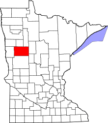 | |
| Townships |
| |
| CDPs | ||
| Unincorporated communities | ||
| Indian reservations | ||
| Footnotes | ‡This populated place also has portions in an adjacent county or counties | |
Coordinates: 46°53′11″N 96°05′40″W / 46.88639°N 96.09444°W