Lake George (village), New York
| Lake George | ||
| Village | ||
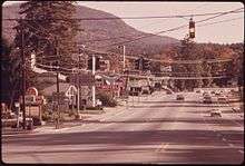
 View north along Canada Street | ||
|
||
| Name origin: from nearby body of water | ||
| Country | United States | |
|---|---|---|
| State | New York | |
| Region | Adirondacks | |
| County | Warren | |
| Town | Lake George | |
| Landmark | Lake George | |
| Center | Old county courthouse | |
| - elevation | 360 ft (110 m) | |
| - coordinates | 43°25′33″N 73°42′43″W / 43.42583°N 73.71194°WCoordinates: 43°25′33″N 73°42′43″W / 43.42583°N 73.71194°W | |
| Highest point | ||
| - location | NW corner of village | |
| - elevation | 480 ft (146 m) | |
| Lowest point | Lake shore | |
| - elevation | 353 ft (108 m) | |
| Area | 0.6 sq mi (2 km2) | |
| Population | 985 (2000) | |
| Density | 1,615.3/sq mi (624/km2) | |
| Founded | 1903 | |
| Government | Village Hall | |
| - location | 26 Old Post Road | |
| - coordinates | 43°25′54″N 73°42′58″W / 43.43167°N 73.71611°W | |
| Mayor | Robert Blais | |
| Timezone | Eastern (EST) (UTC-5) | |
| - summer (DST) | EDT (UTC-4) | |
| ZIP Code | 12845 | |
| Area code | 518 | |
| Exchange | 668 | |
| FIPS code | 36-40508 | |
| GNIS feature ID | 0954913 | |
 Location of Lake George within the state of New York | ||
| Website: Village of Lake George | ||

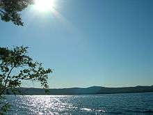
The Village of Lake George is a village within the town of Lake George in Warren County, New York, United States, located at the southern end of its namesake lake. The population was 985 at the 2000 census.[1] It is part of the Glens Falls Metropolitan Statistical Area.[2] The village and the surrounding area is a famous summertime tourist region and historic summer colony, which at one time included Alfred Stieglitz and Georgia O'Keeffe.
Lake George was the county seat of Warren County until 1963, when the county seat was moved to Queensbury.[3]
History
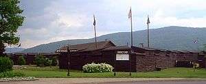
The village of Lake George was originally known as Caldwell, a name preserved in the Caldwell Presbyterian Church. Located on the southern end of Lake George within the eastern edge of the Adirondack Park, the village and surrounding area were on the route between the British and French colonies, and were often traversed by military forces during the Colonial wars. A reconstruction of Fort William Henry, which replaces the original burned during the French and Indian War, is within the village and serves as a living museum.
In the last quarter of the 19th century the area began to become an important tourist destination. Railroad tracks ran onto the steamboat docks on the south end of Lake George. From there steamboats ran several times a day to the hotels further north on the lake. The Lake George Steamboat Company continues to operate steamboats out of Lake George.

The Village of Lake George was incorporated in 1903. Besides the fort with its many associations, historic points of interest include the defunct railway station and a 19th-century courthouse and jail, now operated as a museum by the local historical society. The beach at one motel in the village features a plaque marking the site where the Marquis de Montcalm landed with his army preparatory to attacking the fort. A plaque at the site of the Bloody Pond Massacre is a short distance south of the village along US 9.
The Delaware and Hudson Passenger Station, Lake George Battlefield Park Historic District, Mohican II, Old Warren County Courthouse Complex, St. James Episcopal Church, and United States Post Office are listed on the National Register of Historic Places.[4][5][6][7]
Geography
According to the United States Census Bureau, the village has a total area of 0.6 square miles (1.6 km2), all land. It is situated beside Lake George. The village is located about 50 miles (80 km) north of Albany, New York and about 200 miles (322 km) north of New York City and northwest of Boston, Massachusetts.
Demographics
| Historical population | |||
|---|---|---|---|
| Census | Pop. | %± | |
| 1910 | 632 | — | |
| 1920 | 630 | −0.3% | |
| 1930 | 848 | 34.6% | |
| 1940 | 803 | −5.3% | |
| 1950 | 1,005 | 25.2% | |
| 1960 | 1,026 | 2.1% | |
| 1970 | 1,046 | 1.9% | |
| 1980 | 1,047 | 0.1% | |
| 1990 | 933 | −10.9% | |
| 2000 | 985 | 5.6% | |
| 2010 | 906 | −8.0% | |
| Est. 2015 | 890 | [8] | −1.8% |
As of the census[1] of 2000, there were 985 people, 448 households, and 237 families residing in the village. The population density was 1,615.3 people per square mile (623.5/km2). There are 579 housing units at an average density of 949.5 per square mile (366.5/km2). The racial makeup of the village is 97.36% White, 1.02% Black or African American, 0.10% Native American, 0.61% Asian, 0.30% from other races, and 0.61% from two or more races. Hispanic or Latino of any race were 0.71% of the population.
There were 448 households out of which 26.6% had children under the age of 18 living with them, 37.5% were married couples living together, 10.9% had a female householder with no husband present, and 46.9% were non-families. 36.6% of all households were made up of individuals and 10.7% had someone living alone who was 65 years of age or older. The average household size was 2.19 and the average family size was 2.90.
In the village the population was spread out with 22.5% under the age of 18, 8.5% from 18 to 24, 28.4% from 25 to 44, 26.6% from 45 to 64, and 13.9% who were 65 years of age or older. The median age was 40 years. For every 100 females there were 98.2 males. For every 100 females age 18 and over, there were 98.2 males.
The median income for a household in the village was $33,000, and the median income for a family was $45,625. Males had a median income of $29,318 versus $24,792 for females. The per capita income for the village was $20,077. About 7.7% of families and 11.1% of the population were below the poverty line, including 13.2% of those under the age of 18 and 15.2% of those 65 and older.
References
- 1 2 "American FactFinder". United States Census Bureau. Retrieved 2008-01-31.
- ↑ "Metropolitan Areas and Components, 1999, with FIPS Codes". US Census Bureau. Retrieved July 7, 2009.
- ↑ PostStar, Lake George Officials Consider New Use For Old Courthouse, Retrieved Jan. 14, 2015.
- ↑ National Park Service (2009-03-13). "National Register Information System". National Register of Historic Places. National Park Service.
- ↑ "National Register of Historic Places". Weekly List of Actions Taken on Properties: 12/27/11 through 12/30/11. National Park Service. 2012-01-06.
- ↑ "National Register of Historic Places". Weekly List of Actions Taken on Properties: 5/20/13 through 5/24/13. National Park Service. 2013-05-31.
- ↑ "National Register of Historic Places". Weekly List of Actions Taken on Properties: 12/09/13 through 12/13/13. National Park Service. 2013-12-20.
- ↑ "Annual Estimates of the Resident Population for Incorporated Places: April 1, 2010 to July 1, 2015". Retrieved July 2, 2016.
- ↑ "Census of Population and Housing". Census.gov. Retrieved June 4, 2015.
External links
Municipalities and communities of Warren County, New York, United States | ||
|---|---|---|
| City | 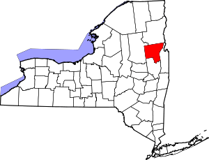 | |
| Towns | ||
| Village | ||
| CDPs | ||
| Other hamlets | ||
| Footnotes | ‡This populated place also has portions in an adjacent county or counties | |