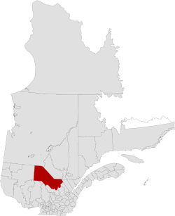
La Tuque (census division)
| La Tuque | |
|---|---|
| Census division | |
 | |
| Coordinates: 47°26′N 72°47′W / 47.433°N 72.783°WCoordinates: 47°26′N 72°47′W / 47.433°N 72.783°W[1] | |
| Country |
|
| Province |
|
| Region | Mauricie |
| Established | March 26, 2003 |
| Area[2] | |
| • Land | 26,356.98 km2 (10,176.49 sq mi) |
| Population (2011)[2] | |
| • Total | 15,130 |
| • Density | 0.6/km2 (2/sq mi) |
| • Pop 2006-2011 |
|
| • Dwellings | 9,040 |
| Time zone | EST (UTC−5) |
| • Summer (DST) | EDT (UTC−4) |
For homonymy, see La Tuque (disambiguation).
La Tuque is a territory equivalent to a regional county municipality (TE) and census division (CD) of Quebec. Its geographical code is 90.
Subdivisions
The TE of La Tuque consists of:
- the municipalities of the urban agglomeration of La Tuque, namely
- the city of La Tuque
- the municipality of La Bostonnais
- the municipality of Lac-Édouard
- three Indian reserves, namely
Demographics
Population
The population of the TE according to the Canada 2011 Census is 15,130.[2]
| Canada census – La Tuque TE, Quebec community profile | |||
|---|---|---|---|
| 2011 | 2006 | ||
| Population: | 15,130 (-2.1% from 2006) | 15,448 (-2.6% from 2001) | |
| Land area: | 26,356.98 km2 (10,176.49 sq mi) | 26,349.80 km2 (10,173.71 sq mi) | |
| Population density: | 0.6/km2 (1.6/sq mi) | 0.6/km2 (1.6/sq mi) | |
| Median age: | 43.2 (M: 41.9, F: 44.4) | 42.2 (M: 41.4, F: 43.0) | |
| Total private dwellings: | 9,040 | 7,675 | |
| Median household income: | $45,484 | $42,333 | |
| References: 2011[2] 2006[3] | |||
| Historical Census Data - La Tuque TE, Quebec[4] | ||||||||||||||||||||
|---|---|---|---|---|---|---|---|---|---|---|---|---|---|---|---|---|---|---|---|---|
|
|
| ||||||||||||||||||
(E) established on March 26, 2003. | ||||||||||||||||||||
Language
| Canada Census Mother Tongue - La Tuque TE, Quebec[4] | ||||||||||||||||||
|---|---|---|---|---|---|---|---|---|---|---|---|---|---|---|---|---|---|---|
| Census | Total | French |
English |
French & English |
Other | |||||||||||||
| Year | Responses | Count | Trend | Pop % | Count | Trend | Pop % | Count | Trend | Pop % | Count | Trend | Pop % | |||||
| 2011 |
14,910 |
11,205 | |
75.15% | 190 | |
1.27% | 55 | |
0.37% | 3,460 | |
23.21% | |||||
| 2006 |
15,245 |
11,940 | n/a | 78.32% | 210 | n/a | 1.38% | 25 | n/a | 0.16% | 3,070 | n/a | 20.14% | |||||
See also
References
- ↑ Reference number 380544 of the Commission de toponymie du Québec (French)
- 1 2 3 4 "(Code 2490) Census Profile". 2011 census. Statistics Canada. 2012.
- ↑ "2006 Community Profiles". Canada 2006 Census. Statistics Canada. March 30, 2011. Retrieved 2014-04-27.
- 1 2 Statistics Canada: 1996, 2001, 2006, 2011 census
 |
Jamésie TE | Le Domaine-du-Roy RCM | Lac-Saint-Jean-Est RCM | |
| La Vallée-de-l'Or RCM | |
La Côte-de-Beaupré RCM La Jacques-Cartier RCM | ||
| ||||
| | ||||
| La Vallée-de-la-Gatineau RCM | Antoine-Labelle RCM / Matawinie RCM / Mékinac RCM | Portneuf RCM |
| Regional county municipalities and equivalent territories | |
|---|---|
| Municipalities | |
This article is issued from Wikipedia - version of the 4/27/2014. The text is available under the Creative Commons Attribution/Share Alike but additional terms may apply for the media files.