Kumluca
| Kumluca | |
|---|---|
| District | |
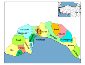 Location of Kumluca within Turkey. | |
 Kumluca Location of Kumluca within Turkey. | |
| Coordinates: 36°22′N 30°17′E / 36.367°N 30.283°ECoordinates: 36°22′N 30°17′E / 36.367°N 30.283°E | |
| Country |
|
| Region | Mediterranean |
| Province | Antalya |
| Government | |
| • Mayor | Hüsamettin Çetinkaya (AKP) |
| Area[1] | |
| • District | 1,227.79 km2 (474.05 sq mi) |
| Elevation | 15 m (49 ft) |
| Population (2012)[2] | |
| • Urban | 33,238 |
| • District | 66,186 |
| • District density | 54/km2 (140/sq mi) |
| Time zone | EET (UTC+2) |
| • Summer (DST) | EEST (UTC+3) |
| Area code(s) | +90 242 |
| Website | http://www.kumluca-bld.gov.tr/ |
Kumluca is a town and district of Antalya Province on the Mediterranean coast of Turkey, part of the Turkish Riviera. Kumluca is located 90 km (56 mi) west of the city of Antalya, on the Teke Peninsula, (between the bays of Antalya and Fethiye). Its neighbour towns are Korkuteli, Elmalı, Finike, Kemer and Antalya
The town of Kumluca, formerly the village of Sarıkavak, is named for its sandy soil (kum meaning sand in Turkish), good for growing watermelons.
Geography
The centre of the district is a plain pointing north from the Mediterranean coast and surrounded by mountains on three sides. The northern part of the district is hilly and mountainous. Summers are hot and dry, winters cool and wet as one would expect in a Mediterranean district. The coast never gets snow but it snows in the mountains. In this climate fruit and vegetables can be grown under glass all year round and this is the mainstay of the local economy, along with orange trees. Kumluca is a wealthy district.
History
In the last years of the Seljuqs of Rum, silver coins were minted in the town. Between 1282 and 1302, the town struck dirhams under Kaykhusraw III, Kayqubad III, and Mesud II with the mint name Sarıkavak (Arabic: ساروقواق, Sārūqawāq)[3]
Demographics
The district has a population of 65,652 according to the 2010 census.[4] The town itself has 31.525 inhabitants. Kumluca has 3 municipalities(Beykonak, Çavuşköy and Mavikent) and 24 villages.
The population of inhabited places are shown in the table(Municipalities are shown in bold)
| Town/Village | Population(2007) |
|---|---|
| Kumluca | 31.581 |
| Altınyaka | 276 |
| Belen | 331 |
| Beşikçi | 523 |
| Beykonak | 7.240 |
| Büyükalan | 234 |
| Çaltı | 172 |
| Çavuşköy | 2.435 |
| Çayiçi | 202 |
| Dereköy | 85 |
| Erentepe | 606 |
| Gölcük | 284 |
| Güzören | 435 |
| Hacıveliler | 2.963 |
| Hızırkahya | 904 |
| İncircik | 290 |
| Karacaağaç | 164 |
| Karacaören | 748 |
| Kavakköy | 620 |
| Kumlucayazarı | 883 |
| Kuzca | 377 |
| Mavikent | 8.033 |
| Ortaköy | 440 |
| Salur | 2.225 |
| Sarıcasu | 2.867 |
| Toptaş | 712 |
| Yenikışla | 141 |
| Yeşilköy | 133 |
| Total | 65.904 |
Tourism
There are a number of important historical sites in the district of Kumluca including Olympos, Kitanaura, Korydalla, Rhodiapolis, Idebessos and Gagai; of these Olympos is the largest and attracts the most visitors.
There is 30 km (19 mi) of coast with many hotels and restaurants between the villages of Adrasan and Olympos, and holiday villages near the town of Mavikent. West of Mavikent there is less development but taken as a whole Kumluca is one of the fastest growing local economies in Turkey.
References
- ↑ "Area of regions (including lakes), km²". Regional Statistics Database. Turkish Statistical Institute. 2002. Retrieved 2013-03-05.
- ↑ "Population of province/district centers and towns/villages by districts - 2012". Address Based Population Registration System (ABPRS) Database. Turkish Statistical Institute. Retrieved 2013-02-27.
- ↑ Diler, Ömer; Hinrichs, Johann-Christoph (2009), Islamic Mints (İslam darp yerleri), 2, Istanbul: Spink, pp. 644–645, ISBN 978-975-8428-18-2
- ↑ Statistical Institute
External links
- District governor's official website (Turkish)
- District municipality's official website (Turkish)
- Information on Kumluca
- Local info website (Turkish)