Kriegsfeld
| Kriegsfeld | ||
|---|---|---|
| ||
 Kriegsfeld | ||
Location of Kriegsfeld within Donnersbergkreis district 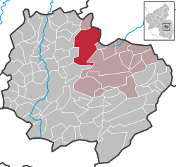 | ||
| Coordinates: 49°42′34″N 7°54′55″E / 49.70944°N 7.91528°ECoordinates: 49°42′34″N 7°54′55″E / 49.70944°N 7.91528°E | ||
| Country | Germany | |
| State | Rhineland-Palatinate | |
| District | Donnersbergkreis | |
| Municipal assoc. | Kirchheimbolanden | |
| Government | ||
| • Mayor | Uwe Ullrich | |
| Area | ||
| • Total | 26.41 km2 (10.20 sq mi) | |
| Population (2015-12-31)[1] | ||
| • Total | 1,018 | |
| • Density | 39/km2 (100/sq mi) | |
| Time zone | CET/CEST (UTC+1/+2) | |
| Postal codes | 67819 | |
| Dialling codes | 06358 | |
| Vehicle registration | KIB | |
| Website | www.kriegsfeld.de | |

Kriegsfeld is a municipality in the Donnersbergkreis district, in Rhineland-Palatinate, Germany.
References
- ↑ "Gemeinden in Deutschland mit Bevölkerung am 31. Dezember 2015" (PDF). Statistisches Bundesamt (in German). 2016.
This article is issued from Wikipedia - version of the 6/21/2015. The text is available under the Creative Commons Attribution/Share Alike but additional terms may apply for the media files.