Kothavalasa railway station
Kothavalasa | |
|---|---|
| Junction Station | |
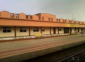 View of a platform | |
| Location |
Visakhapatnam-Aarku Road, Kothavalasa, Vizianagaram dt., Andhra Pradesh India |
| Coordinates | 17°53′30″N 83°11′09″E / 17.8917°N 83.1859°ECoordinates: 17°53′30″N 83°11′09″E / 17.8917°N 83.1859°E |
| Elevation | 56 m (184 ft) |
| Line(s) |
Khurda Road-Visakhapatnam section of Howrah-Chennai main line Kothavalasa-Kirandul line |
| Platforms | 5 |
| Tracks | Broad gauge 1,676 mm (5 ft 6 in) |
| Construction | |
| Structure type | Standard (on ground station) |
| Parking | Available |
| Disabled access | Yes |
| Other information | |
| Status | Functioning |
| Station code | KTV |
| Zone(s) | East Coast Railway zone |
| Division(s) | Waltair |
| History | |
| Opened | 1896 |
| Previous names |
East Coast State Railway Bengal Nagpur Railway |
| Location | |
 Kothavalasa railway station Location in Andhra Pradesh | |
Visakhapatnam Railway | ||||||||||||||||||||||||||||||||||||||||||||||||||||||||||||||||||||||||||||||||||||||||||||||||||||||||||||||||||||||||||||||||||||||||||||||||||||||||||||||||||||||||||||||||||||||||||||||||||||||||||||||||||||||||||||||||||||||||||||||||||||||||||||||||||||||||||||||||||||||||||||||||||||||||||||||||||||||||||||||||||||||||||||||||||||||||||||||||||||||||||||||||||||||||||||||||||||||||||||||||||||||||||||||||||||||||||||||||||||||||||||||||||||||||||||||||||||||||||||||||||||||||||||||||||||||||||||||||||||||
|---|---|---|---|---|---|---|---|---|---|---|---|---|---|---|---|---|---|---|---|---|---|---|---|---|---|---|---|---|---|---|---|---|---|---|---|---|---|---|---|---|---|---|---|---|---|---|---|---|---|---|---|---|---|---|---|---|---|---|---|---|---|---|---|---|---|---|---|---|---|---|---|---|---|---|---|---|---|---|---|---|---|---|---|---|---|---|---|---|---|---|---|---|---|---|---|---|---|---|---|---|---|---|---|---|---|---|---|---|---|---|---|---|---|---|---|---|---|---|---|---|---|---|---|---|---|---|---|---|---|---|---|---|---|---|---|---|---|---|---|---|---|---|---|---|---|---|---|---|---|---|---|---|---|---|---|---|---|---|---|---|---|---|---|---|---|---|---|---|---|---|---|---|---|---|---|---|---|---|---|---|---|---|---|---|---|---|---|---|---|---|---|---|---|---|---|---|---|---|---|---|---|---|---|---|---|---|---|---|---|---|---|---|---|---|---|---|---|---|---|---|---|---|---|---|---|---|---|---|---|---|---|---|---|---|---|---|---|---|---|---|---|---|---|---|---|---|---|---|---|---|---|---|---|---|---|---|---|---|---|---|---|---|---|---|---|---|---|---|---|---|---|---|---|---|---|---|---|---|---|---|---|---|---|---|---|---|---|---|---|---|---|---|---|---|---|---|---|---|---|---|---|---|---|---|---|---|---|---|---|---|---|---|---|---|---|---|---|---|---|---|---|---|---|---|---|---|---|---|---|---|---|---|---|---|---|---|---|---|---|---|---|---|---|---|---|---|---|---|---|---|---|---|---|---|---|---|---|---|---|---|---|---|---|---|---|---|---|---|---|---|---|---|---|---|---|---|---|---|---|---|---|---|---|---|---|---|---|---|---|---|---|---|---|---|---|---|---|---|---|---|---|---|---|---|---|---|---|---|---|---|---|---|---|---|---|---|---|---|---|---|---|---|---|---|---|---|---|---|---|---|---|---|---|---|---|---|---|---|---|---|---|---|---|---|---|---|---|---|---|---|---|---|---|---|---|---|---|---|---|---|---|---|---|---|---|---|---|---|---|---|---|---|---|---|---|---|---|---|---|---|---|---|---|---|---|---|---|---|---|---|---|---|---|---|---|---|---|---|---|---|---|---|---|---|---|---|---|---|---|---|---|---|---|---|---|---|---|---|
Legend
Source:Google maps, India Rail Info 57226 | ||||||||||||||||||||||||||||||||||||||||||||||||||||||||||||||||||||||||||||||||||||||||||||||||||||||||||||||||||||||||||||||||||||||||||||||||||||||||||||||||||||||||||||||||||||||||||||||||||||||||||||||||||||||||||||||||||||||||||||||||||||||||||||||||||||||||||||||||||||||||||||||||||||||||||||||||||||||||||||||||||||||||||||||||||||||||||||||||||||||||||||||||||||||||||||||||||||||||||||||||||||||||||||||||||||||||||||||||||||||||||||||||||||||||||||||||||||||||||||||||||||||||||||||||||||||||||||||||||||||
Kothavalasa railway station, located in the Indian state of Andhra Pradesh, serves Kothavalasa in Vizianagaram district. It is a major freight transit point with iron ore rakes travelling from mines around Kirandul and Bailadila in Chhattisgarh to Visakhapatnam Port.
History
Between 1893 and 1896, 1,288 km (800 mi) of the East Coast State Railway was opened for traffic. In 1898-99, Bengal Nagpur Railway was linked to the lines in southern India.[1]
In 1960, Indian Railway took up three projects: the Kothavalasa - Araku - Koraput - Jeypore - Jagdalpur - Dantewara - Kirandaul line, the Jharsuguda - Sambalpur - Bargarh - Balangir - Titlagarh Project and the Biramitrapur - Rourkela - Bimlagarh - Kiriburu Project. All the three projects taken together were popularly known as the DBK Project or the Dandakaranya Bolangir Kiriburu Project(under Dandakaranya Project).[2] The Kothavalasa-Kirandaul line was opened in 1966-67.[3]
Electrification
The Visakhapatnam - Kothavalasa - Araku - Koraput - Jeypore - Jagdalpur - Dantewara - Kirandul section was electrified in the year 1980-83.[4]
Railway reorganization
The Bengal Nagpur Railway was nationalized in 1944.[5]Eastern Railway was formed on 14 April 1952 with the portion of East Indian Railway Company east of Mughalsarai and the Bengal Nagpur Railway.[6] In 1955, South Eastern Railway was carved out of Eastern Railway. It comprised lines mostly operated by BNR earlier.[6][7] Amongst the new zones started in April 2003 were East Coast Railway and South East Central Railway. Both these railways were carved out of South Eastern Railway.[6]
References
- ↑ "Major Events in the Formation of S.E. Railway". South Eastern Railway. Retrieved 2012-11-10.
- ↑ Baral, Chitta. "History of Indian Railways in Orissa" (PDF). Retrieved 2012-11-27.
- ↑ "History of Waltair Division". Mannanna.com. Retrieved 2013-01-02.
- ↑ "History of Electrification". IRFCA. Retrieved 12 July 2013.
- ↑ "IR History: Part - III (1900 - 1947)". IRFCA. Retrieved 2012-11-21.
- 1 2 3 "Geography – Railway Zones". IRFCA. Retrieved 2012-11-21.
- ↑ "IR History: Part - IV (1947 - 1970)". IRFCA. Retrieved 2012-11-21.
External links
| Preceding station | Indian Railways | Following station | ||
|---|---|---|---|---|
Kantakapalle | East Coast Railway zone | Pendurti |
||
Mallivedu | East Coast Railway zone | Terminus |