Kirandul
| Kirandul | |
|---|---|
| town | |
 Kirandul  Kirandul | |
| Coordinates: 18°37′16″N 81°16′54″E / 18.62111°N 81.28163°ECoordinates: 18°37′16″N 81°16′54″E / 18.62111°N 81.28163°E | |
| Country | India[1] |
| State | Chhattisgarh |
| District | Dantewada |
| Elevation | 540 m (1,770 ft) |
| Languages | |
| • Official | Hindi, Chhattisgarhi |
| • Other | Gondi, Telugu, Koya |
| Time zone | IST (UTC+5:30) |
| PIN | 494556[2] |
| Telephone code | +91(0)-7857 |
| Vehicle registration | CG-18 |
| Website |
dantewada |
Kirandul is a city and a municipality in the Dantewada district[3] in the Indian state of Chhattisgarh.
Demographics
As of 2001 India census,[4] Kirandul had a population of 19,053. Males constitute 52% of the population and females 48%. Kirandul has an average literacy rate of 78%, higher than the national average of 65%: male literacy is 82%, and female literacy is 74%. In Kirandul, 11% of the population is under 6 years of age.
Region
This region is basically a plateau.[5] The Bailadila Range of hills are located at a distance of about 40 km south west of Dantewada, the district headquarters in Chhattisgarh State.
Climate
Bailadila region enjoys mild summer and winter is not severe. The maximum temperature in summer rises up to 40 degree Celsius between May and June whereas minimum temperature in winter drops to 10 degree Celsius. The area receives heavy rains during monsoon from June to October. Weather during rainy season is stormy accompanied by gales and the hilltops are covered with thick clouds and dense fog, which reduces visibility.
| Climate data for kirandul, India | |||||||||||||
|---|---|---|---|---|---|---|---|---|---|---|---|---|---|
| Month | Jan | Feb | Mar | Apr | May | Jun | Jul | Aug | Sep | Oct | Nov | Dec | Year |
| Record high °C (°F) | 32.9 (91.2) |
35.9 (96.6) |
39.6 (103.3) |
42.5 (108.5) |
44.8 (112.6) |
42.6 (108.7) |
35.9 (96.6) |
33.4 (92.1) |
34.0 (93.2) |
33.9 (93) |
33.0 (91.4) |
31.5 (88.7) |
44.8 (112.6) |
| Average high °C (°F) | 28.2 (82.8) |
30.9 (87.6) |
34.9 (94.8) |
37.2 (99) |
38.1 (100.6) |
33.4 (92.1) |
28.6 (83.5) |
28.4 (83.1) |
29.6 (85.3) |
29.9 (85.8) |
28.2 (82.8) |
27.2 (81) |
31.2 (88.2) |
| Daily mean °C (°F) | 19.9 (67.8) |
23.0 (73.4) |
26.9 (80.4) |
30.0 (86) |
31.2 (88.2) |
28.5 (83.3) |
25.7 (78.3) |
25.4 (77.7) |
25.9 (78.6) |
24.7 (76.5) |
21.7 (71.1) |
19.5 (67.1) |
25.2 (77.37) |
| Average low °C (°F) | 11.6 (52.9) |
14.3 (57.7) |
18.5 (65.3) |
22.2 (72) |
24.2 (75.6) |
23.8 (74.8) |
22.3 (72.1) |
22.2 (72) |
22 (72) |
19.6 (67.3) |
14.9 (58.8) |
11.1 (52) |
18.9 (66) |
| Record low °C (°F) | 2.8 (37) |
7.0 (44.6) |
8.3 (46.9) |
14.8 (58.6) |
17.0 (62.6) |
14.3 (57.7) |
18.3 (64.9) |
19.3 (66.7) |
17.4 (63.3) |
11.0 (51.8) |
5.9 (42.6) |
4.4 (39.9) |
2.8 (37) |
| Average precipitation mm (inches) | 9.1 (0.358) |
15.6 (0.614) |
16 (0.63) |
51.1 (2.012) |
73.2 (2.882) |
239.6 (9.433) |
369.4 (14.543) |
377.5 (14.862) |
236.9 (9.327) |
101.1 (3.98) |
24.3 (0.957) |
7.7 (0.303) |
1,521.5 (59.902) |
| Average rainy days | 0.8 | 1.5 | 1.6 | 4.5 | 6.8 | 13.8 | 20.5 | 21.1 | 15.4 | 6.8 | 2.2 | 0.6 | 95.6 |
| Average relative humidity (%) | 59 | 51 | 42 | 43 | 47 | 69 | 84 | 86 | 82 | 74 | 68 | 65 | 64.2 |
| Source: Weatherbase[6] | |||||||||||||
History
The Commercial discovery of Bailadila dates back to 1955-56 when Prof. Euemura of Japanese Steel Mills Association,[7] studying the memoirs of Geological Survey of India, drew the attention of the Japanese Steel Mills to the richness of the vast deposits of iron ore and its proximity to the Eastern Coast of India. Later an agreement had been signed with the Japanese Steel Mills in 1960.[8] An approval of the project report prepared by NMDC was given in 1964 and the Mine Plant had been inaugurated on November 1968.Later on, National Mineral Development Corporation, with help of Japan set up the first iron ore plant in Kirandul.
Kirandul was a crucial part of the princely state of Bastar before India attained independence. This city prospered under the reign of King Annama Deva, the brother of Kakatiya king Pratapa Rudra Deva of Warangal (Telangana). During the 19th century, the city came under the administration of the British rule. It was included as part of Central Provinces and Berar for the ease of British administration. Eventually, it was acceded to the Indian Union on January 1, 1948, and the city became a part of the bastar district of Madhya Pradesh and later in 2000, it was included in the newly formed Chhattisgarh state.[9]
Mining
The iron ore mines here are also an important tourist attraction. Run by the Navratna Organization,'NMDC',[10] these mines operate with the latest technology and hi-tech machinery. However, one needs to obtain permit to visit the mines, which can be done by requesting the NMDC office.The Bailadila iron ore range extends for a length of 40 km with a width of about 10 km mostly along the top of hill,which constitute one of the richest concentration of iron-ore of world. The range contains 1200 million tonnes of high grade [iron ore] distributed in 14 deposits.14 reserves have been discovered, of which 3 are being mined. The entire area was brought to the mainstream of civilisation by the spectacular effort of NMDC by opening-up of mines. Today, Bailadila is a name to reckon with in the world iron ore market because of its super high-grade iron ore.[11] Bailadila complex possesses the world’s best grade of hard lumpy ore having +66% iron content, free from sulphur and other deleterious material and the best physical properties needed for steel making.[12]
Transport
Kirandul is easily accessible and well connected to Raipur, Visakhapatnam and Hyderabad by all-weather roads. It can also be reached by rail from Visakhapatnam.There is regular iron ore movement from this sector to Visakhapatnam port by rail.[13] The K-K line[14] from Visakhapatnam to Kirandul via Araku is laid through eastern ghats. Up to Araku station it has many tunnels.[15] Also it pass through the highest elevation Broad gauge station in the Eastern ghats, Similiguda, just before Borra caves(Officially,under Odisha Government).Kirandul - Kottavalasa Railroad[16] is the record high Broad Gauge line in the Eastern Ghats.The KK Line has the distinction of being the second highest railway line in the country after the one in Jammu[17]].The highest point of the railway line is at Simliguda, which is 996 metres from the mean sea level.
Air transport
There is an airport at Jagdalpur but no scheduled services are currently run to or from here. The airport is predominantly used by political leaders and insurgency operation related activities by the army and the police. The nearest airport is Raipur Airport in the capital city of Raipur and Visakhapatnam Airport, Andhra Pradesh.[18]
References
- ↑ National Portal of India
- ↑ Postal Codes and Zip Codes Database - PostCodesDB
- ↑ District Dantewada Chhattisgarh - General Profile
- ↑ "Census of India 2001: Data from the 2001 Census, including cities, villages and towns (Provisional)". Census Commission of India. Archived from the original on 2004-06-16. Retrieved 2008-11-01.
- ↑ The Journal of the Bombay Natural History Society - Google Books
- ↑ "Weatherbase: Historical Weather for Kirandul, India". Weatherbase. Retrieved 12 July 2013.
- ↑ Forbes India Magazine - Why Japanese Steel Companies Are In India
- ↑ NMDC Ltd. - Director Reports - money.livemint.com
- ↑ History of Kirandul City Chhattisgarh Origin-Background-Significance
- ↑ Buy NMDC; target Rs 138: ICICIdirect.com - Moneycontrol.com
- ↑ Railways hopes to make hay while sun shines - The Times of India
- ↑ http://www.cpcb.nic.in/upload/NewItems/NewItem_105_iron_ore_mining_31.07.08.pdf
- ↑ Waltair Division revenue crosses Rs. 5,000-crore mark - The Hindu
- ↑ Indian Railways - Google Books
- ↑ "Railways to fast-track doubling of KK line - TOI Mobile | The Times of India Mobile Site". m.timesofindia.com. Retrieved 2016-07-08.
- ↑ Kottavalasa-kirandul
- ↑ http://www.newindianexpress.com/states/andhra_pradesh/A-Bridge-Too-High-Poses-Unique-Challenge-to-Railways/2014/10/20/article2486284.ece
- ↑ Maps, Google. "Distance". Retrieved 18 October 2012.
External links
| Governance | 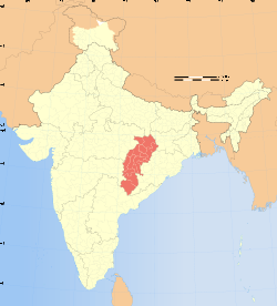 | |
|---|---|---|
| Topics | ||
| Districts | ||
| Cities | ||
| ||