Kokemäki
| Kokemäki | ||
|---|---|---|
| Town | ||
| Kokemäen kaupunki | ||
| ||
 Location of Kokemäki in Finland | ||
| Coordinates: 61°15.5′N 022°21′E / 61.2583°N 22.350°ECoordinates: 61°15.5′N 022°21′E / 61.2583°N 22.350°E | ||
| Country | Finland | |
| Region | Satakunta | |
| Sub-region | Pori sub-region | |
| Parish | 1324 | |
| Charter | 1869 | |
| Town privileges | 1977 | |
| Government | ||
| • Town manager | Reijo Siltala | |
| Area (2011-01-01)[1] | ||
| • Total | 531.27 km2 (205.12 sq mi) | |
| • Land | 481.23 km2 (185.80 sq mi) | |
| • Water | 50.04 km2 (19.32 sq mi) | |
| Area rank | 220th largest in Finland | |
| Population (2016-03-31)[2] | ||
| • Total | 7,579 | |
| • Rank | 134th largest in Finland | |
| • Density | 15.75/km2 (40.8/sq mi) | |
| Population by native language[3] | ||
| • Finnish | 98.6% (official) | |
| • Swedish | 0.1% | |
| • Others | 1.3% | |
| Population by age[4] | ||
| • 0 to 14 | 14.3% | |
| • 15 to 64 | 62.3% | |
| • 65 or older | 23.4% | |
| Time zone | EET (UTC+2) | |
| • Summer (DST) | EEST (UTC+3) | |
| Municipal tax rate[5] | 19.75% | |
| Climate | Dfc | |
| Website | www.kokemaki.fi | |

Kokemäki (Swedish: Kumo) is a town and municipality in the Satakunta Region of Finland.
The town has a population of 7,579 (31 March 2016)[2] and covers an area of 531.27 square kilometres (205.12 sq mi) of which 50.04 km2 (19.32 sq mi) is water.[1] The population density is 15.75 inhabitants per square kilometre (40.8/sq mi).
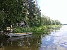
The 121kilometre long Kokemäenjoki river flows from Lake Liekovesi, in the Pirkanmaa region, through Kokemäki and in to the Gulf of Bothnia at Pori. The Kolsi hydro-electric power plant is located at Kokemäki. Kokemäenjoki has long been an important waterway, well known for its salmon, whitefish and lamprey.[6]
Finland is constitutionally bi-lingual with a Swedish speaking minority. The municipality is unilingual with the vast majority of the population speaking Finnish. Many, mostly younger, residents are able to understand or speak some English.
According to the town's official website, Kokemäki was granted a town charter in 1869. The municipality of Kauvatsa was merged with Kokemäki in 1969. Kokemäki was granted city status in 1977.[7]
History
It is believed that the Iron Age town of Teljä was located next to the Kokemäenjoki river at Kokemäki.[8] The oldest stone carving yet found in Finland, dated at 8,000 to 9,000 years old, was discovered in nearby Huittinen in 1903. The 10 cm elk's head is in a permanent exhibition at the National Museum of Finland in the capital, Helsinki. Archeological finds from in and around Kokemäki have been dated to the Middle Ages.
Kokemäki is thought to have been founded in the 12th century, maybe even earlier. The Kokemäki parish was established in 1324. While part of the Swedish Empire, the administrative area (slottslän) of Kokemäenkartanon was created in 1331. Kokemäki served as the administrative centre of the historical province of Satakunta until 1634. The Medieval Kokemäki Castle was demolished in 1367.[9]
The medieval trading route of Huovintie goes from Turku, by Kokemäki and the river of Kokemäenjoki. Along the Huovintie were guild houses where travellers could stay overnight. This was located near the Kokemäki church.[10]
The legend states that in 1156 Bishop Henry of Uppsala visited Satakunta on a preaching tour as a part of Eric IX of Sweden's first crusade to Finland. St. Henry's Chapel is a neogothic style brick chapel one kilometre east of the town centre of Kokemäki. The chapel was built in 1857 on the site of a medieval wooden granary which was used by Bishop Henry. It is possible that the original building dates back to between the 12th and 15th century, making it the oldest remaining wooden building in Finland.
The Kokemäki coat of arms depicts the bishop's mitre.
During the Revolution of 1918 some one-hundred-fifty-three individuals were killed in the municipality of Kokemäki.[11]
Transport
The transport system of Finland is well-developed with an extensive road system.
Road
Highway 2 passes to the south, running from Helsinki to Pori on the Baltic coast.
Highway 12 runs from Rauma to Tampere and Nokia, passing through nearby Huittinen.
Helsinki is 205 km or two and a half hours away by car.
According to Open Charge Map, there are two electric vehicle (EV) charging points in Kokemäki with another 55 within a 160 kilometre radius.
The private coach companies OnniBus and ExpressBus operate services to all major towns and regions in Finland.
Rail
Finnish trains have a reputation for being spacious, comfortable and clean.
The state-owned rail company VR operates a service between Tampere and Pori, stopping at Kokemäki.
The train station is 3 km to the west of the town centre at Peipohja.[12]
Air
The nearest airport is Pori Airport, which is 43 km or 40 minutes away by Highway 2.
Tampere-Pirkkala Airport is 96 km or an hour and ten minutes away by Highway 12.
Helsinki-Vantaa Airport is two hours and twenty minutes away by Highway 2.
Education
The Finnish education system is based on comprehensive schooling and is publicly funded.
Kokemäki has six schools offering primary and secondary education. These are; Tuomaala, Tulkkila, Riste, Peipohja, Lahteenmaki and Korkeaoja High School. There is free pre-school education for all children aged 6. The Peipohjan day-care nursery caters for children aged 9 months to 5 years.
There is a special needs Forsby School for children aged 0-9.[13]
Vocational training is provided by Satakunta Training Consortium, known as SATAEDU'[14] and Huittinen Business and Vocational College.
Tourist attractions
- St. Henry's Chapel
- Tulkkila - Museum Bridge
- Vestry of Saint Maria's Church
- Puurijärvi-Isosuo National Park
- Museum of Agriculture or "Maatalousmuseo" (in Finnish)
- Open-air Museum (in Finnish)
- Kokemäenjoki river
- Kriivari Reindeer Farm
- Sapila Suspension Bridge
- Church of Gustav lll
Gallery

International relations
Twin towns — Sister cities
Kokemäki is twinned with:
References
- 1 2 "Area by municipality as of 1 January 2011" (PDF) (in Finnish and Swedish). Land Survey of Finland. Retrieved 9 March 2011.
- 1 2 "Ennakkoväkiluku sukupuolen mukaan alueittain, maaliskuu.2016" (in Finnish). Statistics Finland. Retrieved 31 March 2016.
- ↑ "Population according to language and the number of foreigners and land area km2 by area as of 31 December 2008". Statistics Finland's PX-Web databases. Statistics Finland. Retrieved 29 March 2009.
- ↑ "Population according to age and gender by area as of 31 December 2008". Statistics Finland's PX-Web databases. Statistics Finland. Retrieved 28 April 2009.
- ↑ "List of municipal and parish tax rates in 2011". Tax Administration of Finland. 29 November 2010. Retrieved 13 March 2011.
- ↑ "Historia - Kokemäen kaupunki". www.kokemaki.fi. Retrieved 2015-11-23.
- ↑ "Basic information about town of Kokemäki". Kokemaki City Council.
- ↑ "Mikä oli Telja? - Kokemäen kaupunki". www.kokemaki.fi. Retrieved 2015-11-21.
- ↑ "Historia - Kokemäen kaupunki". www.kokemaki.fi. Retrieved 2015-11-23.
- ↑ "Historia - Kokemäen kaupunki". www.kokemaki.fi. Retrieved 2015-11-23.
- ↑ Torvinen/Koodipaja, Jarmo. "Suomen sotasurmat 1914-1922". vesta.narc.fi. Retrieved 2016-07-13.
- ↑ "Liikenne - Kokemäen kaupunki". www.kokemaki.fi. Retrieved 2015-11-23.
- ↑ "Perusopetus - Kokemäen kaupunki". www.kokemaki.fi. Retrieved 2015-11-22.
- ↑ "Sataedu Kokemäki, Suoratie 1 | Sataedu". sataedu.fi. Retrieved 2015-11-23.
External links
![]() Media related to Kokemäki at Wikimedia Commons
Media related to Kokemäki at Wikimedia Commons
- Town of Kokemäki – Official website (Finnish)
- VR Group
- OnniBus
- ExpressBus
- Satakunta.fi
- Official Travel Guide of Finland
- Ali-Ketolan Tila
| Municipalities | 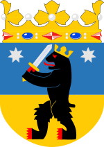 | |
|---|---|---|
| Former municipalities | ||