Knollwood, Texas
| Knollwood, Texas | |
|---|---|
| City | |
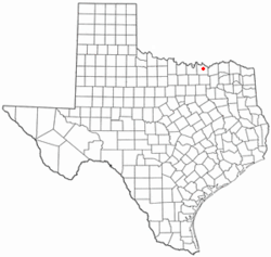 Location of Knollwood, Texas | |
 | |
| Coordinates: 33°41′15″N 96°37′10″W / 33.68750°N 96.61944°WCoordinates: 33°41′15″N 96°37′10″W / 33.68750°N 96.61944°W | |
| Country | United States |
| State | Texas |
| County | Grayson |
| Area | |
| • City | 0.3 sq mi (0.8 km2) |
| • Land | 0.3 sq mi (0.8 km2) |
| • Water | 0.0 sq mi (0.0 km2) |
| • Metro | 979 sq mi (2,536 km2) |
| Elevation | 827 ft (252 m) |
| Population (2000) | |
| • City | 375 |
| • Density | 1,196.4/sq mi (461.9/km2) |
| • Metro | 120,877 |
| • Metro density | 130/sq mi (50/km2) |
| Time zone | Central (CST) (UTC-6) |
| • Summer (DST) | CDT (UTC-5) |
| FIPS code | 48-39680[1] |
| GNIS feature ID | 1388595[2] |
| Website | http://www.knollwoodvillage.com/City.php |
Knollwood is a City in Grayson County, Texas, United States. The population was 226 at the 2010 census. It is part of the Sherman–Denison Metropolitan Statistical Area.
Geography
Knollwood is located at 33°41′15″N 96°37′10″W / 33.68750°N 96.61944°W.
According to the United States Census Bureau, the city has a total area of 0.3 square miles (0.78 km2), all of it land.
Demographics
| Historical population | |||
|---|---|---|---|
| Census | Pop. | %± | |
| 1990 | 205 | — | |
| 2000 | 375 | 82.9% | |
| 2010 | 226 | −39.7% | |
| Est. 2015 | 443 | [3] | 96.0% |
As of the census[1] of 2000, there were 375 people, 143 households, and 91 families residing in the city. The population density was 1,196.4 people per square mile (467.1/km²). There were 150 housing units at an average density of 478.6/sq mi (186.8/km²). The racial makeup of the city was 87.73% White, 5.87% African American, 0.53% Native American, 1.07% Asian, 0.53% Pacific Islander, 3.20% from other races, and 1.07% from two or more races. Hispanic or Latino of any race were 6.13% of the population.
There were 143 households out of which 39.2% had children under the age of 18 living with them, 44.8% were married couples living together, 16.1% had a female householder with no husband present, and 35.7% were non-families. 28.0% of all households were made up of individuals and 3.5% had someone living alone who was 65 years of age or older. The average household size was 2.62 and the average family size was 3.25.
In the city the population was spread out with 31.5% under the age of 18, 11.2% from 18 to 24, 36.0% from 25 to 44, 17.6% from 45 to 64, and 3.7% who were 65 years of age or older. The median age was 28 years. For every 100 females there were 94.3 males. For every 100 females age 18 and over, there were 81.0 males.
The median income for a household in the city was $30,893, and the median income for a family was $32,813. Males had a median income of $21,125 versus $17,417 for females. The per capita income for the city was $13,497. About 1.1% of families and 2.5% of the population were below the poverty line, including 1.9% of those under age 18 and 14.3% of those age 65 or over.
Education
Knollwood is served by Sherman Independent School District.
Climate
The climate in this area is characterized by hot, humid summers and generally mild to cool winters. According to the Köppen Climate Classification system, Knollwood has a humid subtropical climate, abbreviated "Cfa" on climate maps.[5]
References
- 1 2 "American FactFinder". United States Census Bureau. Retrieved 2008-01-31.
- ↑ "Knollwood". Geographic Names Information System. United States Geological Survey. Retrieved 2009-05-03.
- ↑ "Annual Estimates of the Resident Population for Incorporated Places: April 1, 2010 to July 1, 2015". Retrieved July 2, 2016.
- ↑ "Census of Population and Housing". Census.gov. Retrieved June 4, 2015.
- ↑ Climate Summary for Knollwood, Texas
External links
- Knollwood, Texas is at coordinates 33°41′15″N 96°37′10″W / 33.68750°N 96.61944°W.
- Knollwood, Texas at the Handbook of Texas Online.
Municipalities and communities of Grayson County, Texas, United States | ||
|---|---|---|
| Cities | 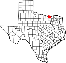 | |
| Towns | ||
| CDPs |
| |
| Other unincorporated communities | ||
| Footnotes | ‡This populated place also has portions in an adjacent county or counties | |