Kistanje
| Kistanje Кистање (Serbian)[1] | |
|---|---|
| Municipality | |
| Kistanje Municipality Općina Kistanje | |
 | |
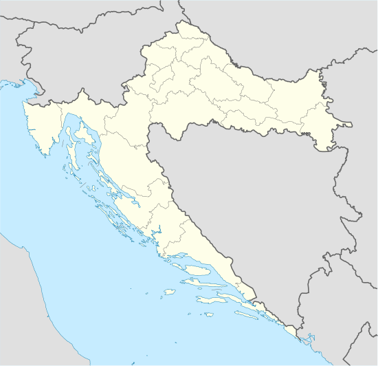 Kistanje Location of Kistanje in Croatia | |
| Coordinates: 43°59′N 15°58′E / 43.983°N 15.967°E | |
| Country |
|
| County | Šibenik-Knin County |
| Government | |
| • Mayor | Goran Reljić (SDSS) |
| Area | |
| • Total | 244.11 km2 (94.25 sq mi) |
| Population (2011) | |
| • Total | 3,481 |
| Time zone | CET (UTC+1) |
| • Summer (DST) | CEST (UTC+2) |
| Postal code | 22305 |
| Area code(s) | 022 |
Kistanje (Serbian Cyrillic: Кистање) is a village and municipality in Šibenik-Knin County, Croatia.
Geography
Kistanje is located in the microregion of Bukovica, in Zagora. Kistanje is 28 kilometres (17 mi) from county seat Šibenik, 20 kilometres (12 mi) from Knin and 18 kilometres (11 mi) from Skradin. The Adriatic Sea is 25 kilometres (16 mi) to the south-west. The climate is Mediterranean, with an average of 27 °C in the summer and 8 °C in the winter.
History
Kistanje was first mentioned as Latin: Kyztane in 1408.[2][3] It originated close to remains of Roman camp Burnum and medieval church. During the Middle Ages it was part of Luka parish and it belonged to Šubić noble family. In 1537 was built an Orthodox church dedicated to St. Nicholas.[4] Kistanje was a trade center of this part of Bukovica. After the Kuridža rebellion in 1704, the village was renamed to Kvartir, but in the 19th century it was again known as Kistanje. In 1888 was built the second Orthodox church, dedicated to Sts Cyril and Methodius. In 1894 the Catholic Church of Our Lady of Health was built.[5] In the 19th and the first part of the 20th century, Kistanje was a centre of a municipality. In the 1960s, the municipality was abolished and its territory was joined to the municipality of Knin.
During the Croatian War of Independence, local Serbs held the village until Croatian forces captured it during Operation Storm on August 5, 1995 by rebel Serbs. During the Krajina regime, the Church of Our Lady of Health was devastated. The village remained under rebel Serbs until 1995, when it suffered heavy damages, and some of the local civilians were killed (see Varivode massacre), while others went missing or fled during Operation Storm.
In 1997, Kistanje became a municipality within the Šibenik-Knin County. In 1997, ca. 1,000 Croats from Janjevo in Kosovo settled the village. In 2003 was dedicated the second Catholic church, the Church of Saint Nicholas.[5]
Population
According to the 2011 census, the municipality of Kistanje had 3,481 inhabitants, who lived in 14 villages:
- Biovičino Selo – 223
- Đevrske – 293
- Gošić – 46
- Ivoševci – 360
- Kakanj – 49
- Kistanje – 1,909
- Kolašac – 50
- Krnjeuve – 74
- Modrino Selo – 47
- Nunić – 110
- Parčić – 22
- Smrdelje – 111
- Varivode – 124
- Zečevo – 63
In the 2011 census, there were 3,481 inhabitants of Kistanje municipality, 62.22% Serbs and 36.83% Croats.[6]
Politics
The municipality council has 14 seats, out of which 10 are Independent Democratic Serb Party (SDSS), 3 are Croatian Democratic Union (HDZ), and 1 is Croatian Social Liberal Party (HSLS).[7] The mayor of Kistanje, since 2012, is Goran Reljić (SDSS).
Notable people
Prominent individuals that were born or that have lived either in Kistanje or the surrounding villages include:
- Vuk Mandušić
- Petar Jagodić Kuridža
- Vladimir Ardalić
- Mirko Korolija
- Simo Dubajić[8]
- Predrag Šarić
Gallery
 Orthodox church
.JPG) Orthodox church in Bezbradice
Orthodox church in Bezbradice Railway station
See also
| Wikimedia Commons has media related to Kistanje. |
- Burnum
- Krka Monastery, Eastern Orthodox monastery dedicated to the Archangel Michael located 2.5 km from Kistanje near the Krka river.
- Krka Manojlovac Waterfall
References
- ↑ Government of Croatia (October 2013). "Peto izvješće Republike Hrvatske o primjeni Europske povelje o regionalnim ili manjinskim jezicima" (PDF) (in Croatian). Council of Europe. p. 36. Retrieved 30 November 2016.
- ↑ "Šesto godina imena Kistanje". Slobodna Dalmacija (in Croatian). 12 October 2008. Retrieved 29 August 2014.
- ↑ "600 godina Kistanja..." (in Croatian). Retrieved 9 April 2015.
- ↑ "Kistanje". Eparhija-dalmatinska.hr. Retrieved 2014-01-28.
- 1 2 "Kistanje". zadarskanadbiskupija.hr. Retrieved 2014-01-28.
- ↑ "Census 2011" (PDF). Državni zavod za statistiku. Retrieved 9 January 2015.
- ↑ "Sastav vijeća". kistanje.hr (in Croatian). Retrieved 27 September 2015.
- ↑ [http:/-War criminal in world war two and pro serbian terrorist in 90ssecretdalmatia.wordpress.com/2010/05/26/hiking-in-croatia-manojlovac-waterfalls/ "WordPress.com"] Check
|url=value (help). Secretdalmatia.wordpress.com. Retrieved 2014-01-28.
External links
- "Official municipality website" (in Croatian).
- "Moje Kistanje".
Subdivisions of Šibenik-Knin County | ||
|---|---|---|
| Cities and towns |  | |
| Municipalities | ||
Coordinates: 43°59′N 15°58′E / 43.983°N 15.967°E