Kirkwall River
| Kirkwall River | |
| River | |
| Country | Canada |
|---|---|
| Province | Ontario |
| Region | Northeastern Ontario |
| Districts | Algoma, Sudbury |
| Part of | James Bay drainage basin |
| Source | Unnamed marsh |
| - location | Bonar Township, Sudbury District |
| - elevation | 347 m (1,138 ft) |
| - coordinates | 48°26′08″N 83°07′27″W / 48.43556°N 83.12417°W |
| Mouth | Dunrankin River |
| - location | Kirkwall Township, Algoma District |
| - elevation | 315 m (1,033 ft) |
| - coordinates | 48°33′58″N 83°08′12″W / 48.56611°N 83.13667°WCoordinates: 48°33′58″N 83°08′12″W / 48.56611°N 83.13667°W |
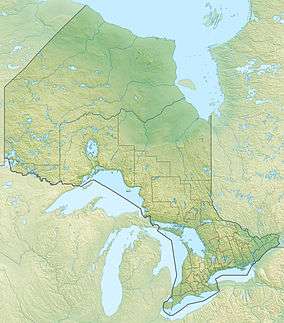 Location of the mouth of the Kirkwall River in Ontario | |
The Kirkwall River is a river in Algoma District and Sudbury District in northeastern Ontario, Canada.[1] It is in the James Bay drainage basin, and is a right tributary of the Dunrankin River.
Course
The river begins at an unnamed marsh in geographic Bonar Township,[2] Sudbury District, and flows northwest. It enters Algoma District at geographic Kirkwall Township,[3] continues northwest, then turns northeast, and reaches its mouth at the Dunrankin River, about 3.2 kilometres (2.0 mi) southwest of the railway point of Dunrankin on the Canadian National Railway transcontinental railway main line. The Dunrankin River flows via the Kapuskasing River, the Mattagami River and the Moose River to James Bay.
References
- ↑ "Kirkwall River". Geographical Names Data Base. Natural Resources Canada. Retrieved 2016-08-11.
- ↑ "Bonar" (PDF). Geology Ontario - Historic Claim Maps. Ontario Ministry of Northern Development, Mines and Forestry. Retrieved 2016-08-11.
- ↑ "Kirkwall" (PDF). Geology Ontario - Historic Claim Maps. Ontario Ministry of Northern Development, Mines and Forestry. Retrieved 2016-08-11.
Other map sources:
- Map 14 (PDF) (Map). 1 : 1,600,000. Official road map of Ontario. Ministry of Transportation of Ontario. 2010-01-01. Retrieved 2016-08-11.
- Restructured municipalities - Ontario map #3 (Map). Restructuring Maps of Ontario. Ontario Ministry of Municipal Affairs and Housing. 2006. Retrieved 2016-08-11.
This article is issued from Wikipedia - version of the 8/12/2016. The text is available under the Creative Commons Attribution/Share Alike but additional terms may apply for the media files.