King Street–Old Town station
| Washington Metro rapid transit station | ||||||||||||||||||||||||
 | ||||||||||||||||||||||||
| Location |
1900 King Street Alexandria, VA 22301 | |||||||||||||||||||||||
| Coordinates | 38°48′23″N 77°03′40″W / 38.806501°N 77.06112°WCoordinates: 38°48′23″N 77°03′40″W / 38.806501°N 77.06112°W | |||||||||||||||||||||||
| Owned by | WMATA | |||||||||||||||||||||||
| Line(s) |
| |||||||||||||||||||||||
| Platforms | 1 island platform | |||||||||||||||||||||||
| Tracks | 2 | |||||||||||||||||||||||
| Connections |
| |||||||||||||||||||||||
| Construction | ||||||||||||||||||||||||
| Structure type | Embankment | |||||||||||||||||||||||
| Parking | 30 spaces (parking meters) | |||||||||||||||||||||||
| Bicycle facilities | 34 racks, 20 lockers | |||||||||||||||||||||||
| Disabled access | Yes | |||||||||||||||||||||||
| Other information | ||||||||||||||||||||||||
| Station code | C13 | |||||||||||||||||||||||
| History | ||||||||||||||||||||||||
| Opened | December 17, 1983 | |||||||||||||||||||||||
| Previous names | King Street (1983–2011) | |||||||||||||||||||||||
| Traffic | ||||||||||||||||||||||||
| Passengers (2015) |
8908 daily [1] | |||||||||||||||||||||||
| Services | ||||||||||||||||||||||||
| ||||||||||||||||||||||||
| Location | ||||||||||||||||||||||||
 | ||||||||||||||||||||||||
King Street–Old Town is an island platformed Washington Metro station in Alexandria, Virginia, United States. The station opened on December 17, 1983, and is operated by the Washington Metropolitan Area Transit Authority (WMATA). Providing service for both the Blue and Yellow Lines, this is the southernmost transfer station for the Blue and Yellow lines, as the two lines converge just south of the station. During inclement weather, Crystal City is commonly used as an unofficial transfer point, being the southernmost underground station common to both lines. King Street was originally served only by the Yellow Line, until the Blue Line was extended from National Airport to Van Dorn Street in 1991. The station entrance pylon on the street still reflects this period of Yellow-only service, lacking a blue stripe.
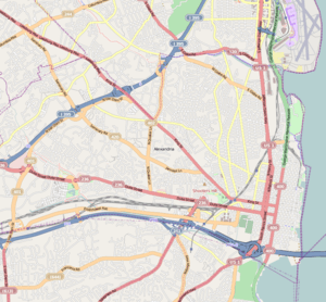
The station is located at King Street and Commonwealth Avenue. Entrances to the station are located on King Street and on the Diagonal Road side of the station. The station is above ground, and access to the platform is provided by one pair of escalators, one staircase, and one elevator. King Street is the second fastest growing station on the Washington Metro (behind Gallery Place). Over the past ten years, its ridership has increased 11%.[2]
History
Originally scheduled to open in summer 1982, its opening was delayed due to both unavailability of new subway cars and the lack of a test track.[3] Construction of the station was complete by summer 1982,[4] and in September 1983 Metro announced the station would open that December as the new cars would be ready for service.[5] The station opened on December 17, 1983.[6] Its opening coincided with the completion of 4.2 miles (6.8 km)[7] of rail between National Airport and Huntington and the opening of the Braddock Road, Eisenhower Avenue and Huntington stations.[6]
An expansion to the station added a second entrance and mezzanine across Commonwealth Avenue from the existing mezzanine, with the new entrance located on Cameron Street, across from the nearby Hilton Hotel. The expansion also includes a new canopy over the north end of the platform, designed to match the original canopy.[8][9] A gap was left between the two canopies to preserve the view of the George Washington Masonic Memorial from Old Town.
The station was named King Street from its 1983 opening until November 3, 2011, when the station was given its present name as part of a preparation for service changes planned for 2012.[10]
Transit connections
The station is adjacent to Alexandria Union Station, together with which it serves Old Town Alexandria and as a transit hub for the city as a whole. Both Metrobus and DASH provide service to the station. A free daily trolley service provides direct access to Old Town and the Waterfront, making many stops along King Street. Car sharing is also available. The station is about 12 blocks (one mile or 1.6 kilometers) from the intersection of King and Washington Streets; it is about 17 blocks from the Waterfront.
Station layout
| P Platform level |
Westbound | ← ← |
| Island platform, doors will open on the left | ||
| Eastbound | → → | |
| M | Mezzanine | One-way faregates, ticket machines, station agent |
| G | Street Level | Exit/Entrance, connection to VRE and Amtrak platforms at Union Station |
Notable places nearby
- George Washington Masonic National Memorial
- United States Patent and Trademark Office (PTO)
- Regent University, Alexandria Campus
References
- ↑ "Metrorail Average Weekday Passenger Boardings" (PDF). WMATA. Retrieved 2016-06-07.
- ↑ "Metrorail Average Weekday Passenger Boardings" (PDF). WMATA. Retrieved 2014-11-04.
- ↑ Feaver, Douglas B. (January 30, 1981). "Status of future Metro openings". The Washington Post. p. C5.
- ↑ Battiata, Mary (September 22, 1982). "Alexandria angered by delays in opening of subway". The Washington Post. p. VA1.
- ↑ Lynton, Stephen J. (September 21, 1983). "Metro panel approves plan for December Yellow Line opening". The Washington Post. p. C4.
- 1 2 Burgess, John (December 20, 1983). "Yellow Line trains run smoothly as new stations get first test". The Washington Post. p. C3.
- ↑ Washington Metropolitan Area Transit Authority (July 2009). "Sequence of Metrorail openings" (PDF). Retrieved July 25, 2010.
- ↑ O'Hanlon, Ann (February 14, 2002). "King Street Metro Station to get more entrances". The Washington Post. p. T3.
- ↑ Staff Reporters (September 21, 2004). "Ground was broken yesterday on $16 million in improvements to the King Street Station". The Washington Post. p. B3.
- ↑ "Station names updated for new map" (Press release). Washington Metropolitan Area Transit Authority. 2011-11-03. Archived from the original on 2011-11-05. Retrieved 2011-11-05.
External links
![]() Media related to King Street – Old Town (WMATA station) at Wikimedia Commons
Media related to King Street – Old Town (WMATA station) at Wikimedia Commons
- WMATA: King Street – Old Town Station
- StationMasters Online: King Street – Old Town Station
- The Schumin Web Transit Center: King Street – Old Town Station
- south entrance from Google Maps Street View
- King Street entrance from Google Maps Street View
- Commonwealth Avenue entrance from Google Maps Street View