Killenaule
| Killenaule Cill Náile | |
|---|---|
| Town | |
 Killenaule Location in Ireland | |
| Coordinates: 52°32′18″N 7°46′11″W / 52.5382°N 7.7697°WCoordinates: 52°32′18″N 7°46′11″W / 52.5382°N 7.7697°W | |
| Country | Ireland |
| Province | Munster |
| County | County Tipperary |
| Elevation | 169 m (554 ft) |
| Population (2006) | |
| • Urban | 597 |
| • Rural | 1,177 |
| Time zone | WET (UTC+0) |
| • Summer (DST) | IST (WEST) (UTC-1) |
| Irish Grid Reference | S221464 |
Killenaule (Irish: Cill Náile) is a town and a civil parish[1] in County Tipperary in Ireland. It is also one half of the ecclesiastical parish of Killenaule and Moyglass in the Roman Catholic Archdiocese of Cashel and Emly. It is in the barony of Slievardagh. It is located 19 km (12 mi) east of Cashel on the R689 and R691 regional roads. It lies at the south-western edge of the Slieveardagh Hills.
History

Killenaule came to national prominence in Ireland due to the discovery of the Derrynaflan Chalice. It was discovered in Derrynaflan Island in February 1980 by Mr. Michael Webb and his son. They were scanning the area with a metal detector, then a relatively new device on the market. The chalice was part of the Derrynaflan Hoard, consisting of an 8th-century chalice, a strainer or ladle and a paten. They were enclosed in a bronze basin buried 45 cm below ground and found about 20 metres from a church ruin. Many students of history and tourists visit Derrynaflan Island which is situated approximately 6 km (3.7 mi) northwest of Killenaule.
Demographics
The population of the town decreased by 16.5% between 2002 and 2006. And the population of the rural area also decreased by just under 10% from 1,307 to 1,177.
Sport
See also
References
External links
Places in County Tipperary | ||
|---|---|---|
| Towns | 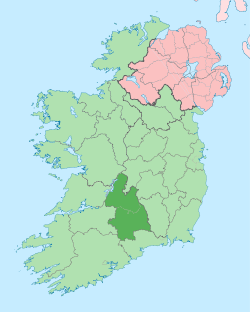 | |
| Villages |
| |
| Baronies | ||
| ||