Kershaw, South Carolina
| Kershaw, South Carolina | |
|---|---|
| Town | |
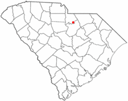 Location of Kershaw, South Carolina | |
| Coordinates: 34°32′50″N 80°34′58″W / 34.54722°N 80.58278°WCoordinates: 34°32′50″N 80°34′58″W / 34.54722°N 80.58278°W | |
| Country | United States |
| State | South Carolina |
| County | Lancaster |
| Area | |
| • Total | 1.9 sq mi (4.8 km2) |
| • Land | 1.9 sq mi (4.8 km2) |
| • Water | 0.0 sq mi (0.0 km2) |
| Elevation | 558 ft (170 m) |
| Population (2015) | |
| • Total | 2,052 |
| • Density | 888.5/sq mi (343.1/km2) |
| Time zone | Eastern (EST) (UTC-5) |
| • Summer (DST) | EDT (UTC-4) |
| ZIP code | 29067 |
| Area code(s) | 803 |
| FIPS code | 45-38095[1] |
| GNIS feature ID | 1246239[2] |
| Website | www.townofkershaw.net |
Kershaw, incorporated in 1888, is a town in Lancaster County, South Carolina, United States. The Haile Gold Mine, where gold was discovered in 1825 is three miles from town and was at one time the largest single producer of gold in the Appalachian region.
History
The Dr. William Columbus Cauthen House, Clinton AME Zion Church, East Richland Street-East Church Street Historic District, Kershaw Depot, Matson Street Historic District, and Unity Baptist Church are listed on the National Register of Historic Places.[3]
Geography and climate
Kershaw is located at 34°32′50″N 80°34′58″W / 34.54722°N 80.58278°W (34.547245, -80.582843).[4]
According to the United States Census Bureau, the town has a total area of 1.9 square miles (4.9 km2), all of which is land.
Demographics
| Historical population | |||
|---|---|---|---|
| Census | Pop. | %± | |
| 1900 | 1,002 | — | |
| 1910 | 950 | −5.2% | |
| 1920 | 1,022 | 7.6% | |
| 1930 | 1,120 | 9.6% | |
| 1940 | 1,264 | 12.9% | |
| 1950 | 1,376 | 8.9% | |
| 1960 | 1,567 | 13.9% | |
| 1970 | 990 | −36.8% | |
| 1980 | 1,993 | 101.3% | |
| 1990 | 1,814 | −9.0% | |
| 2000 | 1,645 | −9.3% | |
| 2010 | 1,803 | 9.6% | |
| Est. 2015 | 2,052 | [5] | 13.8% |
As of the census[1] of 2000, there were 1,645 people, and 465 families residing in the town. The population density was 888.5 people per square mile (343.3/km²). There were 771 housing units at an average density of 416.4 per square mile (160.9/km²). The racial makeup of the town was 75.68% White, 22.80% African American, 0.36% Native American, 0.12% Asian, 0.24% from other races, and 0.79% from two or more races. Hispanic or Latino of any race were 0.73% of the population.
There were 690 households out of which 26.8% had children under the age of 18 living with them, 50.7% were married couples living together, 13.0% had a female householder with no husband present, and 32.6% were non-families. 30.1% of all households were made up of individuals and 16.8% had someone living alone who was 65 years of age or older. The average household size was 2.38 and the average family size was 2.95.
In the town the population was spread out with 22.5% under the age of 18, 8.6% from 18 to 24, 24.5% from 25 to 44, 23.0% from 45 to 64, and 21.3% who were 65 years of age or older. The median age was 42 years. For every 100 females there were 86.7 males. For every 100 females age 18 and over, there were 82.1 males.
The median income for a household in the town was $36,065, and the median income for a family was $41,204. Males had a median income of $30,987 versus $21,827 for females. The per capita income for the town was $16,370. About 9.5% of families and 14.4% of the population were below the poverty line, including 19.6% of those under age 18 and 11.4% of those age 65 or over.
References
- 1 2 "American FactFinder". United States Census Bureau. Retrieved 2008-01-31.
- ↑ "US Board on Geographic Names". United States Geological Survey. 2007-10-25. Retrieved 2008-01-31.
- ↑ National Park Service (2010-07-09). "National Register Information System". National Register of Historic Places. National Park Service.
- ↑ "US Gazetteer files: 2010, 2000, and 1990". United States Census Bureau. 2011-02-12. Retrieved 2011-04-23.
- ↑ "Annual Estimates of the Resident Population for Incorporated Places: April 1, 2010 to July 1, 2015". Retrieved July 2, 2016.
- ↑ "Census of Population and Housing". Census.gov. Retrieved June 4, 2015.
External links
Municipalities and communities of Lancaster County, South Carolina, United States | ||
|---|---|---|
| City | 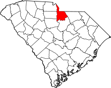 | |
| Towns | ||
| CDPs | ||
| Unincorporated communities | ||
| Footnotes | ‡This populated place also has portions in an adjacent county or counties | |