Kennington, Kent
| Kennington | |
 Kennington |
|
| Population | 2,400 (2005)[1] 4,076 (2011)[2] |
|---|---|
| OS grid reference | TR021449 |
| Civil parish | Kennington |
| District | Ashford |
| Shire county | Kent |
| Region | South East |
| Country | England |
| Sovereign state | United Kingdom |
| Post town | ASHFORD |
| Postcode district | TN24, TN25 |
| Dialling code | 01233 |
| Police | Kent |
| Fire | Kent |
| Ambulance | South East Coast |
| EU Parliament | South East England |
| UK Parliament | Ashford |
Coordinates: 51°10′03″N 0°53′30″E / 51.1674°N 0.8918°E
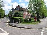
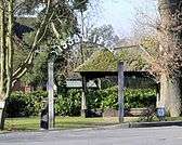
Kennington is a suburb of Ashford in Kent, England. It is about a mile northeast of the town centre and north of the M20 motorway, and contains the 12th-century church, St Mary's. The main A28 Canterbury Road and A251 Faversham Road run through the village. In recent years the village has expanded with the building of new housing estates in the Little Burton and Towers View areas.
The Great Stour river and the Kennington stream run through the area.
Kennington is also home to 1st Kennington Scout group, a long running scout group that includes all factions of the Scouting association; Beavers, Cubs, Scouts, Explorers (also known as 'Big Cubs'), and a highly successful branch of Network, dubbed 'The Roosters', featuring local minor celebrity 'Little' John Sheret. Kennington has four pubs, "The Old Mill" (formerly The Golden Ball), "The Pilgrims Rest", "The Rose Inn" and "The Pheasant".
The "Kennington Carvery"[3] is a new business to the area, opening on Wednesday's, Sunday's & Bank holiday Monday's for an eat as much as you like Carvery. On Friday's & Saturday's the venue can be hired for weddings, parties & all other events.
The Kennington News, published quarterly by Kennington Community Forum, is delivered to 5,000 homes and can also be read online.[4]
Local Government
The Kennington area is represented by the following borough wards and councillors:[5]
| Ward | Councillor | Party | Notes |
|---|---|---|---|
| Kennington | Philip F J Sims | Conservative | |
| Bybrook | Andrew Buchanan | Conservative | |
| Bockhanger (part) | Luke Powell | Conservative | north of M20 |
| Little Burton Farm | Mrs Marion Martin | Conservative | |
| Boughton Aluph & Eastwell (part) | Winston Michael | Independent | Polling district BAE3 Kennington North |
From May 2019, Kennington will also be represented by a parish council, which will be called Kennington Community Council.
Schools
There is one secondary school in the village, the Towers School, with a local junior school, Kennington CE Academy, and an infants school, Downs View Infants School. Since the county still operates a grammar school system, those who pass the Kent Test (which replaced the 11+) are given the opportunity to attend the grammar school in Ashford, the Norton Knatchbull School or Highworth Grammar School.[6]
Demography
| Kennington compared | |||
|---|---|---|---|
| 2001 UK Census | Kennington | Ashford district | England |
| Population | 2,321 | 102,661 | 49,138,831 |
| Foreign born | 6.9% | 5.5% | 9.2% |
| White | 96.3% | 97.6% | 90.9% |
| Asian | 1.6% | 0.9% | 4.6% |
| Black | 0.5% | 0.4% | 2.3% |
| Christian | 79.5% | 76.5% | 71.7% |
| Muslim | 0.6% | 0.6% | 3.1% |
| Hindu | 0.7% | 0.3% | 1.1% |
| No religion | 10.3% | 14.6% | 14.6% |
| Unemployed | 1.9% | 2.4% | 3.3% |
| Retired | 13.4% | 13.8% | 13.5% |
At the 2001 UK census, the Kennington electoral ward had a population of 2,321. The ethnicity was 96.3% white, 1.1% mixed race, 1.6% Asian, 0.5% black and 0.5% other. The place of birth of residents was 93.1% United Kingdom, 0.6% Republic of Ireland, 1.9% other Western European countries, and 4.4% elsewhere. Religion was recorded as 79.5% Christian, 0.2% Buddhist, 0.7% Hindu, 0.2% Sikh, 0.1% Jewish, and 0.6% Muslim. 10.3% were recorded as having no religion, 0.3% had an alternative religion and 8.2% did not state their religion.[7]
The economic activity of residents aged 16–74 was 43.3% in full-time employment, 14% in part-time employment, 10.2% self-employed, 1.9% unemployed, 3.6% students with jobs, 4.9% students without jobs, 13.4% retired, 4.7% looking after home or family, 2.6% permanently sick or disabled and 1.5% economically inactive for other reasons. The industry of employment of residents was 16.1% retail, 13.8% manufacturing, 7.8% construction, 12.1% real estate, 10.9% health and social work, 8.4% education, 8% transport and communications, 6.6% public administration, 5.7% hotels and restaurants, 5% finance, 1.1% agriculture and 4.5% other. Compared with national figures, the ward had a relatively high proportion of workers in hotels and restaurants, and a relatively low proportion in agriculture. Of the ward's residents aged 16–74, 21.6% had a higher education qualification or the equivalent, compared with 19.9% nationwide.[7]
References
| Wikimedia Commons has media related to Kennington, Kent. |
- ↑ "2005 Ward Level Population Estimates" (PDF). Kent County Council. September 2006. Retrieved 2007-08-20.
- ↑ "Civil Parish population 2011". Neighbourhood Statistics. Office for National Statistics. Retrieved 9 September 2016.
- ↑ http://thekenningtonevents.co.uk
- ↑ http://www.kenningtoncf.kentparishes.gov.uk
- ↑ http://www.ashford.gov.uk/councillors-meetings-elections
- ↑ http://www.kent.gov.uk/Kcc.eGov.SchoolAdmissions.Web.Public.UI/defaultssd.aspx
- 1 2 "Neighbourhood Statistics". Statistics.gov.uk. Retrieved 2008-02-22.