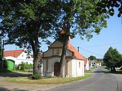
Kejnice
| Kejnice | |||
|---|---|---|---|
| Municipality | |||
 | |||
| |||
 Kejnice | |||
| Coordinates: 49°16′1″N 13°41′42″E / 49.26694°N 13.69500°ECoordinates: 49°16′1″N 13°41′42″E / 49.26694°N 13.69500°E | |||
| Country |
| ||
| Region | Plzeň | ||
| District | Klatovy | ||
| Area | |||
| • Total | 3.7 km2 (1.4 sq mi) | ||
| Elevation | 540 m (1,770 ft) | ||
| Population (1.1.2015) | |||
| • Total | 111 | ||
| • Density | 30/km2 (78/sq mi) | ||
| Postal code | 341 01 to 341 67 | ||


Kejnice is a village and municipality (obec) in Klatovy District in the Plzeň Region of the Czech Republic.
The municipality covers an area of 3.7 square kilometres (1.4 sq mi), and has a population of 127 (as at 28 August 2006).
Kejnice lies approximately 34 kilometres (21 mi) south-east of Klatovy, 59 km (37 mi) south-east of Plzeň, and 105 km (65 mi) south-west of Prague.
References
| Wikimedia Commons has media related to Kejnice. |
This article is issued from Wikipedia - version of the 4/7/2016. The text is available under the Creative Commons Attribution/Share Alike but additional terms may apply for the media files.