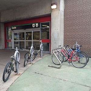
Keele (TTC)
Keele | |||||||||||
|---|---|---|---|---|---|---|---|---|---|---|---|
 | |||||||||||
| Location |
21 Keele Street Toronto, Ontario Canada | ||||||||||
| Coordinates | 43°39′20″N 79°27′35″W / 43.65556°N 79.45972°WCoordinates: 43°39′20″N 79°27′35″W / 43.65556°N 79.45972°W | ||||||||||
| Platforms | side platforms | ||||||||||
| Tracks | 2 | ||||||||||
| Connections |
| ||||||||||
| Construction | |||||||||||
| Structure type | elevated | ||||||||||
| Parking | 187 spaces | ||||||||||
| Disabled access | No | ||||||||||
| History | |||||||||||
| Opened | 25 February 1966 | ||||||||||
| Traffic | |||||||||||
| Passengers (2014[1]) | 17,550 | ||||||||||
| Services | |||||||||||
| |||||||||||
Keele is a station on the Bloor–Danforth line in Toronto, Ontario, Canada. It is located just north of Bloor Street West on the east side of Keele Street. The station opened in 1966, and was the western terminus of the line until 1968.
History
When the Bloor-Danforth line was opened in 1966 from Keele to Woodbine (TTC) station, the Bloor streetcar route was dramatically shortened. It now traveled east from Jane Loop only as far as Keele Station; at the eastern end of the line, a separate Danforth streetcar was established, from Woodbine station to Luttrell Loop. On 11 May 1968, the Bloor and Danforth streetcars were both eliminated when the subway extensions west to Islington and east to Warden were opened. During this initial two-year period the trolleybuses and streetcars serving the station used separate loops (both within the fare-paid area), one near each of the station's entrances, so that passengers transferring between streetcars and trolleybuses had to walk along the subway platform. While the main (Keele Street) entrance and trolleybus loop had escalators up to the platform, the east (parking lot and Indian Grove) entrance and streetcar loop were provided with a moving ramp leading up to what is now the eastbound subway platform. After streetcar service to the station ended in 1968, the streetcar loop property was redeveloped and the moving ramp was sealed off.[2][3] The former trolleybus loop is still used, by buses.
Keele and Dundas West were considered potential stations for the northwestern terminus of Phase Two of the proposed Downtown Relief Line.
Subway infrastructure in the vicinity
Just west of Keele Street, the line emerges from a hillside, changing directly from tunnel to an elevated alignment on an enclosed bridge, then enters the station. The fully enclosed station crosses over both Keele Street and a parallel side street named Indian Grove. Just east of the station the line emerges onto an open viaduct, with a 187 space parking lot located underneath parking lot at 400 Indian Road. The line then continues at ground level beside the no longer active Vincent Subway Yard, before descending into the Dorval Portal as it continues to Dundas West Station.
Nearby landmarks
Nearby landmarks include High Park and Keele Junior Public School. The neighbourhood of The Junction is located north of the station.
Surface connections
- 41A Keele to York University and Steeles Avenue
- 41B to Steeles Avenue and Petrolia Road via York University
- 41E to York University - express service
- 80A Queensway to Sherway Gardens
- 89 Weston to Albion Road
- 341 Blue Night Keele to York University and Steeles Avenue
References
- ↑ "Subway ridership, 2014" (PDF). Toronto Transit Commission. Retrieved September 12, 2015.
This table shows the typical number of customer-trips made on each subway on an average weekday and the typical number of customers travelling to and from each station platform on an average weekday.
- ↑ TTC system map in 1966
- ↑ "The Abandoned Streetcar Shuttle Connection Passages" (HTML). Transit Toronto. 2006-11-10. Retrieved 2008-05-10.
External links
![]() Media related to Keele Station at Wikimedia Commons
Media related to Keele Station at Wikimedia Commons