Katari
| Katari Municipality कटारी नगरपालिका | |
|---|---|
| Municipality | |
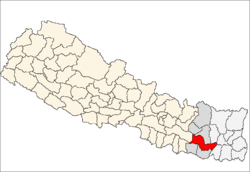
 Katari Municipality Location in Nepal | |
| Coordinates: 26°57′N 86°22′E / 26.95°N 86.37°ECoordinates: 26°57′N 86°22′E / 26.95°N 86.37°E | |
| Country |
|
| Zone | Sagarmatha Zone |
| District | Udayapur District |
| Population (1991) | |
| • Total | 7,230 |
| Time zone | NST (UTC+5:45) |
| Website | www.kataarimun.gov.np |
Katari is a Municipality in Udayapur District in the Sagarmatha Zone of south-eastern Nepal.It lies by the tawa river having the bridge of length 123.5m. This was established by merging two existing village development committees i.e. Triveni and Katari on 18 May 2014.[1][2] At the time of the 1991 Nepal census it had a population of 7230 people living in 1410 individual households.[3]
References
- ↑ 72 new municipalities announced My Republica
- ↑ Govt announces 72 new municipalities The Kathmandu Post
- ↑ "Nepal Census 2001". Nepal's Village Development Committees. Digital Himalaya. Archived from the original on October 12, 2008. Retrieved 13 November 2008.
External links
This article is issued from Wikipedia - version of the 9/11/2016. The text is available under the Creative Commons Attribution/Share Alike but additional terms may apply for the media files.