Kapla, Tabor
| Kapla | |
|---|---|
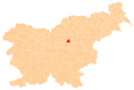
 Kapla Location in Slovenia | |
| Coordinates: 46°14′49.76″N 15°1′11.91″E / 46.2471556°N 15.0199750°ECoordinates: 46°14′49.76″N 15°1′11.91″E / 46.2471556°N 15.0199750°E | |
| Country |
|
| Traditional region | Styria |
| Statistical region | Savinja |
| Municipality | Tabor |
| Area | |
| • Total | 3.16 km2 (1.22 sq mi) |
| Elevation | 303 m (994 ft) |
| Population (2002) | |
| • Total | 255 |
| [1] | |
Kapla (pronounced [ˈkaːpla]) is a village in the Municipality of Tabor in central Slovenia. The Slovenian A1 motorway runs along the northern edge of the territory belonging to the village. The area is part of the traditional region of Styria. The municipality is now included in the Savinja Statistical Region.[2]
The local church is dedicated to Saint Radegund and belongs to the Parish of Sveti Jurij ob Taboru. It has a Gothic core with major 19th-century rebuilding and a belfry dating to 1669.[3]
References
External links
| Settlements | Administrative centre: Tabor
|  |
|---|---|---|
| Landmarks |
| |
This article is issued from Wikipedia - version of the 10/17/2016. The text is available under the Creative Commons Attribution/Share Alike but additional terms may apply for the media files.