Kapandriti
This article is about the town in East Attica. For the village in Kefalonia, see Xenopoulo.
| Kapandriti Καπανδρίτι | |
|---|---|
 Kapandriti | |
|
Location within the regional unit 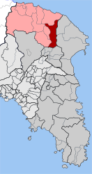 | |
| Coordinates: 38°13′N 23°53′E / 38.217°N 23.883°ECoordinates: 38°13′N 23°53′E / 38.217°N 23.883°E | |
| Country | Greece |
| Administrative region | Attica |
| Regional unit | East Attica |
| Municipality | Oropos |
| • Municipal unit | 36.789 km2 (14.204 sq mi) |
| Elevation | 356 m (1,168 ft) |
| Population (2011)[1] | |
| • Municipal unit | 4,213 |
| • Municipal unit density | 110/km2 (300/sq mi) |
| Time zone | EET (UTC+2) |
| • Summer (DST) | EEST (UTC+3) |
| Postal code | 190 14 |
| Area code(s) | 22950 |
| Vehicle registration | Z |
| Website | www.kapandriti.gr |
Kapandriti (Greek: Καπανδρίτι) is a town in the north of East Attica in Greece. Since the 2011 local government reform it is part of the municipality Oropos, of which it is a municipal unit.[2] The municipal unit has an area of 36.789 km2.[3]
Kapandriti is situated east of the Parnitha mountains and north of the Marathon Reservoir. It is 10 km northwest of Marathon and 29 km northeast of Athens. Motorway 1 (Athens - Thessaloniki) passes west of the town. Besides the main town, the community Kapandriti also contains the villages Mikrochori (pop. 578) and Agioi Anargyroi (276).
Historical population
| Year | Village population | Community population |
|---|---|---|
| 1981 | 1,676 | - |
| 1991 | 1,597 | 1,838 |
| 2001 | 2,326 | 2,937 |
| 2011 | 3,359 | 4,213 |
See also
References
- ↑ "Απογραφή Πληθυσμού - Κατοικιών 2011. ΜΟΝΙΜΟΣ Πληθυσμός" (in Greek). Hellenic Statistical Authority.
- ↑ Kallikratis law Greece Ministry of Interior (Greek)
- ↑ "Population & housing census 2001 (incl. area and average elevation)" (PDF) (in Greek). National Statistical Service of Greece.
External links
- Official website (Greek) (under construction)
- City of Kapandriti (Greek)
- GTP Travel Pages (Community)
- A guide of the town's businesses and services
 |
Malakasa | Kalamos | Varnavas | |
| Polydendri | |
|||
| ||||
| | ||||
| Afidnes | Marathon |
This article is issued from Wikipedia - version of the 11/28/2016. The text is available under the Creative Commons Attribution/Share Alike but additional terms may apply for the media files.