Kanitz Nunatak
Kanitz Nunatak (Bulgarian: нунатак Каниц, ‘Nunatak Kanitz’ \'nu-na-tak 'ka-nits\) is the rocky peak rising to over 600 m in the southern foothills of Laclavère Plateau on Trinity Peninsula, Antarctic Peninsula. Situated 8.43 km south of Ami Boué Peak, 9.81 km east-southeast of Dabnik Peak, 6.15 km north of Cain Nunatak and 9.84 km west by south of Theodolite Hill. Overlooking Broad Valley to the south.
The peak is named after the settlement of Kanitz in northwestern Bulgaria, in connection with the Austro-Hungarian geographer and ethnographer Felix Kanitz (1829–1904).
Location
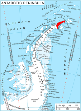
Kanitz Nunatak is located at 63°29′33″S 57°46′41″W / 63.49250°S 57.77806°WCoordinates: 63°29′33″S 57°46′41″W / 63.49250°S 57.77806°W. German-British mapping in 1996.
Map
- Trinity Peninsula. Scale 1:250000 topographic map No. 5697. Institut für Angewandte Geodäsie and British Antarctic Survey, 1996.
References
- Bulgarian Antarctic Gazetteer. Antarctic Place-names Commission. (details in Bulgarian, basic data in English)
- SCAR Composite Antarctic Gazetteer.
This article includes information from the Antarctic Place-names Commission of Bulgaria which is used with permission.