Kan-i-Gut
| Kan-i-Gut | |
|---|---|
|
IUCN category III (natural monument or feature) | |
 Kan-i-Gut | |
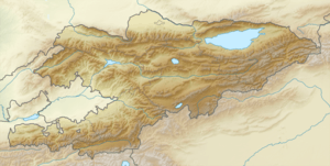
| Location | Batken District, Batken Region, Kyrgyzstan |
| Coordinates | 40°00.764′N 70°20.782′E / 40.012733°N 70.346367°ECoordinates: 40°00.764′N 70°20.782′E / 40.012733°N 70.346367°E |
| Established | 1975 |
Kan-i-Gut (or Kanigut or Kani-Gut, "mine-of-loss") cave is a geological protected area (nature monument) located at north slopes of Turkestan Range in Batken Region of Kyrgyzstan. The cave consists of 18 large caverns, deep cavities, narrow passageways and tunnels. Its length is more than 1 km. From the 6th to the 11th century the cave served as a lead and iron mine.[1]
External links
References
- ↑ Ошская область: Энциклопедия [Osh Oblast Encyclopedia] (in Russian). Frunze: Chief Editorial Board of Kyrgyz Soviet Encyclopedia. 1994. p. 445.
This article is issued from Wikipedia - version of the 11/19/2016. The text is available under the Creative Commons Attribution/Share Alike but additional terms may apply for the media files.