Kamta-Rajaula State
| Kamta-Rajaula State कामता-राजुला रियासत | |||||
| Princely Estate (Jagir) | |||||
| |||||
 | |||||
| History | |||||
| • | Established | 1812 | |||
| • | Independence of India | 1948 | |||
| Area | |||||
| • | 1901 | 34 km2 (13 sq mi) | |||
| Population | |||||
| • | 1901 | 1,232 | |||
| Density | 36.2 /km2 (93.8 /sq mi) | ||||
| | |||||
Kamta-Rajaula was a princely state in India during the British Raj.
History
It was one of the Chaube Jagirs, part of the Bagelkhand Agency which was merged into the Indian state of Vindhya Pradesh in 1948.
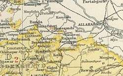
Kamta-Rajaula was a place of pilgrimage, for according to legend it was one of the places where Rama had been.[1] The capital was the village of Rajaula, located at 15 km from Karwi railway station.
Rulers
The rulers of Kamta-Rajaula were titled 'Rao'.[2]
Raos
- 1812 - 1873 Gopal Lal
- 1873 - 18.. Bharat Prasad
- 1892 - 1906* Ram Prasad
- 1928 - 1946 Radha Kishan
- 1946 - 1947 Rajiv Nandan Prasad
See also
References
- ↑ Great Britain India Office. The Imperial Gazetteer of India. Oxford: Clarendon Press, 1908
- ↑ Indian Princely States
Coordinates: 25°11′N 80°51′E / 25.183°N 80.850°E
This article is issued from Wikipedia - version of the 12/29/2015. The text is available under the Creative Commons Attribution/Share Alike but additional terms may apply for the media files.