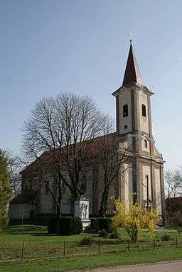
Kamenín
| Kamenín | |
| Kéménd | |
| village | |
 | |
| Country | Slovakia |
|---|---|
| Region | Nitra |
| District | Nové Zámky |
| River | Nitra |
| Elevation | 124 m (407 ft) |
| Coordinates | SK 47°53′16″N 18°38′42″E / 47.88778°N 18.64500°ECoordinates: SK 47°53′16″N 18°38′42″E / 47.88778°N 18.64500°E |
| Area | 28.04 km2 (10.826 sq mi) |
| Population | 1,504 (2006) |
| Density | 54/km2 (140/sq mi) |
| Founded | 1183 |
| Mayor | László Benefi |
| Timezone | CET (UTC+1) |
| - summer (DST) | CEST (UTC+2) |
| Postal code | 943 57 |
| Area code | +421-36 |
| Car plate | NZ |
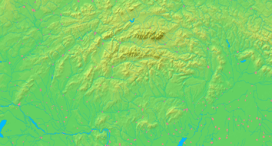  Location in Slovakia | |
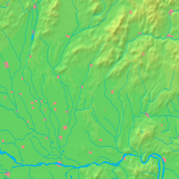  Location in the Nitra Region | |
| Wikimedia Commons: Kamenín | |
| Statistics: MOŠ/MIS | |
| Website: http://www.parkany.sk/kemend/slov/jobb.htm | |
Kamenín (Hungarian: Kéménd) is a village and municipality in the Nové Zámky District in the Nitra Region of south-west Slovakia.
Geography
The village lies at an altitude of 127 metres and covers an area of 28.058 km².
History
In historical records the village was first mentioned in 1183 After the Austro-Hungarian army disintegrated in November 1918, Czechoslovak troops occupied the area, later acknowledged internationally by the Treaty of Trianon. Between 1938 and 1945 Kamenín once more became part of Miklós Horthy's Hungary through the First Vienna Award. From 1945 until the Velvet Divorce, it was part of Czechoslovakia. Since then it has been part of Slovakia.
Population
It has a population of about 1523 people. The population is about 1179 Hungarian, 250 Slovak and has 29 Romany and 19 Czech minorities.
Facilities
The village has a public library and a DVD rental store.
Genealogical resources
The records for genealogical research are available at the state archive "Statny Archiv in Nitra, Slovakia"
- Roman Catholic church records (births/marriages/deaths): 1724-1895 (parish A)
- Reformated church records (births/marriages/deaths): 1784-1953 (parish B)
See also
External links
- http://www.statistics.sk/mosmis/eng/run.html
- Kamenín – Nové Zámky Okolie
- Surnames of living people in Kamenin