Kalida, Ohio
| Kalida, Ohio | |
|---|---|
| Village | |
|
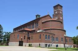
St. Michael's Catholic Church, which dominates the skyline | |
 Location of Kalida, Ohio | |
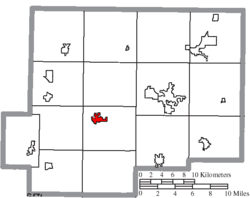 Location of Kalida in Putnam County | |
| Coordinates: 40°59′4″N 84°11′51″W / 40.98444°N 84.19750°WCoordinates: 40°59′4″N 84°11′51″W / 40.98444°N 84.19750°W | |
| Country | United States |
| State | Ohio |
| County | Putnam |
| Area[1] | |
| • Total | 1.47 sq mi (3.81 km2) |
| • Land | 1.44 sq mi (3.73 km2) |
| • Water | 0.03 sq mi (0.08 km2) |
| Elevation[2] | 725 ft (221 m) |
| Population (2010)[3] | |
| • Total | 1,542 |
| • Estimate (2012[4]) | 1,550 |
| • Density | 1,070.8/sq mi (413.4/km2) |
| Time zone | Eastern (EST) (UTC-5) |
| • Summer (DST) | EDT (UTC-4) |
| ZIP code | 45853 |
| Area code(s) | 419 |
| FIPS code | 39-39536[5] |
| GNIS feature ID | 1042172[2] |
Kalida is a village in Putnam County, Ohio, United States. The population was 1,542 at the 2010 census.
History
Founded in 1834, Kalida was the first county seat of Putnam County.[6] Kalida is a name derived from Greek meaning "beautiful".[7] A post office has been in operation in Kalida since 1834.[8] Kalida was incorporated as a village in 1839.[9] The county seat was transferred to Ottawa in 1866.[9]
The Putnam County Historical Society Museum is housed in Kalida.[10]
Geography
Kalida is located at 40°59′4″N 84°11′51″W / 40.98444°N 84.19750°W (40.984530, -84.197585).[11]
According to the United States Census Bureau, the village has a total area of 1.47 square miles (3.81 km2), of which 1.44 square miles (3.73 km2) is land and 0.03 square miles (0.08 km2) is water.[1]
Demographics
| Historical population | |||
|---|---|---|---|
| Census | Pop. | %± | |
| 1850 | 216 | — | |
| 1860 | 335 | 55.1% | |
| 1870 | 290 | −13.4% | |
| 1880 | 404 | 39.3% | |
| 1890 | 444 | 9.9% | |
| 1900 | 622 | 40.1% | |
| 1910 | 770 | 23.8% | |
| 1920 | 583 | −24.3% | |
| 1930 | 431 | −26.1% | |
| 1940 | 521 | 20.9% | |
| 1950 | 533 | 2.3% | |
| 1960 | 705 | 32.3% | |
| 1970 | 900 | 27.7% | |
| 1980 | 1,019 | 13.2% | |
| 1990 | 947 | −7.1% | |
| 2000 | 1,031 | 8.9% | |
| 2010 | 1,542 | 49.6% | |
| Est. 2015 | 1,562 | [12] | 1.3% |
2010 census
As of the census[3] of 2010, there were 1,542 people, 588 households, and 408 families residing in the village. The population density was 1,070.8 inhabitants per square mile (413.4/km2). There were 612 housing units at an average density of 425.0 per square mile (164.1/km2). The racial makeup of the village was 98.7% White, 0.2% African American, 0.1% Pacific Islander, 0.6% from other races, and 0.4% from two or more races. Hispanic or Latino of any race were 1.1% of the population.
There were 588 households of which 33.7% had children under the age of 18 living with them, 61.7% were married couples living together, 4.9% had a female householder with no husband present, 2.7% had a male householder with no wife present, and 30.6% were non-families. 28.1% of all households were made up of individuals and 16.8% had someone living alone who was 65 years of age or older. The average household size was 2.53 and the average family size was 3.14.
The median age in the village was 39.6 years. 26.5% of residents were under the age of 18; 5.5% were between the ages of 18 and 24; 23.1% were from 25 to 44; 27.1% were from 45 to 64; and 17.7% were 65 years of age or older. The gender makeup of the village was 48.8% male and 51.2% female.
2000 census
As of the census[5] of 2000, there were 1,031 people, 385 households, and 284 families residing in the village. The population density was 924.4 people per square mile (355.4/km²). There were 397 housing units at an average density of 356.0 per square mile (136.9/km²). The racial makeup of the village was 99.13% White, 0.19% Native American, 0.48% from other races, and 0.19% from two or more races. Hispanic or Latino of any race were 0.78% of the population.
There were 385 households out of which 37.9% had children under the age of 18 living with them, 63.9% were married couples living together, 7.8% had a female householder with no husband present, and 26.2% were non-families. 24.2% of all households were made up of individuals and 15.3% had someone living alone who was 65 years of age or older. The average household size was 2.68 and the average family size was 3.20.
In the village the population was spread out with 27.5% under the age of 18, 8.6% from 18 to 24, 30.7% from 25 to 44, 19.3% from 45 to 64, and 13.8% who were 65 years of age or older. The median age was 35 years. For every 100 females there were 101.4 males. For every 100 females age 18 and over, there were 97.1 males.
The median income for a household in the village was $52,411, and the median income for a family was $59,861. Males had a median income of $37,750 versus $27,065 for females. The per capita income for the village was $21,293. About 3.3% of families and 4.4% of the population were below the poverty line, including 4.1% of those under age 18 and 7.2% of those age 65 or over.
Education
Kalida High School (KHS) and Kalida Elementary School (KES) are both part of the Kalida Local School District.
Festivals
Pioneer Days is a county-wide festival held in Kalida, on the weekend following Labor Day. The festival is the oldest in Ohio.[14]
Notable person
- David Ayers, Medal of Honor recipient.
- Gene "Geno" Stechschulte, St. Louis Cardinals pitcher
References
- 1 2 "US Gazetteer files 2010". United States Census Bureau. Retrieved 2013-01-06.
- 1 2 "US Board on Geographic Names". United States Geological Survey. 2007-10-25. Retrieved 2008-01-31.
- 1 2 "American FactFinder". United States Census Bureau. Retrieved 2013-01-06.
- ↑ "Population Estimates". United States Census Bureau. Retrieved 2013-06-17.
- 1 2 "American FactFinder". United States Census Bureau. Retrieved 2008-01-31.
- ↑ Warren, Robert (May 31, 1953). "Blanchard River Brought Pioneers To Putnam". Toledo Blade. p. 3. Retrieved 30 April 2015.
- ↑ Mangus, Michael; Herman, Jennifer L. (2008). Ohio Encyclopedia. North American Book Dist LLC. p. 430. ISBN 978-1-878592-68-2.
- ↑ "Putnam County". Jim Forte Postal History. Retrieved 30 April 2015.
- 1 2 Kinder, George D. (1915). History of Putnam County, Ohio : its peoples, industries, and institutions. B.F. Bowen. p. 161.
- ↑ "Homepage". The Putnam County, Ohio, Historical Society and Museum. Retrieved 30 April 2015.
- ↑ "US Gazetteer files: 2010, 2000, and 1990". United States Census Bureau. 2011-02-12. Retrieved 2011-04-23.
- ↑ "Annual Estimates of the Resident Population for Incorporated Places: April 1, 2010 to July 1, 2015". Retrieved July 2, 2016.
- ↑ "Census of Population and Housing". Census.gov. Retrieved June 4, 2015.
- ↑ Pioneer Days "Always the Weekend After Labor Day", Pioneer Days, 2007. Accessed 2007-09-10.
External links
Municipalities and communities of Putnam County, Ohio, United States | ||
|---|---|---|
| Villages | 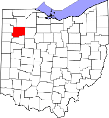 | |
| Townships | ||
| CDP | ||
| Unincorporated communities | ||
| Ghost towns | ||