Junction Road railway station
| Junction Road | |
|---|---|
 | |
| Location | Tufnell Park |
| Local authority | London Borough of Islington |
| Owner | Tottenham & Hampstead Junction Railway |
| Number of platforms | 2 |
| Key dates | |
| 1 January 1872 | Opened |
| 3 May 1943 | Closed |
| Other information | |
| Lists of stations | |
|
| |
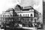
Junction Road railway station (originally Junction Road for Tufnell Park) was a railway station in London. The station was opened by the Tottenham & Hampstead Junction Railway on 1 January 1872. It was located at the corner of Junction Road and Station Road in N19, near the northern tip of Islington.
It comprised two wooden platforms, accessed by means of a footbridge and stairs, and also served the nearby Tufnell Park goods depot.
Trains from the station generally ran between St Pancras or Kentish Town to Barking or Southend, however over its history trains ran to a number of other locations including Cambridge, Chingford and Victoria.

It was initially very heavily used, mainly due to the nearby Metropolitan Cattle Market. At its peak, in 1902, over 140,000 passengers used the station. When the nearby Tufnell Park Underground station was opened on the Charing Cross, Euston and Hampstead Railway (now the Northern line), passenger levels dropped drastically (in a 1937 poem, John Betjeman described it as "a lonely station"[1]). The station was closed on 3 May 1943 and demolished in the early 1950s; the only remaining evidence of the station is the name "Station Road".
The Gospel Oak to Barking Line passes through the site of the station. This has led to suggestions that it could be rebuilt, offering an interchange with the Northern line; in 2013, however, the Mayor of London and Transport for London stated that there were no plans to do so, although they would keep the possibility of rebuilding the station under review.[2]
References
- ↑ https://books.google.co.uk/books?id=s2phRLbALuIC&pg=PT49&lpg=PT49&dq=John+Betjeman+junction+road+station&source=bl&ots=DXN5U9ipsC&sig=hC57p17qRVeCzNYM7GT-X0bKO0c&hl=en&sa=X&ved=0ahUKEwiOjarKxejMAhWCCMAKHT8ICOQQ6AEIIjAB#v=onepage&q=John%20Betjeman%20junction%20road%20station&f=false
- ↑ "Mayor answers to London: Junction Road station". London Assembly. London Assembly. Retrieved 27 March 2015.
| Preceding station | Disused railways | Following station | ||
|---|---|---|---|---|
| Highgate Road (High Level) towards Gospel Oak or Kentish Town |
Tottenham & Hampstead Junction Railway | Upper Holloway towards Barking | ||
| Highgate Road (Low Level) towards Haverstock Hill or Kentish Town |
||||
Coordinates: 51°33′32″N 0°08′13″W / 51.559°N 0.137°W