Juphal
| Juphal जुफाल | |
|---|---|
| Municipality | |
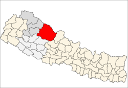
 Juphal Location in Nepal | |
| Coordinates: 28°58′N 82°49′E / 28.97°N 82.81°ECoordinates: 28°58′N 82°49′E / 28.97°N 82.81°E | |
| Country |
|
| Zone | Karnali Zone |
| District | Dolpa District |
| Population (1991) | |
| • Total | 1,513 |
| Time zone | Nepal Time (UTC+5:45) |
Juphal is a village development committee in Dolpa District in the Karnali Zone of north-western Nepal. The 1991 Nepal census counted 1,513 persons in 300 households.[1]
Jufal has Dolpa Airport, used by small propeller planes flying out of Nepalgunj.[2] and Pokhara.[3] They are the only practicable ways to reach Dolpo and Dolpa District's headquarters at Dunai from the rest of Nepal.
References
- ↑ "Nepal Census 2001". Nepal's Village Development Committees. Digital Himalaya. Retrieved 3 September 2008.
- ↑ Yeti Air offers non-scheduled flights from Nepalgunj on a 19-seated DHC-6/300 Twin Otter plane.
- ↑ Bezruchka, Stephen (1999), Trekking in Nepal (7th ed.), p. 323, ISBN 978-0-89886-662-9.
External links
Capital: Dunai | ||
 | ||
This article is issued from Wikipedia - version of the 2/14/2016. The text is available under the Creative Commons Attribution/Share Alike but additional terms may apply for the media files.