Jordan, Montana
| Jordan, Montana | |
|---|---|
| Town | |
|
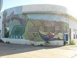
Intersection of Main Street and Jordan Avenue | |
 Location of Jordan, Montana | |
| Coordinates: 47°19.3′N 106°54.6′W / 47.3217°N 106.9100°WCoordinates: 47°19.3′N 106°54.6′W / 47.3217°N 106.9100°W | |
| Country | United States |
| State | Montana |
| County | Garfield |
| Area[1] | |
| • Total | 0.34 sq mi (0.88 km2) |
| • Land | 0.34 sq mi (0.88 km2) |
| • Water | 0 sq mi (0 km2) |
| Elevation | 2,602 ft (793 m) |
| Population (2010)[2] | |
| • Total | 343 |
| • Estimate (2012[3]) | 376 |
| • Density | 1,008.8/sq mi (389.5/km2) |
| Time zone | Mountain (MST) (UTC-7) |
| • Summer (DST) | MDT (UTC-6) |
| ZIP code | 59337 |
| Area code(s) | 406 |
| FIPS code | 30-39925 |
| GNIS feature ID | 0772903 |
Jordan is a town in and the county seat of Garfield County, Montana, United States.[4] The population was 343 at the 2010 census.
History
Originally settled in 1896, Jordan received a post office on July 11, 1899. The founder, Arthur Jordan, had hunted the area a great deal and in 1896 decided to bring his family here to settle along the banks of the Big Dry Creek.
Before very long a town began to spring up around the post office. There were saloons, rooming houses, livery stables, blacksmiths and stores. In the later part of the 1910s the homestead boom hit Garfield County, which was then actually part of Dawson County to the east. By 1919, it became the consensus of many locals that they needed to form a county of their own and Garfield County was established. After much ado by competing towns in the area, Jordan was finally chosen as the county seat, by popular vote.
Jordan was incorporated as a town in 1951.
On March 25, 1996 an 81-day-long standoff between the antigovernment Montana Freemen and federal officers began near here.
Geography
Jordan is located at 47°19.3′N 106°54.6′W / 47.3217°N 106.9100°W (47.3212, -106.9106).[5]
According to the United States Census Bureau, the town has a total area of 0.34 square miles (0.88 km2), all of it land.[1]
Climate
Jordan experiences a semi-arid climate (Köppen BSk) with long, cold, dry winters and hot, wetter summers. The town is noted for its extreme weather; On December 15, 2009, the low was −40 °F (−40 °C).[6] Jordan ranks 10th in the U.S. in temperature range, from its lowest at −58 °F (−50 °C), to its highest at 112 °F (44 °C), a range of 170 °F (94 °C).[7]
| Climate data for Jordan, Montana | |||||||||||||
|---|---|---|---|---|---|---|---|---|---|---|---|---|---|
| Month | Jan | Feb | Mar | Apr | May | Jun | Jul | Aug | Sep | Oct | Nov | Dec | Year |
| Record high °F (°C) | 68 (20) |
74 (23) |
81 (27) |
94 (34) |
102 (39) |
111 (44) |
112 (44) |
110 (43) |
107 (42) |
95 (35) |
78 (26) |
71 (22) |
112 (44) |
| Average high °F (°C) | 27.4 (−2.6) |
36.1 (2.3) |
47.8 (8.8) |
59.9 (15.5) |
70.3 (21.3) |
80.9 (27.2) |
88.4 (31.3) |
88.3 (31.3) |
75.6 (24.2) |
62.6 (17) |
42.7 (5.9) |
31.4 (−0.3) |
59.28 (15.16) |
| Daily mean °F (°C) | 14.1 (−9.9) |
22.3 (−5.4) |
33.3 (0.7) |
44.9 (7.2) |
55.2 (12.9) |
65.4 (18.6) |
71.4 (21.9) |
70.4 (21.3) |
57.6 (14.2) |
46.0 (7.8) |
28.9 (−1.7) |
18.4 (−7.6) |
43.99 (6.67) |
| Average low °F (°C) | 0.7 (−17.4) |
8.4 (−13.1) |
18.7 (−7.4) |
29.8 (−1.2) |
40.0 (4.4) |
49.9 (9.9) |
54.3 (12.4) |
52.5 (11.4) |
39.6 (4.2) |
29.3 (−1.5) |
15.1 (−9.4) |
5.3 (−14.8) |
28.63 (−1.88) |
| Record low °F (°C) | −51 (−46) |
−58 (−50) |
−35 (−37) |
−13 (−25) |
10 (−12) |
29 (−2) |
31 (−1) |
29 (−2) |
13 (−11) |
−14 (−26) |
−32 (−36) |
−46 (−43) |
−58 (−50) |
| Average precipitation inches (mm) | 0.51 (13) |
0.36 (9.1) |
0.61 (15.5) |
0.98 (24.9) |
2.19 (55.6) |
2.27 (57.7) |
1.73 (43.9) |
1.19 (30.2) |
1.23 (31.2) |
0.88 (22.4) |
0.44 (11.2) |
0.51 (13) |
12.9 (327.7) |
| Source #1: NOAA (normals, 1971–2000) [8] | |||||||||||||
| Source #2: The Weather Channel (Records) [9] | |||||||||||||
Demographics
| Historical population | |||
|---|---|---|---|
| Census | Pop. | %± | |
| 1960 | 557 | — | |
| 1970 | 529 | −5.0% | |
| 1980 | 485 | −8.3% | |
| 1990 | 494 | 1.9% | |
| 2000 | 364 | −26.3% | |
| 2010 | 343 | −5.8% | |
| Est. 2015 | 399 | [10] | 16.3% |
2010 census
As of the census[2] of 2010, there were 343 people, 170 households, and 93 families residing in the town. The population density was 1,008.8 inhabitants per square mile (389.5/km2). There were 206 housing units at an average density of 605.9 per square mile (233.9/km2). The racial makeup of the town was 98.8% White, 0.6% Native American, 0.3% from other races, and 0.3% from two or more races. Hispanic or Latino of any race were 0.9% of the population.
There were 170 households of which 18.2% had children under the age of 18 living with them, 42.9% were married couples living together, 8.2% had a female householder with no husband present, 3.5% had a male householder with no wife present, and 45.3% were non-families. 37.6% of all households were made up of individuals and 18.9% had someone living alone who was 65 years of age or older. The average household size was 2.02 and the average family size was 2.71.
The median age in the town was 48.8 years. 18.7% of residents were under the age of 18; 6.1% were between the ages of 18 and 24; 19.2% were from 25 to 44; 31% were from 45 to 64; and 25.1% were 65 years of age or older. The gender makeup of the town was 49.0% male and 51.0% female.
2000 census
As of the census[13] of 2000, there were 364 people, 169 households, and 98 families residing in the town. The population density was 1,024.9 people per square mile (390.4/km²). There were 233 housing units at an average density of 656.0 per square mile (249.9/km²). The racial makeup of the town was 98.63% White, 0.27% African American, 0.27% Pacific Islander, and 0.82% from two or more races. Hispanic or Latino of any race were 1.37% of the population.

There were 169 households out of which 26.0% had children under the age of 18 living with them, 46.2% were married couples living together, 8.3% had a female householder with no husband present, and 42.0% were non-families. 39.1% of all households were made up of individuals and 23.1% had someone living alone who was 65 years of age or older. The average household size was 2.08 and the average family size was 2.80.
In the town the population was spread out with 22.3% under the age of 18, 6.3% from 18 to 24, 23.1% from 25 to 44, 22.3% from 45 to 64, and 26.1% who were 65 years of age or older. The median age was 43 years. For every 100 females there were 94.7 males. For every 100 females age 18 and over, there were 87.4 males.
The median income for a household in the town was $26,250, and the median income for a family was $34,583. Males had a median income of $21,250 versus $11,979 for females. The per capita income for the town was $17,426. About 10.4% of families and 19.2% of the population were below the poverty line, including 36.4% of those under age 18 and 13.6% of those age 65 or over.
Notable people
- Jerry Kramer, National Football League player and author, was born here in 1936.
References
- 1 2 "US Gazetteer files 2010". United States Census Bureau. Retrieved 2012-12-18.
- 1 2 "American FactFinder". United States Census Bureau. Retrieved 2012-12-18.
- ↑ "Population Estimates". United States Census Bureau. Retrieved 2013-06-03.
- ↑ "Find a County". National Association of Counties. Retrieved 2011-06-07.
- ↑ "US Gazetteer files: 2010, 2000, and 1990". United States Census Bureau. 2011-02-12. Retrieved 2011-04-23.
- ↑ [[Associated Press ]], "The nation's weather 16 December 2009," online
- ↑ Christopher C. Burt. Extreme Weather: A Guide and Record Book (2007) p. 35
- ↑ "Climatography of the United States NO.81" (PDF). National Oceanic and Atmospheric Administration. Retrieved January 15, 2011.
- ↑ "Monthly Averages for Jordan, MT". The Weather Channel. Retrieved January 15, 2011.
- ↑ "Annual Estimates of the Resident Population for Incorporated Places: April 1, 2010 to July 1, 2015". Retrieved July 2, 2016.
- ↑ "Census of Population and Housing". Census.gov. Retrieved June 4, 2015.
- ↑ "Census & Economic Information Center". Retrieved July 3, 2015.
- ↑ "American FactFinder". United States Census Bureau. Retrieved 2008-01-31.
Municipalities and communities of Garfield County, Montana, United States | ||
|---|---|---|
| Town | 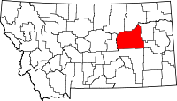 | |
| Unincorporated communities | ||