Johnston, Iowa
| Johnston, Iowa | ||
|---|---|---|
| City | ||
|
Johnston welcome sign | ||
| ||
| Motto: Living. Learning. Growing. | ||
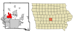 Location of Johnston, Iowa | ||
| Coordinates: 41°40′17″N 93°42′21″W / 41.67139°N 93.70583°WCoordinates: 41°40′17″N 93°42′21″W / 41.67139°N 93.70583°W | ||
| Country |
| |
| State |
| |
| County | Polk | |
| Incorporated | September 18, 1969 | |
| Government | ||
| • Type | Mayor-council government | |
| • Mayor | Paula Dierenfeld | |
| Area[1] | ||
| • Total | 18.37 sq mi (47.58 km2) | |
| • Land | 17.16 sq mi (44.44 km2) | |
| • Water | 1.21 sq mi (3.13 km2) | |
| Elevation | 830 ft (253 m) | |
| Population (2010)[2] | ||
| • Total | 17,278 | |
| • Estimate (2013[3]) | 19,798 | |
| • Rank | 24th in Iowa | |
| • Density | 1,006.9/sq mi (388.8/km2) | |
| Time zone | Central (CST) (UTC-6) | |
| • Summer (DST) | CDT (UTC-5) | |
| ZIP code | 50131 | |
| Area code(s) | 515 | |
| FIPS code | 19-39765 | |
| GNIS feature ID | 0457978 | |
| Website | www.cityofjohnston.com | |
Johnston is a city in Polk County, Iowa, United States. The population was 17,278 in the 2010 census, an increase of almost 100% from the 8,649 population in the 2000 census.[4][5] It is part of the Des Moines–West Des Moines Metropolitan Statistical Area.
Johnston is the location of the headquarters of Pioneer Hi-Bred Seeds, Iowa Public Television, and The Gardeners of America/Men's Garden Clubs of America. Also located here are the Camp Dodge Military Reservation as well as the Paul J. and Ida Trier House, a private residence designed by famous architect Frank Lloyd Wright, and the Des Moines Weather Forecast Office of the National Weather Service.[6]
History
Johnston was established in 1905 as a station on the interurban railway between Des Moines and Perry known as Johnston Station. It was named for the railway's freight supervisor, John F. Johnston.[7]
Incorporation did not come until September 18, 1969. At the time, the Johnston Station area did not become part of the incorporated city because of a state law that prevented a town within three miles (5 km) of another city from incorporating. The neighboring cities of Des Moines and Urbandale were also interested in that land, but in April 1970, Johnston and Urbandale reached an agreement that allowed Johnston to annex the Johnston Station area.[8]
Economy
Pioneer Hi-Bred (a DuPont company-DuPont Pioneer) and John Deere Financial are based in Johnston.[9]
Geography
Johnston is located at 41°40′17″N 93°42′21″W / 41.67139°N 93.70583°W (41.671337, -93.705800).[10]
According to the United States Census Bureau, the city has a total area of 18.37 square miles (47.58 km2), of which, 17.16 square miles (44.44 km2) is land and 1.21 square miles (3.13 km2) is water.[1]
The city is bordered on the east by the Des Moines River and the city's area includes part of Saylorville Reservoir. On the south the city is bordered by Interstate 80 and on the west the city limits extend to a half mile east of Highway 141. The city is bisected by Beaver Creek, which flows southerly through the city until it nearly reaches Interstate 80, at which point the course turn easterly and flows to the Des Moines River.
Demographics
| Historical population | |||
|---|---|---|---|
| Census | Pop. | %± | |
| 1970 | 222 | — | |
| 1980 | 2,526 | 1,037.8% | |
| 1990 | 4,702 | 86.1% | |
| 2000 | 8,649 | 83.9% | |
| 2010 | 17,278 | 99.8% | |
| Est. 2015 | 20,871 | [11] | 20.8% |
2010 census
As of the census[2] of 2010, there were 17,278 people, 6,369 households, and 4,720 families residing in the city. The population density was 1,006.9 inhabitants per square mile (388.8/km2). There were 6,618 housing units at an average density of 385.7 per square mile (148.9/km2). The racial makeup of the city was 91.0% White, 2.2% African American, 0.1% Native American, 4.6% Asian, 0.6% from other races, and 1.5% from two or more races. Hispanic or Latino of any race were 2.0% of the population.
There were 6,369 households of which 42.2% had children under the age of 18 living with them, 64.4% were married couples living together, 6.8% had a female householder with no husband present, 2.9% had a male householder with no wife present, and 25.9% were non-families. 20.7% of all households were made up of individuals and 6.9% had someone living alone who was 65 years of age or older. The average household size was 2.67 and the average family size was 3.14.
The median age in the city was 36.9 years. 29.9% of residents were under the age of 18; 5.8% were between the ages of 18 and 24; 28.7% were from 25 to 44; 25.6% were from 45 to 64; and 9.9% were 65 years of age or older. The gender makeup of the city was 49.0% male and 51.0% female.
2000 census
As of the census[13] of 2000, there were 8,649 people, 3,216 households, and 2,318 families residing in the city. The estimated population of Johnston in 2009 was 16,161 people. The population density was 602.8 people per square mile (232.7/km²). There were 3,406 housing units at an average density of 237.4 per square mile (91.6/km²). The racial makeup of the city was 96.20% White, 0.58% African American, 0.10% Native American, 2.00% Asian, 0.49% from other races, and 0.64% from two or more races. Hispanic or Latino of any race were 1.53% of the population.
There were 3,216 households out of which 39.5% had children under the age of 18 living with them, 65.1% were married couples living together, 5.1% had a female householder with no husband present, and 27.9% were non-families. 23.3% of all households were made up of individuals and 9.3% had someone living alone who was 65 years of age or older. The average household size was 2.61 and the average family size was 3.13.
Age spread: 29.7% under the age of 18, 5.2% from 18 to 24, 31.6% from 25 to 44, 22.6% from 45 to 64, and 10.9% who were 65 years of age or older. The median age was 36 years. For every 100 females there were 96.6 males. For every 100 females age 18 and over, there were 88.8 males.
The median income for a household in the city was $76,094, and the median income for a family was $97,322. Males had a median income of $61,585 versus $36,008 for females. The per capita income for the city was $36,407. About 2.0% of families and 4.1% of the population were below the poverty line, including 2.4% of those under age 18 and 10.8% of those age 65 or over.
Notable people
- Dina Manfredini, Italian-American supercentenarian and the oldest person in the world December 4–17, 2012 (born April 4, 1897)
- Jessica Pray, Miss Iowa 2011
References
- 1 2 "US Gazetteer files 2010". United States Census Bureau. Retrieved 2012-05-11.
- 1 2 "American FactFinder". United States Census Bureau. Retrieved 2012-05-11.
- ↑ "Population Estimates". United States Census Bureau. Retrieved 2014-06-27.
- ↑ "Population & Housing Occupancy Status 2010". United States Census Bureau American FactFinder. Archived from the original on 2011-07-21. Retrieved 2011-08-03.
- ↑ "Data from the 2010 Census". State Data Center of Iowa. Retrieved 2011-08-03.
- ↑ "NWS Forecast Office Des Moines, IA". National Weather Service. Retrieved 2016-06-01.
- ↑ Henning, Barbara Beving Long; Patrice K. Beam (2003). Des Moines and Polk County: Flag on the Prairie. Sun Valley, California: American Historical Press. ISBN 1-892724-34-0.
- ↑ Lutz, Renda (2004-09-14). "Town's Early Years Proved Bumpy". The Des Moines Register.
- ↑ Greater Des Moines Partnership. "Large Private and Publicly Held Employers, Greater Des Moines" (PDF). Retrieved June 19, 2012.
- ↑ "US Gazetteer files: 2010, 2000, and 1990". United States Census Bureau. 2011-02-12. Retrieved 2011-04-23.
- ↑ "Annual Estimates of the Resident Population for Incorporated Places: April 1, 2010 to July 1, 2015". Retrieved July 2, 2016.
- ↑ "Census of Population and Housing". Census.gov. Archived from the original on May 11, 2015. Retrieved June 4, 2015.
- ↑ "American FactFinder". United States Census Bureau. Archived from the original on 2013-09-11. Retrieved 2008-01-31.
External links
| Wikimedia Commons has media related to Johnston, Iowa. |
- City of Johnston
- Johnston Chamber of Commerce
- Johnston Community School District
- Iowa Chinese Language School
- City-Data Comprehensive statistical data and more about Johnston
Municipalities and communities of Polk County, Iowa, United States | ||
|---|---|---|
| Cities | ||
| Townships | ||
| CDP | ||
| Other communities | ||
| Footnotes | ‡This populated place also has portions in an adjacent county or counties | |