Jensen, Utah
| Jensen | |
|---|---|
| CDP | |
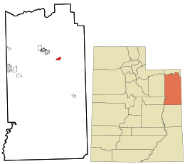 Location in Uintah County and the state of Utah | |
| Coordinates: 40°22′02″N 109°21′26″W / 40.36722°N 109.35722°WCoordinates: 40°22′02″N 109°21′26″W / 40.36722°N 109.35722°W | |
| Country | United States |
| State | Utah |
| County | Uintah |
| Settled | 1877 |
| Named for | Lars Jensen |
| Elevation[1] | 4,760 ft (1,450 m) |
| Population (2010)[2] | |
| • Total | 412 |
| Time zone | Mountain (MST) (UTC-7) |
| • Summer (DST) | MDT (UTC-6) |
| ZIP code | 84035 |
| Area code(s) | 435 |
| GNIS feature ID | 2629950[1] |
Jensen is a census-designated place in eastern Uintah County, Utah, United States. The population was 412 at the 2010 census. It lies along the Green River and U.S. Route 40, southeast of the city of Vernal, the county seat of Uintah County, and about 17 miles west of the Colorado border.[3] Although Jensen is unincorporated, it has a post office, with the ZIP code of 84035.[4]
Jensen was first settled in 1877 and named for Lars Jensen, an early prospector and ferryman. Today its main importance is as the Utah entrance to Dinosaur National Monument.
Demographics
As of the census[2] of 2010, there were 412 people residing in the CDP. There were 156 housing units. The racial makeup of the town was 91.3% White, 0.2% Black or African American, 5.3% from some other race, and 3.2% from two or more races. Hispanic or Latino of any race were 6.3% of the population.
Climate
According to the Köppen Climate Classification system, Jensen has a semi-arid climate, abbreviated "BSk" on climate maps.[5]
| Climate data for Jensen, Utah (1981–2010 normals) | |||||||||||||
|---|---|---|---|---|---|---|---|---|---|---|---|---|---|
| Month | Jan | Feb | Mar | Apr | May | Jun | Jul | Aug | Sep | Oct | Nov | Dec | Year |
| Record high °F (°C) | 58 (14) |
67 (19) |
82 (28) |
87 (31) |
100 (38) |
106 (41) |
105 (41) |
103 (39) |
100 (38) |
87 (31) |
74 (23) |
60 (16) |
106 (41) |
| Average high °F (°C) | 30.6 (−0.8) |
38.9 (3.8) |
55.2 (12.9) |
65.7 (18.7) |
75.5 (24.2) |
85.2 (29.6) |
92.0 (33.3) |
89.5 (31.9) |
79.9 (26.6) |
66.2 (19) |
48.7 (9.3) |
33.3 (0.7) |
63.4 (17.4) |
| Daily mean °F (°C) | 17.7 (−7.9) |
25.3 (−3.7) |
39.5 (4.2) |
48.7 (9.3) |
58.1 (14.5) |
66.6 (19.2) |
73.0 (22.8) |
70.7 (21.5) |
61.3 (16.3) |
49.2 (9.6) |
34.7 (1.5) |
21.2 (−6) |
47.2 (8.4) |
| Average low °F (°C) | 4.7 (−15.2) |
11.6 (−11.3) |
23.8 (−4.6) |
31.8 (−0.1) |
40.7 (4.8) |
47.9 (8.8) |
53.9 (12.2) |
51.9 (11.1) |
42.8 (6) |
32.1 (0.1) |
20.8 (−6.2) |
9.1 (−12.7) |
30.9 (−0.6) |
| Record low °F (°C) | −36 (−38) |
−40 (−40) |
−17 (−27) |
8 (−13) |
18 (−8) |
25 (−4) |
38 (3) |
30 (−1) |
17 (−8) |
0 (−18) |
−12 (−24) |
−36 (−38) |
−40 (−40) |
| Average precipitation inches (mm) | 0.56 (14.2) |
0.51 (13) |
0.53 (13.5) |
0.81 (20.6) |
0.78 (19.8) |
0.61 (15.5) |
0.60 (15.2) |
0.63 (16) |
1.07 (27.2) |
1.21 (30.7) |
0.62 (15.7) |
0.70 (17.8) |
8.82 (224) |
| Average snowfall inches (cm) | 5.6 (14.2) |
3.2 (8.1) |
0.7 (1.8) |
0.5 (1.3) |
0 (0) |
0 (0) |
0 (0) |
0 (0) |
0 (0) |
0.3 (0.8) |
1.9 (4.8) |
6.2 (15.7) |
17.4 (44.2) |
| Average precipitation days (≥ 0.01 in) | 5 | 5 | 5 | 7 | 7 | 5 | 5 | 6 | 6 | 7 | 5 | 5 | 71 |
| Average snowy days (≥ 0.1 in) | 4 | 3 | 1 | 0 | 0 | 0 | 0 | 0 | 0 | 0 | 1 | 4 | 12 |
| Source: NOAA (extremes 1939–present)[6] | |||||||||||||
References
- 1 2 "Jensen, Utah". Geographic Names Information System. United States Geological Survey. Retrieved May 25, 2011.
- 1 2 "American FactFinder". United States Census Bureau. Retrieved May 25, 2011.
- ↑ Rand McNally. The Road Atlas '08. Chicago: Rand McNally, 2008, p. 103.
- ↑ Zip Code Lookup
- ↑ Climate Summary for Jensen, Utah
- ↑ "NowData - NOAA Online Weather Data". National Oceanic and Atmospheric Administration. Retrieved May 30, 2016.
Municipalities and communities of Uintah County, Utah, United States | ||
|---|---|---|
| Cities | 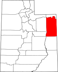 | |
| Town | ||
| CDPs | ||
| Unincorporated communities | ||
| Indian reservation | ||
| Ghost town | ||
| Footnotes | ‡This populated place also has portions in an adjacent county or counties | |