Jefferson, Georgia
| Jefferson, Georgia | |
|---|---|
| City | |
|
Jackson County Courthouse in Jefferson | |
 Location in Jackson County and the state of Georgia | |
| Coordinates: 34°7′36″N 83°35′25″W / 34.12667°N 83.59028°WCoordinates: 34°7′36″N 83°35′25″W / 34.12667°N 83.59028°W | |
| Country | United States |
| State | Georgia |
| County | Jackson |
| Government | |
| • Type | Mayor/City Council |
| • Mayor | Roy Plott |
| • City Manager | John Ward |
| • City Councilman | Steve Kinney, Malcolm "Mac" Gramley, Steve Quinn, Mark Mobley, Don Kupis |
| Area | |
| • Total | 19 sq mi (49.1 km2) |
| • Land | 19 sq mi (49.1 km2) |
| • Water | 0 sq mi (0 km2) |
| Elevation | 751 ft (229 m) |
| Population (2010) | |
| • Total | 9,432 |
| • Density | 201.3/sq mi (77.9/km2) |
| Time zone | Eastern (EST) (UTC-5) |
| • Summer (DST) | EDT (UTC-4) |
| ZIP code | 30549 |
| Area code(s) | 706 |
| FIPS code | 13-41988[1] |
| GNIS feature ID | 0356332[2] |
| Website | http://www.cityofjeffersonga.com |

Jefferson is a city in Jackson County, Georgia, United States. The population was 9,432 at the 2010 census. The city is the county seat of Jackson County.[3]
History
Jefferson was founded in 1800. That same year, the seat of Jackson County was transferred to Jefferson from Clarkesboro. Jefferson was incorporated as a town in 1806 and as a city in 1896.[4] The city was named after Thomas Jefferson.
Geography
Jefferson is located at 34°7′36″N 83°35′25″W / 34.12667°N 83.59028°W (34.126736, -83.590297).[5] According to the United States Census Bureau, the city has a total area of 19.0 square miles (49 km2), all of it land.
Demographics
| Historical population | |||
|---|---|---|---|
| Census | Pop. | %± | |
| 1880 | 419 | — | |
| 1890 | 540 | 28.9% | |
| 1900 | 726 | 34.4% | |
| 1910 | 1,207 | 66.3% | |
| 1920 | 1,626 | 34.7% | |
| 1930 | 1,869 | 14.9% | |
| 1940 | 1,839 | −1.6% | |
| 1950 | 2,040 | 10.9% | |
| 1960 | 1,746 | −14.4% | |
| 1970 | 1,647 | −5.7% | |
| 1980 | 1,820 | 10.5% | |
| 1990 | 2,763 | 51.8% | |
| 2000 | 3,825 | 38.4% | |
| 2010 | 9,432 | 146.6% | |
| Est. 2015 | 10,195 | [6] | 8.1% |
There were 1,415 households out of which 37.2% had children under the age of 18 living with them, 55.0% were married couples living together, 15.6% had a female householder with no husband present, and 26.0% were non-families. 23.3% of all households were made up of individuals and 9.2% had someone living alone who was 65 years of age or older. The average household size was 2.67 and the average family size was 3.15.

As of the census[1] of 2000, there were 3,825 people, 1,415 households, and 1,047 families residing in the city. The population density was 201.6 people per square mile (77.8/km²). There were 1,522 housing units at an average density of 80.2 per square mile (31.0/km²). The racial makeup of the city was 80.44% White, 16.05% African American, 1.20% Asian, 1.15% from other races, and 1.15% from two or more races. Hispanic or Latino of any race were 4.21% of the population.

In the city the population was spread out with 28.1% under the age of 18, 8.0% from 18 to 24, 30.1% from 25 to 44, 21.4% from 45 to 64, and 12.5% who were 65 years of age or older. The median age was 35 years. For every 100 females there were 88.7 males. For every 100 females age 18 and over, there were 84.0 males.
The median income for a household in the city was $41,146, and the median income for a family was $46,755. Males had a median income of $33,512 versus $25,250 for females. The per capita income for the city was $18,456. About 12.5% of families and 15.2% of the population were below the poverty line, including 21.8% of those under age 18 and 10.8% of those age 65 or over.
The overall population grew 59% from 2000 to 2006 (6,456).[8]
Education
Jackson County School District

The Jackson County School District holds pre-school to grade twelve, and consists of eight elementary schools, three middle schools, two high schools, and an alternative school.[9] The district has 345 full-time teachers and over 5,472 students.[10]
- Benton Elementary School
- East Jackson Elementary School
- Gum Springs Elementary School
- Maysville Elementary School
- North Jackson Elementary School
- South Jackson Elementary School
- West Jackson Intermediate School
- West Jackson Primary School
- East Jackson Middle School
- Kings Bridge Middle School
- West Jackson Middle School
- East Jackson Comprehensive High School
- Jackson County Comprehensive High School
- Regional Evening Alternative School
Jefferson City School District
The Jefferson City School District holds kindergarten to grade twelve, and consists of two elementary schools, a middle school, and a high school.[11] The district has 115 full-time teachers and over 1,525 students.[12]
- Jefferson Elementary School
- Jefferson Academy
- Jefferson Middle School
- Jefferson High School
Notable people
- Brantley Gilbert - country music singer, songwriter
- Dr. Crawford W. Long - physician who first used ether for surgical anesthesia
- Brandon Mosley - former Auburn University and current New York Giants offensive lineman
- Corey Smith - country music singer, songwriter
References
- 1 2 "American FactFinder". United States Census Bureau. Retrieved 2008-01-31.
- ↑ "US Board on Geographic Names". United States Geological Survey. 2007-10-25. Retrieved 2008-01-31.
- ↑ "Find a County". National Association of Counties. Retrieved 2011-06-07.
- ↑ Hellmann, Paul T. (May 13, 2013). Historical Gazetteer of the United States. Routledge. p. 234. Retrieved 30 November 2013.
- ↑ "US Gazetteer files: 2010, 2000, and 1990". United States Census Bureau. 2011-02-12. Retrieved 2011-04-23.
- ↑ "Annual Estimates of the Resident Population for Incorporated Places: April 1, 2010 to July 1, 2015". Retrieved July 2, 2016.
- ↑ "Census of Population and Housing". Census.gov. Retrieved June 4, 2015.
- ↑ Fact Finder Census
- ↑ Georgia Board of Education, Retrieved 21 April 2012.
- ↑ School Stats, Retrieved June 5, 2010.
- ↑ Georgia Board of Education, Retrieved 21 April 2012.
- ↑ School Stats, Retrieved June 5, 2010.
External links
- City of Jefferson Website
- City of Jefferson Parks & Recreation Website
- The Jackson Herald - Local Newspaper
- Builder of the Nation historical marker
Municipalities and communities of Jackson County, Georgia, United States | ||
|---|---|---|
| Cities | 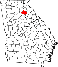 | |
| Towns | ||
| Footnotes | ‡This populated place also has portions in an adjacent county or counties | |