Java, South Dakota
| Java, South Dakota | |
|---|---|
| Town | |
 Location in Walworth County and the state of South Dakota | |
| Coordinates: 45°30′10″N 99°53′10″W / 45.50278°N 99.88611°WCoordinates: 45°30′10″N 99°53′10″W / 45.50278°N 99.88611°W | |
| Country | United States |
| State | South Dakota |
| County | Walworth |
| Incorporated | 1903[1] |
| Area[2] | |
| • Total | 0.49 sq mi (1.27 km2) |
| • Land | 0.49 sq mi (1.27 km2) |
| • Water | 0 sq mi (0 km2) |
| Elevation | 2,096 ft (639 m) |
| Population (2010)[3] | |
| • Total | 129 |
| • Estimate (2012[4]) | 130 |
| • Density | 263.3/sq mi (101.7/km2) |
| Time zone | Central (CST) (UTC-6) |
| • Summer (DST) | CDT (UTC-5) |
| ZIP code | 57452 |
| Area code(s) | 605 |
| FIPS code | 46-32460[5] |
| GNIS feature ID | 1255814[6] |
Java is a town in Walworth County, South Dakota, United States. The population was 129 at the 2010 census.
Java may derive its name from Java coffee, since Coffee Town was an early variant name.[7]
Geography
Java is located at 45°30′10″N 99°53′10″W / 45.50278°N 99.88611°W (45.502870, -99.886049).[8]
According to the United States Census Bureau, the town has a total area of 0.49 square miles (1.27 km2), all of it land.[2]
Java has been assigned the ZIP code 57452 and the FIPS place code 32460.
Demographics
| Historical population | |||
|---|---|---|---|
| Census | Pop. | %± | |
| 1910 | 473 | — | |
| 1920 | 527 | 11.4% | |
| 1930 | 529 | 0.4% | |
| 1940 | 493 | −6.8% | |
| 1950 | 433 | −12.2% | |
| 1960 | 406 | −6.2% | |
| 1970 | 305 | −24.9% | |
| 1980 | 261 | −14.4% | |
| 1990 | 161 | −38.3% | |
| 2000 | 197 | 22.4% | |
| 2010 | 129 | −34.5% | |
| Est. 2015 | 129 | [9] | 0.0% |
2010 census
As of the census[3] of 2010, there were 129 people, 69 households, and 38 families residing in the town. The population density was 263.3 inhabitants per square mile (101.7/km2). There were 119 housing units at an average density of 242.9 per square mile (93.8/km2). The racial makeup of the town was 93.0% White, 3.1% Native American, and 3.9% from two or more races.
There were 69 households of which 13.0% had children under the age of 18 living with them, 44.9% were married couples living together, 7.2% had a female householder with no husband present, 2.9% had a male householder with no wife present, and 44.9% were non-families. 40.6% of all households were made up of individuals and 24.6% had someone living alone who was 65 years of age or older. The average household size was 1.87 and the average family size was 2.47.
The median age in the town was 57.1 years. 14% of residents were under the age of 18; 3.2% were between the ages of 18 and 24; 15.5% were from 25 to 44; 30.4% were from 45 to 64; and 37.2% were 65 years of age or older. The gender makeup of the town was 45.0% male and 55.0% female.
2000 census
As of the census[5] of 2000, there were 197 people, 94 households, and 56 families residing in the town. The population density was 410.9 people per square mile (158.5/km²). There were 133 housing units at an average density of 277.4 per square mile (107.0/km²). The racial makeup of the town was 95.94% White and 4.06% Native American.
There were 94 households out of which 13.8% had children under the age of 18 living with them, 56.4% were married couples living together, 4.3% had a female householder with no husband present, and 39.4% were non-families. 37.2% of all households were made up of individuals and 25.5% had someone living alone who was 65 years of age or older. The average household size was 2.10 and the average family size was 2.72.
In the town the population was spread out with 16.2% under the age of 18, 3.0% from 18 to 24, 20.3% from 25 to 44, 23.9% from 45 to 64, and 36.5% who were 65 years of age or older. The median age was 56 years. For every 100 females there were 103.1 males. For every 100 females age 18 and over, there were 98.8 males.
The median income for a household in the town was $29,125, and the median income for a family was $36,875. Males had a median income of $20,625 versus $14,750 for females. The per capita income for the town was $19,427. About 6.4% of families and 11.0% of the population were below the poverty line, including 9.4% of those under the age of eighteen and 6.5% of those sixty five or over.
References
- ↑ "SD Towns" (PDF). South Dakota State Historical Society. Retrieved 2010-02-13.
- 1 2 "US Gazetteer files 2010". United States Census Bureau. Retrieved 2012-06-21.
- 1 2 "American FactFinder". United States Census Bureau. Retrieved 2012-06-21.
- ↑ "Population Estimates". United States Census Bureau. Retrieved 2013-05-29.
- 1 2 "American FactFinder". United States Census Bureau. Retrieved 2008-01-31.
- ↑ "US Board on Geographic Names". United States Geological Survey. 2007-10-25. Retrieved 2008-01-31.
- ↑ Federal Writers' Project (1940). South Dakota place-names, v.1-3. University of South Dakota. p. 43.
- ↑ "US Gazetteer files: 2010, 2000, and 1990". United States Census Bureau. 2011-02-12. Retrieved 2011-04-23.
- ↑ "Annual Estimates of the Resident Population for Incorporated Places: April 1, 2010 to July 1, 2015". Retrieved July 2, 2016.
- ↑ "Census of Population and Housing". Census.gov. Retrieved June 4, 2015.
Municipalities and communities of Walworth County, South Dakota, United States | ||
|---|---|---|
| Cities | 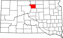 | |
| Towns | ||