Jarrahdale, Western Australia
| Jarrahdale Perth, Western Australia | |||||||||||||
|---|---|---|---|---|---|---|---|---|---|---|---|---|---|
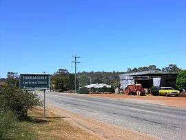 Entering Jarrahdale from Perth | |||||||||||||
 Jarrahdale | |||||||||||||
| Coordinates | 32°20′20″S 116°03′43″E / 32.339°S 116.062°ECoordinates: 32°20′20″S 116°03′43″E / 32.339°S 116.062°E | ||||||||||||
| Population | 1,082 (2011 census)[1] | ||||||||||||
| Postcode(s) | 6124 | ||||||||||||
| LGA(s) | Shire of Serpentine-Jarrahdale | ||||||||||||
| State electorate(s) | Darling Range | ||||||||||||
| Federal Division(s) | Canning | ||||||||||||
| |||||||||||||
Jarrahdale is a small historic town located 45 km south-east of Perth, Western Australia in the Darling Range. The name is derived from its situation in a jarrah forest. Established in the late 1800s as the state's first major timber milling operation, it played a key role in the development of Western Australia through the exportation of jarrah around the world.[2] At the 2011 census, Jarrahdale had a population of 1,082.[1] Since 2001, the historic precinct has been managed by the state's National Trust organisation alongside private residential and tourism-oriented developments.
History
The Jarrahdale Timber Company constructed a railway for the transport of timber from Jarrahdale through Mundijong to Rockingham. In 1872 the townsite was granted timber concessions and the town was born,[3] though it was not gazetted until 1913.[4]
The locality was destroyed by an 1895 bushfire.[5] and the town was relocated west of its original position.
Historic buildings in the area include a mill manager's house, nurses' quarters/hospital, general store, single men's quarters, Gianatti store, Murray Arms/Jarrahdale Tavern/Rileys Bar, churches, post office and other buildings. A POW camp was located outside the town during World War II. Recently the old mill office, behind the nurses' quarters, was destroyed by fire, a recurring hazard throughout the township's history.
The population of the town was 600 (400 males and 200 females) in 1898.[6]
Bauxite had been mined by Western Aluminium near Jarrahdale throughout the 1960s. The ore was transported by rail to Kwinana for processing at the company's Alumina refinery. In 1967 the company had mined 405,000 metric tons (398,604 long tons) of bauxite.[7]
On 14 July 1997, the Jarrahdale townsite was entered on the National Trust's List of Classified Heritage places, the seventh Western Australian town to be so classified.[8]
The Shire of Serpentine-Jarrahdale instigated a redevelopment scheme for the Jarrahdale Heritage Park which houses the previous mill sites and the last standing mill built in the 1930s. This mill is still operating as a small production business called Heritage Sawmillers, located on the Gooralong Brook which flows through the townsite. Following negotiations with the landowners Wesfarmers/Sotico, the shire purchased some of the land for housing development and, in 2001, an entire historic precinct was donated to National Trust of Australia (WA), including the site of a closed timber sawmill.[2]
Surviving relics
On the main pass road, Jarrahdale Road, are located the successive mill sites and, to the extremity of the town heading east, the last mill site which still contains relics of its existence. This mill was operated by Bunnings until 1997. An Alcoa alumina mining operation was concluded in 1998. Both Bunnings and Alcoa removed most of their plant fittings when they departed.
The surrounding area includes catchments and steep slopes with remnants of the former native forest, e.g., near the Kitty's Gorge walk trail within the Serpentine National Park. In 2009, the Forest Products Commission announced plans for renewed logging in the vicinity, plotting 50-year-old regrowth sites east of the townsite.[9]
There were once many timber mills in the jarrah forest surrounding Jarrahdale, some of which were flooded when the Serpentine Dam was constructed in 1957–61.[10] Railway formations and cuttings are indicators of past development. "By the 1900s, Jarrahdale had a town population of about 1200 people while 800 more were housed in surrounding bush landings and remote sites." From 1925 until 1927, a portable school was established in a building mounted on railway trucks, so that it could be easily transported by forestry train from one work camp to another, as timber-cutters and their families moved through the forest.[11]
See also
References
- 1 2 Australian Bureau of Statistics (31 October 2012). "Jarrahdale (State Suburb)". 2011 Census QuickStats. Retrieved 3 October 2011.
- 1 2 Jarrahdale Heritage Park at Natural Heritage site of the National Trust (W.A.)
- ↑ History and Culture www.peel.wa.gov.au. Retrieved 15 October 2007.
- ↑ Western Australian Land Information Authority. "History of country town names – J". Retrieved 2007-10-15.
- ↑ Jarrahdale - main mill burned down West Australian, 5 June 1895
- ↑ "Population of Western Australia.". Western Mail (Perth, WA : 1885 - 1954). Perth, WA: National Library of Australia. 22 April 1898. p. 23. Retrieved 31 May 2012.
- ↑ "Government Members Mining and National Development Committees Fact Finding Tour July 21st-28th 1968" (PDF). Commonwealth of Australia. 1968. Retrieved 3 September 2016.
- ↑ Jarradale Forest Heritage at Jarradale Forest Protectors website
- ↑ Chris Thomson Last jarrah yanked from Jarrahdale at WA Today (Fairfax Media), 25 June 2009. Accessed: 16 December 2011
- ↑ Serpentine Dams at Western Australian Water Corporation
- ↑ Australian Railway Historical Society Bulletin, October 1987 pp232-234
Further reading
- Jarrahdale Heritage Park at Natural Heritage site of the National Trust (W.A.)
- Welcome to Jarrahdale Tourism promotion site
External links
- Jarrahdale Museum and history at Jarrahdale Heritage Society
- Mill Manager's Residence Assessment documentation for entry to Register of Heritage Places, at W.A. Heritage Council, 14 May 1999
- McGregor, Suzanne Jarrahdale Brief account of her visit on 28 July 2009
- Suburb Profile for Jarrahdale - Real Estate Institute of WA