Jarfjorden
| Jarfjorden Ruovdevuotna | |
|---|---|
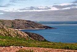 Jarfjorden seen from N886, 6 July 2012 | |
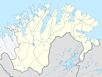 Jarfjorden Location in Finnmark | |
| Location | Sør-Varanger Municipality, Finnmark |
| Coordinates | 69°42′53″N 30°25′30″E / 69.71472°N 30.42500°ECoordinates: 69°42′53″N 30°25′30″E / 69.71472°N 30.42500°E |
| Basin countries | Norway |
| Max. length | 21 kilometres (13 mi) |
| Settlements | Lanabukt, Storbukt, Tårnet |
Jarfjorden (Northern Sami: Ruovdevuotna)[1] is a fjord on Varanger Fjord in Sør-Varanger Municipality in Finnmark county, Norway. The fjord stretches 21 kilometres (13 mi) south to Jarfjordbotn.
The fjord inlet is between Oterneset in the west and Rundskjeret in the east. Just inside the entrance is Litle Jarfjorden almost parallel to Jarfjorden on the east side. There are few human settlements up the fjord before the settlement Lanabukt on the east side. A bit further to the south are the villages of Storbukt and Tårnet. Here the fjord turns almost ninety degrees to the west into the last section to Jarfjordbotn.[2]
When navigating into Jarfjorden, it is advised to travel nearer the west side.[3] The best place to anchor in Jarfjorden is at Lanabukt, where the water is 20 to 24 metres deep,[3] and where a floating wharf is now in place, thanks to the Sea Salmon Fishermen's Association (Sjølaksefiskarlaget) with Sami support.[4] There is a small uninhabited island called Hinnøya in Jarfjorden, close to Lanabukt.[5] King eider and Steller's eider can be seen on Jarfjorden near Lanabukt during the winter.[6]
Small vessels can alternatively anchor off Jarfjordbotn near the head of the fjord, where the depth is up to 22 metres.[3]
Norwegian National Road 886 runs along the south side of the fjord. By the fjord is Norway's oldest bedrock, Jarfjordgneis, migmatitic gneiss, which is 2900 million years old, dating from the Precambrian period.[7]
References
- ↑ Kaisa Rautio Helander (2008). "Namat dan nammii" (PDF). Giellagas Institute, University of Oulu, Finland. p. 93. Retrieved 20 August 2016.
- ↑ "Geologisk Havbunnskart 69303000" (PDF). Norwegian Geological Survey. 9 June 2015. Retrieved 20 August 2016.
- 1 2 3 Prostar Sailing Directions 2004 North and West Coast of Norway Enroute. ProStar Publications. 2004. p. 183. ISBN 978-1-57785-656-6.
- ↑ "Flytebrygga på plass i Lanabukt". Sør-Varanger Avis. Retrieved 2016-08-28.
- ↑ "Norgeskart". norgeskart.no. Retrieved 2016-08-28.
- ↑ "Grense Jakobselv | Fact sheet for the project "Bird Tourism in Central and Eastern Finnmark", a project in "Natural heritage of creating value"" (PDF). Bioforsk. 3 December 2013. Retrieved 20 August 2016.
- ↑ Askheim, Svein. "Jarfjordgneis". Store norske leksikon. Retrieved 21 August 2016.
External links
- This article incorporates information from this version of the equivalent article on the Norwegian Wikipedia.