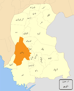
Jamshoro District
| Jamshoro District ضلعو ڄامشورو | |
|---|---|
| District | |
 Map of Pakistani Districts with Jamshoro District highlighted | |
| Coordinates: 25°25′57″N 68°15′47″E / 25.432512°N 68.263171°ECoordinates: 25°25′57″N 68°15′47″E / 25.432512°N 68.263171°E | |
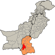
| Country | Pakistan |
| Province | Sindh |
| Headquarters | Jamshoro |
| Government | |
| • Chairman | MALIK SHAHNAWAZ SIKANDER |
| Population (2015) | |
| • Total | 1,452,351[1] |
| Time zone | PST (UTC+5) |
| Number of Tehsils | 5 |
| Website |
www |
Jamshoro District (Sindhi: ضلعو ڄام شورو), (Urdu: ضِلع جامشورو), is a district of Sindh province, Pakistan. Jamshoro city is the capital of Jamshoro District.
Jamshoro district was split from Dadu district in December 2004. It is situated on the west bank of River Indus. The district has taken its name from its city Jamshoro, known as Educational City. However district's headquarter is Kotri.
Boundaries
The district borders Dadu district to the north. To the east, the Indus separates it from Nawab Shah, Matyari and Hyderabad districts. Thatta district lies to the south, and Karachi district to the south west. To the west, the Kheerthar Range separates it from the Sindh and Lasbela district of Baluchistan.
Geography
The total geographical area of the district is 11,517 square kilometres. It is about 220 kilometers from north to south and about 100 kilometres wide from east to west. A 2 to 6 kilometres wide belt of the west bank of River Indus is cultivated and irrigated and the remaining land of the district is either hilly or cultivated. Agriculture is the main source of income.
Demographics
Following are the demographic indicators of the district, The population of the district is according to 1,452,351 Population 2015.[2]
Religion
Languages
- Sindhi: 97.50%
- Baluchi:0.60%
- Urdu: 0.30%
- Others language :1.60% Pashto Saraiki Punjabi Bihari Brahui & Others Language
Climate
In summer, the northern part (Sehwan) is hotter than that of other parts of the district and normally cool in winter.
Jobs
The majority of the population of the district is rural and they are involved in cultivation. Industrial areas and Power plants are using manpower, while towns are providing business opportunities to the residents. The inhabitants of mountainous area keep cattle while Mallahs o Manchhar Lake earn their living by fishing. Approximately 20% of the district population works for the federal and provincial government.
Mining
The district is rich in limestone, salika sand, gravels, silt, and marble. These minerals are found in Taluka Thano Bula Khan and Sehwan. Coal is obtained from Lakhra Taluka Manjhand.
Industries
Nooriabad Industrial Area and Kotri Industrial area are two big zones of Industries where more than 500 different industries are located..
Power plants
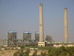
Jamshoro Power Station, Lakhra Power Project and Kotri Thermal Power Station are the main power units in this district.
Universities
Mehran University of Engineering and Technology, Liaquat University of Medical and Health Sciences and University of Sindh are located in Jamshoro.
Administrative divisions
The district is administratively subdivided into the following talukas:
- Kotri
- Jamshoro
- Sehwan Sharif
- Thana Bulla Khan
- Manjhand
towns
References
- ↑ "Sindh population surges by 81.5 pc, households by 83.9 pc". Thenews.com.pk. 2 April 2012. Retrieved 2013-04-21.
- ↑ "Sindh population surges by 81.5 pc, households by 83.9 pc". Thenews.com.pk. 2 April 2012. Retrieved 2013-04-21.
Provincial capital: Karachi | ||
| Banbhore | 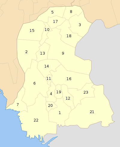 | |
| Hyderabad | ||
| Karachi | ||
| Larkana | ||
| Mirpur Khas | ||
| Sukkur | ||
| Shaheed Benazir Abad | ||
| Disputed | ||
Kherthar national Park.