Larkana District
| Larkana ضلعو لاڙڪاڻو | |
|---|---|
| District | |
 Larkana is located in the North-West of Sindh | |
| Coordinates: 27°33′36″N 68°13′35″E / 27.56000°N 68.22639°ECoordinates: 27°33′36″N 68°13′35″E / 27.56000°N 68.22639°E | |
| Country | Pakistan |
| Province | Sindh |
| Headquarters | Larkana |
| Area | |
| • Total | 7,423 km2 (2,866 sq mi) |
| Population (2010) | |
| • Total | 2,527,066 |
| • Density | 259.6/km2 (672/sq mi) |
| Time zone | PKT (UTC+5) |
| Languages (1981) |
78.43% Sindhi 6.98% Balochi 5.92% Brahui 5.04% Punjabi (Saraiki dialect)[1] |
| Number of Tehsils | 04 |
| Website |
www |
Larkana District (Sindhi: ضلعو لاڙڪاڻو) ; Urdu: ضلع لاڑکانہ) is a district of Sindh province of Pakistan . It is also called Larkano , locally.
According to the 1998 census of Pakistan, it had a population of 1,927,066 of which 28.70% were urban.[2] Its main city is Larkana. It is home district of two former Prime Ministers of Pakistan, Zulfikar Ali Bhutto and Benazir Bhutto and also the district of former Chief Minister of Sindh, Mumtaz Ali Bhutto. Other towns of the district include Miro Khan, Ratodero, Dokri, Bakrani and Naodero. In 2005, the Government of Pakistan under Pervez Musharraf bifurcated the district, forming a new district called Qamber and Shahdadkot, with two towns of Qambar Khan and Shahdadkot.
Administration
The district of Larkana is administratively subdivided into the following talukas:[3]
Economy
Some 10 km away from Larkana city, sugarcane is cultivated and processed at the Larkana Sugar Mills (Pvt) Ltd. which was inaugurated by then Prime Minister Zulfikar Ali Bhutto on January 30, 1974.[4]
Larkana's guava and berries are famous both nationally and internationally, the annual output of the district stands at thousands of tons. All the villages of Larkana on the right bank of River Indus have vast guava orchids spread over thousands of acres, located in Dodai, Mahotta, Naundero, Chooharpur, Agani, Metla, Izzat Ji Wandh, Phulpota and other villages.[5][6]
Education
Cadet College Larkana, was inaugurated by the former Prime Minister of Pakistan Benazir Bhutto in 1994, first planned by her late father Prime Minister Zulfikar Ali Bhutto in 1975. The College is located 24 kilometres (15 mi) away from Larkana, and some 3 kilometres from Mohen-jo-Daro.[7]
Transport
Moenjodaro Airport is located near Mohen-jo-daro, 28 km away to the south of the city of Larkana, about 5 kilometres away from Dokri. The main users of the airport are Pakistan International Airlines, the country's national flag-carrier. The outdated infrastructure of the airport prevents the use of large, advanced aircraft, with the PIA largely using Fokker aeroplanes for flights.
Demographics

Following are the demographic indicators of the district (including Qambar Dist) as per the 1998 census of Pakistan:
| Ahmaddiya | 0.06% |
|---|---|
| Islam | 98.45% |
| Hinduism | 1.42% |
| Christianity | 0.06% |
| Others | 0.01% |
| Sindhi | 78.43% |
|---|---|
| Balochi | 6.98% |
| Brahui | 5.92% |
| Punjabi (Saraiki dialect) | 5.04% |
Sites to visit:
Sport
Larkana Cricket Stadium alternatively called as Shaheed Mohtarama Benazir Bhutto International Cricket Stadium was built by Pakistan Cricket Board in Garhi Khuda Bakhsh near the tomb of Benazir Bhutto.[8][9]
See also
- Zulfikar Ali Bhutto
- Benazir Bhutto
- Cadet College Larkana www.ccl.edu.pk
- ZA Bhutto Agricultural College
References
- ↑ Stephen P. Cohen (2004). The Idea of Pakistan. Brookings Institution Press. p. 202. ISBN 0815797613.
- ↑ 1998 Census details - Urban Resource Centre
- ↑ "District Larkana Online! [ApnaLarkana.com] - First Official & Commercial website on District Larkana... Complete guide to Larkana, Sindh, Pakistan. Larkana, Chandka, Moen jo daro, benazir Bhutto, Zulfiqar Bhutto, garhi khuda baksh, murtaza bhutto, bhutto,". apnalarkana.com. Retrieved 23 March 2016.
- ↑ "LARKANA SUGAR MILLS (PVT) LTD.". enic.pk. Retrieved 23 March 2016.
- ↑ the Newspaper. "Berries and guava of Larkana". dawn.com. Retrieved 23 March 2016.
- ↑ Web Desk (15 January 2015). "Chilly weather badly affects guava orchid crop". Pakistan Times. Retrieved 23 March 2016.
- ↑ Official, CCL. "Cadet College Larkana". Retrieved 23 March 2016.
- ↑ Larkana. "Larkana Stadium". Dawn. Retrieved 22 March 2016.
- ↑ "Shaheed Mohtarama Benazir Bhutto International Cricket Stadium - Pakistan - Cricket Grounds - ESPN Cricinfo". Cricinfo. Retrieved 23 March 2016.
External links
- District of Larkana
- Local Govt. Department of Sindh - District of Larkana
- Unofficial Web Portal of District Larkana
Provincial capital: Karachi | ||
| Banbhore | 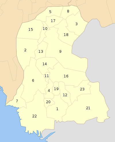 | |
| Hyderabad | ||
| Karachi | ||
| Larkana | ||
| Mirpur Khas | ||
| Sukkur | ||
| Shaheed Benazir Abad | ||
| Disputed | ||