Jamestown, Missouri
| Jamestown, Missouri | |
|---|---|
| Village | |
 Location of Jamestown, Missouri | |
| Coordinates: 38°45′57″N 92°28′41″W / 38.76583°N 92.47806°WCoordinates: 38°45′57″N 92°28′41″W / 38.76583°N 92.47806°W | |
| Country | United States |
| State | Missouri |
| County | Moniteau |
| Area[1] | |
| • Total | 1.01 sq mi (2.62 km2) |
| • Land | 1.00 sq mi (2.59 km2) |
| • Water | 0.01 sq mi (0.03 km2) |
| Elevation | 869 ft (265 m) |
| Population (2010)[2] | |
| • Total | 386 |
| • Estimate (2012[3]) | 387 |
| • Density | 386.0/sq mi (149.0/km2) |
| Time zone | Central (CST) (UTC-6) |
| • Summer (DST) | CDT (UTC-5) |
| ZIP code | 65046 |
| Area code(s) | 660 |
| FIPS code | 29-36368[4] |
| GNIS feature ID | 0720255[5] |
Jamestown is a village in Moniteau County, Missouri, United States. The population was 386 at the 2010 census. It is part of the Jefferson City, Missouri Metropolitan Statistical Area.
History
Jamestown had its start in 1846 when E. H. and S. L. James established a country store at that point.[6][7] A post office called Jamestown has been in operation since 1850.[8]
Dick-Kobel Homestead was listed on the National Register of Historic Places in 1982.[9]
Geography
Jamestown is located at 38°45′57″N 92°28′41″W / 38.76583°N 92.47806°W (38.765754, -92.477960).[10]
According to the United States Census Bureau, the village has a total area of 1.01 square miles (2.62 km2), of which, 1.00 square mile (2.59 km2) of it is land and 0.01 square miles (0.03 km2) is water.[1]
Demographics
| Historical population | |||
|---|---|---|---|
| Census | Pop. | %± | |
| 1880 | 185 | — | |
| 1890 | 313 | 69.2% | |
| 1900 | 344 | 9.9% | |
| 1910 | 305 | −11.3% | |
| 1920 | 264 | −13.4% | |
| 1930 | 273 | 3.4% | |
| 1940 | 269 | −1.5% | |
| 1950 | 245 | −8.9% | |
| 1960 | 216 | −11.8% | |
| 1970 | 243 | 12.5% | |
| 1980 | 317 | 30.5% | |
| 1990 | 298 | −6.0% | |
| 2000 | 382 | 28.2% | |
| 2010 | 386 | 1.0% | |
| Est. 2015 | 391 | [11] | 1.3% |
2010 census
As of the census[2] of 2010, there were 386 people, 161 households, and 100 families residing in the village. The population density was 386.0 inhabitants per square mile (149.0/km2). There were 187 housing units at an average density of 187.0 per square mile (72.2/km2). The racial makeup of the village was 97.9% White and 2.1% from two or more races. Hispanic or Latino of any race were 1.0% of the population.
There were 161 households of which 34.2% had children under the age of 18 living with them, 48.4% were married couples living together, 11.2% had a female householder with no husband present, 2.5% had a male householder with no wife present, and 37.9% were non-families. 36.6% of all households were made up of individuals and 18.6% had someone living alone who was 65 years of age or older. The average household size was 2.40 and the average family size was 3.16.
The median age in the village was 36.6 years. 28.5% of residents were under the age of 18; 5.7% were between the ages of 18 and 24; 24.3% were from 25 to 44; 22% were from 45 to 64; and 19.4% were 65 years of age or older. The gender makeup of the village was 49.2% male and 50.8% female.
2000 census
As of the census[4] of 2000, there were 382 people, 175 households, and 103 families residing in the town. The population density was 381.2 people per square mile (147.5/km²). There were 191 housing units at an average density of 190.6 per square mile (73.7/km²). The racial makeup of the town was 97.12% White, 0.79% Native American, 0.26% Asian, 0.26% Pacific Islander, and 1.57% from two or more races. Hispanic or Latino of any race were 0.52% of the population.
There were 175 households out of which 27.4% had children under the age of 18 living with them, 44.6% were married couples living together, 9.7% had a female householder with no husband present, and 40.6% were non-families. 36.0% of all households were made up of individuals and 16.0% had someone living alone who was 65 years of age or older. The average household size was 2.18 and the average family size was 2.81.
In the town the population was spread out with 23.0% under the age of 18, 8.9% from 18 to 24, 27.0% from 25 to 44, 24.3% from 45 to 64, and 16.8% who were 65 years of age or older. The median age was 38 years. For every 100 females there were 94.9 males. For every 100 females age 18 and over, there were 86.1 males.
The median income for a household in the town was $31,667, and the median income for a family was $41,389. Males had a median income of $27,917 versus $20,461 for females. The per capita income for the town was $16,498. About 3.7% of families and 8.1% of the population were below the poverty line, including 10.6% of those under age 18 and 9.8% of those age 65 or over.
Education
There is one high school in Jamestown, Jamestown C-1.
References
- 1 2 "US Gazetteer files 2010". United States Census Bureau. Retrieved 2012-07-08.
- 1 2 "American FactFinder". United States Census Bureau. Retrieved 2012-07-08.
- ↑ "Population Estimates". United States Census Bureau. Retrieved 2013-05-30.
- 1 2 "American FactFinder". United States Census Bureau. Retrieved 2008-01-31.
- ↑ "US Board on Geographic Names". United States Geological Survey. 2007-10-25. Retrieved 2008-01-31.
- ↑ Eaton, David Wolfe (1917). How Missouri Counties, Towns and Streams Were Named. The State Historical Society of Missouri. p. 333.
- ↑ "Moniteau County Place Names, 1928–1945". The State Historical Society of Missouri. Archived from the original on June 24, 2016. Retrieved November 10, 2016.
- ↑ "Post Offices". Jim Forte Postal History. Retrieved 10 November 2016.
- ↑ National Park Service (2010-07-09). "National Register Information System". National Register of Historic Places. National Park Service.
- ↑ "US Gazetteer files: 2010, 2000, and 1990". United States Census Bureau. 2011-02-12. Retrieved 2011-04-23.
- ↑ "Annual Estimates of the Resident Population for Incorporated Places: April 1, 2010 to July 1, 2015". Retrieved July 2, 2016.
- ↑ "Census of Population and Housing". Census.gov. Retrieved June 4, 2015.
Municipalities and communities of Moniteau County, Missouri, United States | ||
|---|---|---|
| Cities | 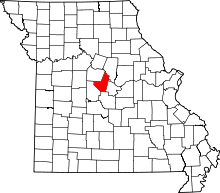 | |
| Village | ||
| Townships |
| |
| Unincorporated communities | ||