Jamesport, Missouri
| Jamesport, Missouri | |
|---|---|
| City | |
|
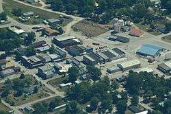
Aerial view of Jamesport, Missouri | |
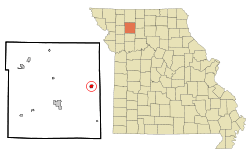 Location of Jamesport, Missouri | |
| Coordinates: 39°58′29″N 93°48′8″W / 39.97472°N 93.80222°WCoordinates: 39°58′29″N 93°48′8″W / 39.97472°N 93.80222°W | |
| Country | United States |
| State | Missouri |
| County | Daviess |
| Area[1] | |
| • Total | 0.56 sq mi (1.45 km2) |
| • Land | 0.56 sq mi (1.45 km2) |
| • Water | 0 sq mi (0 km2) |
| Elevation | 991 ft (302 m) |
| Population (2010)[2] | |
| • Total | 524 |
| • Estimate (2012[3]) | 509 |
| • Density | 935.7/sq mi (361.3/km2) |
| Time zone | Central (CST) (UTC-6) |
| • Summer (DST) | CDT (UTC-5) |
| ZIP code | 64648 |
| Area code(s) | 660 |
| FIPS code | 29-36332[4] |
| GNIS feature ID | 0720254[5] |

Jamesport is a city in Daviess County, Missouri, United States. The population was 524 at the 2010 census.
History
A post office called Jamesport has been in operation since 1857.[6] The community's name honors two first settlers with the given name James, namely James Gillilan and James Allen.[7]
Jamesport has the largest Amish community in the state of Missouri.[8]
Geography
Jamesport is located at 39°58′29″N 93°48′8″W / 39.97472°N 93.80222°W (39.974725, -93.802324).[9]
According to the United States Census Bureau, the city has a total area of 0.56 square miles (1.45 km2), all of it land.[1]
Demographics
| Historical population | |||
|---|---|---|---|
| Census | Pop. | %± | |
| 1860 | 59 | — | |
| 1880 | 608 | — | |
| 1890 | 790 | 29.9% | |
| 1900 | 728 | −7.8% | |
| 1910 | 611 | −16.1% | |
| 1920 | 884 | 44.7% | |
| 1930 | 839 | −5.1% | |
| 1940 | 761 | −9.3% | |
| 1950 | 720 | −5.4% | |
| 1960 | 622 | −13.6% | |
| 1970 | 614 | −1.3% | |
| 1980 | 651 | 6.0% | |
| 1990 | 570 | −12.4% | |
| 2000 | 505 | −11.4% | |
| 2010 | 524 | 3.8% | |
| Est. 2015 | 507 | [10] | −3.2% |
2010 census
As of the census[2] of 2010, there were 524 people, 230 households, and 145 families residing in the city. The population density was 935.7 inhabitants per square mile (361.3/km2). There were 308 housing units at an average density of 550.0 per square mile (212.4/km2). The racial makeup of the city was 96.0% White, 0.2% Native American, 0.4% Asian, and 3.4% from two or more races. Hispanic or Latino of any race were 0.6% of the population.
There were 230 households of which 31.7% had children under the age of 18 living with them, 40.0% were married couples living together, 16.5% had a female householder with no husband present, 6.5% had a male householder with no wife present, and 37.0% were non-families. 32.2% of all households were made up of individuals and 14.4% had someone living alone who was 65 years of age or older. The average household size was 2.28 and the average family size was 2.87.
The median age in the city was 38.4 years. 27.5% of residents were under the age of 18; 8.7% were between the ages of 18 and 24; 21% were from 25 to 44; 25.8% were from 45 to 64; and 17% were 65 years of age or older. The gender makeup of the city was 47.5% male and 52.5% female.
2000 census
As of the Census[4] of 2000, there were 505 people, 211 households, and 140 families residing in the city. The population density was 895.0 people per square mile (348.2/km²). There were 258 housing units at an average density of 457.2 per square mile (177.9/km²). The racial makeup of the city was 99.01% White, 0.59% Native American, and 0.40% from two or more races. Hispanic or Latino of any race were 1.78% of the population.
There were 211 households out of which 25.1% had children under the age of 18 living with them, 52.1% were married couples living together, 10.9% had a female householder with no husband present, and 33.6% were non-families. 29.9% of all households were made up of individuals and 15.2% had someone living alone who was 65 years of age or older. The average household size was 2.39 and the average family size was 2.94.
In the city the population was spread out with 23.6% under the age of 18, 10.1% from 18 to 24, 21.2% from 25 to 44, 25.3% from 45 to 64, and 19.8% who were 65 years of age or older. The median age was 41 years. For every 100 females there were 92.0 males. For every 100 females age 18 and over, there were 84.7 males.
The median income for a household in the city was $29,265, and the median income for a family was $30,556. Males had a median income of $38,438 versus $28,167 for females. The per capita income for the city was $12,447. About 22.2% of families and 27.1% of the population were below the poverty line, including 29.1% of those under age 18 and 40.2% of those age 65 or over.
Education
Public education from kindergarten through 12th grade is provided by the Tri-County R-VII School District. K-6 is located at Tri-County Elementary School, and 7-12 is located at Tri-County High School. There are also five private schools in the area. The Jamesport Mennonite School provides education for 1st through 8th grades. The four Amish schools in the area include Hickory Hill (1-8), Meadow View (1-7), Oak Grove (1-8), and Walnut Creek (1-8).
Of adults 25 years of age and older in Jamesport, 75.4% possess a high school diploma or higher, while 6.2% hold a bachelor's degree or higher as their highest educational attainment.
Media
Jamesport is served by a weekly newspaper, the Tri-County Weekly, which has been in circulation since 1944.
Notable natives
- Phog Allen - University of Kansas coach called the "Father of Basketball Coaching"
- Martha Scott - Academy Award nominated actress
References
- 1 2 "US Gazetteer files 2010". United States Census Bureau. Retrieved 2012-07-08.
- 1 2 "American FactFinder". United States Census Bureau. Retrieved 2012-07-08.
- ↑ "Population Estimates". United States Census Bureau. Retrieved 2013-05-30.
- 1 2 "American FactFinder". United States Census Bureau. Retrieved 2008-01-31.
- ↑ "US Board on Geographic Names". United States Geological Survey. 2007-10-25. Retrieved 2008-01-31.
- ↑ "Post Offices". Jim Forte Postal History. Retrieved 26 September 2016.
- ↑ "Daviess County Place Names, 1928–1945 (archived)". The State Historical Society of Missouri. Retrieved 26 September 2016.
- ↑ "Discovering Amish Country". missourilife.com. May 31, 2011. Retrieved 26 September 2016.
- ↑ "US Gazetteer files: 2010, 2000, and 1990". United States Census Bureau. 2011-02-12. Retrieved 2011-04-23.
- ↑ "Annual Estimates of the Resident Population for Incorporated Places: April 1, 2010 to July 1, 2015". Retrieved July 2, 2016.
- ↑ "Census of Population and Housing". Census.gov. Retrieved June 4, 2015.
External links
- www.jamesport.net
- www.jamesport-mo.com
- Jamesport Community Association
- Historic maps of Jamesport in the Sanborn Maps of Missouri Collection at the University of Missouri
Municipalities and communities of Daviess County, Missouri, United States | ||
|---|---|---|
| Cities | 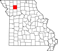 | |
| Villages | ||
| Townships | ||
| CDP | ||
| Unincorporated communities | ||
| Footnotes | ‡This populated place also has portions in an adjacent county or counties | |