Jameson Land
|
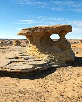
Eolian sandstone in Jameson Land. | |
 Location | |
| Geography | |
|---|---|
| Location | East Greenland |
| Coordinates | 71°10′N 23°30′W / 71.167°N 23.500°WCoordinates: 71°10′N 23°30′W / 71.167°N 23.500°W |
| Adjacent bodies of water | |
| Highest elevation | 1,444 m (4,738 ft) |
| Administration | |
|
Greenland (Denmark) | |
| Zone | NE Greenland National Park |
Jameson Land is a peninsula in eastern Greenland.
Geographgy
Jameson Land is bounded to the southwest by Scoresby Sound (the world's largest fjord), to the northwest by the Stauning Alps, to the north by Scoresby Land, to the northeast by the Fleming Fjord and the Nathorst Fjord of the Greenland Sea, and to the east by Carlsberg Fjord, the smaller Liverpool Land peninsula branching off, and Hurry Inlet.
The Mestersvig military base is located in the northern part of the peninsula.
Geology
Jameson Land mainly consists of a tilted peneplain of jurassic sandstone, highest in the east. In the northern end there are also rocks of triassic origin.[1] Jameson land triassic fossils include prosauropod and theropod dinosaurs, phytosaurs, temnospondyls, and sharks.[2]
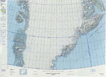 Map of Greenland section. |
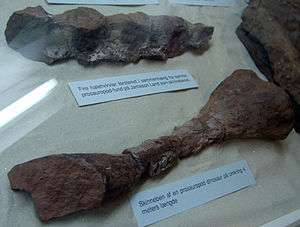 Tail vertebrae and tibia of a 4 meter long prosauropod dinosaur from Jameson Land, at the Geological Museum in Copenhagen |
See also
References
- ↑ Geological map of Greenland 1 : 2 500 000
- ↑ Mateus, O., Clemmensen L., Klein N., Wings O., Frobøse N., Milàn J., Adolfssen J., & Estrup E. (2014). The Late Triassic of Jameson Land revisited: new vertebrate findings and the first phytosaur from Greenland. Journal of Vertebrate Paleontology. Program and Abstracts, 2014, 182.