Jaiyl District
| Jaiyl | |
|---|---|
| Raion | |
 | |
| Country | Kyrgyzstan |
| Province | Chuy Province |
| Area | |
| • Total | 1,326 sq mi (3,435 km2) |
| Population (2009) | |
| • Total | 94,428 |
| Time zone | GMT +5 (UTC+5) |
| Website | http://www.jaiyl.kg/ |
Jaiyl is a raion (district) (Kalinin District until May 1993) of Chuy Province in northern Kyrgyzstan. The capital lies at Kara-Balta. It also administers an exclave in the southwestern heel of Chuy Province (not on map at right).:[1]
Populated places
As of 2009, Jaiyl District comprised 1 town and 36 villages in 12 rural communities (Aiyl Okmotus). The rural communities and settlements in the Jaiyl District are:[2]
- town Kara-Balta
- Ak-Bashat Aiyl Okmotu (villages: Ak-Bashat, Aydarbek, Aral, Novo-Nikolaevka)
- Jaiyl Aiyl Okmotu (villages: Jaiyl, Alekseevka)
- Kara-Suu Aiyl Okmotu (villages: Stavropolovka and Kara-Suu)
- Krasnovostochnyi Aiyl Okmotu (villages: Kalininskoe, Kaldyk, Kara-Tyube)
- Kyzyl-Dyikan Aiyl Okmotu (villages: Kyzyl-Dyikan and Petropavlovka)
- Poltavka Aiyl Okmotu (villages: Poltavka, Rpto-Suu, Maltobar)
- Sary-Bulak Aiyl Okmotu (villages: Sary-Bulak, Molondor)
- Sarykoo Aiyl Okmotu (villages: Iyiri-Suu, Eriktuu, Altyn, Fedorovka, Jeken, and Djonaryk)
- Sosnovka Aiyl Okmotu (village: Sosnovka)
- Stepnoe Aiyl Okmotu (village: Stepnoe)
- Suusamyr Aiyl Okmotu (villages: Suusamyr, Kojomkul, Tunuk, 1-st May, Kyzyl-Oi, and Kaisar)
- Taldy-Bulak Aiyl Okmotu (center - village: Bokso-Jol, and also villages: Kaiyrma, Bekitay, and area Sorgo)
References
Capital: Bishkek (also four raions: Lenin, Oktyabr, Pervomay, Sverdlov) | ||
| Batken Region | 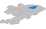 | |
| Chuy Region | ||
| Issyk Kul Region | ||
| Jalal-Abad Region | ||
| Naryn Region | ||
| Osh Region | ||
| Talas Region | ||
Coordinates: 42°49′N 73°51′E / 42.817°N 73.850°E
This article is issued from Wikipedia - version of the 1/28/2015. The text is available under the Creative Commons Attribution/Share Alike but additional terms may apply for the media files.