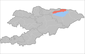
Issyk Kul District
| Issyk-Kul District Ысыккөл району | |
|---|---|
| District | |
| Ысыккөл району | |
|
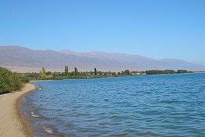
Lake Issyk Kul shoreline at Tamchy, Issyk Kul district | |
 | |
| Country | Kyrgyzstan |
| Region | Issyk Kul Region |
| Area | |
| • Total | 1,391 sq mi (3,603 km2) |
| Population (2009) | |
| • Total | 75,533 |
| Time zone | GMT +5 (UTC+5) |
Issyk-Kul District (Kyrgyz: Ысыккөл району; Russian: Иссык-кульский район) is a raion (district) of Issyk-Kul Region in north-eastern Kyrgyzstan. The capital lies at Cholpon-Ata.[1]
The district is located on the northern shore of Issyk Kul and on the southern slopes of the Küngöy Ala-Too Range, which dominate much of the landscape.
Towns, rural communities, and villages
In total, Issyk Kul District include 1 town and 12 rural communities (aiyl okmotus). Each rural community may include one or several villages. The rural communities and villages in the Issyk - Kul District are:[2]
- town of district significance Cholpon-Ata
- Anan'yevo aiyl okmotu (center village Anan'yevo, and also villages Kek-Debe, and Chet-Baysoorun)
- Bosteri aiyl okmotu (center - village Bosteri, and also village Baktuu-Dolonotu)
- Sadyr Ake aiyl okmotu (cener - village Grigor'yevka, and also village Grigor'yevskaya Pristan')
- Kara-Oy aiyl okmotu (center - village Kara-Oy)
- Kum-Bel' aiyl okmotu (center - village Korumdu, and also village Bulan-Segettu)
- Semenovka aiyl okmotu (center - village Semenovka, and also village Kojoyar)
- Tamchy aiyl okmotu (center - village Tamchy, and also villages Koshkol', and Chyrpykty)
- Abdrakhmanov aiyl okmotu (center - village Jarkynbaevo, and also village Karool-Debe)
- Temirov aiyl okmotu (center - village Temirovka, and also village Kashat)
- Toru-Aygyr aiyl okmotu (center - village Toraygyr, and also villages Kyzyl-Oruk, and Sary-Kamysh)
- Oryukty aiyl okmotu (center - village Chong-Uryukty, and also villages Orto-Uryuktu, and Oryuktu Khutor)
- Chong Sary Oy aiyl okmotu (center - village chon-Sary-Oy, and also villages Baetovka, Ornek, Sary-Oy, and Choktal)
Gallery
 Guesthouse at Tamchy
 Irrigation
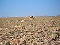 Desert above Tamchy
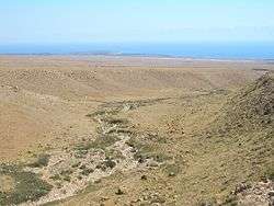 In the desert above Tamchy. Choktal peninsula in the background.
 Sea buckthorn shrubs on the lake shore east of Kosh Köl
 An abandoned resort at Kosh Köl.
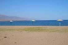 On the beach at Kosh Köl.
See also
References
Capital: Bishkek (also four raions: Lenin, Oktyabr, Pervomay, Sverdlov) | ||
| Batken Region |  | |
| Chuy Region | ||
| Issyk Kul Region | ||
| Jalal-Abad Region | ||
| Naryn Region | ||
| Osh Region | ||
| Talas Region | ||
Coordinates: 42°39′N 77°05′E / 42.650°N 77.083°E
This article is issued from Wikipedia - version of the 8/16/2016. The text is available under the Creative Commons Attribution/Share Alike but additional terms may apply for the media files.