Ivinghoe Beacon
| Ivinghoe Beacon | |
|---|---|
|
Ivinghoe Beacon, looking north from the Ridgeway | |
| Highest point | |
| Elevation | 233 m (764 ft) |
| Coordinates | 51°50′31″N 0°36′21″W / 51.841985°N 0.605755°WCoordinates: 51°50′31″N 0°36′21″W / 51.841985°N 0.605755°W |
| Geography | |
 Ivinghoe Beacon Ivinghoe Beacon shown within Buckinghamshire | |
| Location | Ivinghoe |
| OS grid | SP961168 |
Ivinghoe Beacon is a prominent hill and landmark in the Chiltern Hills, standing 233 m (757 ft) above sea level.[1] It is situated close to the village of Ivinghoe in Buckinghamshire, the Ashridge Estate, and the villages of Aldbury and Little Gaddesden in Hertfordshire and is managed and owned by the National Trust. Ivinghoe Beacon is part of the Ivinghoe Hills Site of Special Scientific Interest.[2][3] It lies between the towns of Dunstable in Bedfordshire, and Berkhamsted and Tring in Hertfordshire. It is the starting point of the Icknield Way to the east, and the Ridgeway long-distance path to the west.
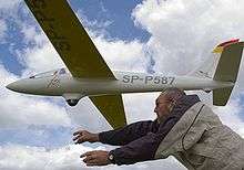
Ivinghoe Beacon is a popular spot for walkers, sightseers, and model aircraft enthusiasts, who use lift generated by the wind blowing up the hill – a technique known as slope soaring.
Ivinghoe Beacon's appearance of remoteness, yet relative proximity to the film studios at Elstree, meant that it was a favoured location for many dramas, especially those produced by ITC in the 1960s.
The beacon has a memorial on top of it.
| Wikimedia Commons has media related to Ivinghoe Beacon. |
References
- ↑ http://benchmarks.ordnancesurvey.co.uk/pls/htmldb/f?p=111:12:6255072357299077241::NO::P12_TRIG_STATION_ID:14576
- ↑ "Ivinghoe Hills citation" (PDF). Sites of Special Scientific Interest. Natural England. Retrieved 30 September 2015.
- ↑ "Map of Ivinghow Hills". Sites of Special Scientific Interest. Natural England. Retrieved 30 September 2015.
External links
- Ivinghoe Soaring Association - Controls model slope soaring off Ivinghoe Beacon.
- Ivinghoe Beacon, Bucks Earth Heritage Group