Irthington
| Irthington | |
 St Kentigern's Church |
|
 Irthington |
|
| Population | 860 (Census 2011) |
|---|---|
| OS grid reference | NY4918059994 |
| Civil parish | Irthington |
| District | Carlisle |
| Shire county | Cumbria |
| Region | North West |
| Country | England |
| Sovereign state | United Kingdom |
| Post town | CA |
| Postcode district | Cumbria |
| Dialling code | 01697 |
| Police | Cumbria |
| Fire | Cumbria |
| Ambulance | North West |
| EU Parliament | North West England |
Coordinates: 54°56′46″N 2°47′06″W / 54.946°N 2.785°W
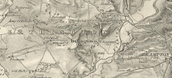
Irthington is a village and civil parish within the City of Carlisle district in Cumbria, England, situated to the north-east of Carlisle Lake District Airport. The population in 2011 was 860 according to the 2011 census.[1]
Toponomy
The name Irthington derives from Old English and means farmstead or village on the river Irthing.[2]
History
The most important period Irthington's history was during the Romano-British era. Irthington lies close to, if not on, the line of the Roman Stanegate road which ran from Corbridge (Coria) west to Carlisle (Luguvalium). The village was described as being "intersected by the site of the great Roman wall, and also by the military road from Newcastle to Carlisle"[3] Some of the building stone used in the south wall of the church of St Kentigern chancel is thought to come from Hadrian's Wall, which runs less than 1 kilometre (0.62 mi) to the northwest of the village. St Kentigern church is dated as far back as Norman times. Restoration took place in 1849 in the gothic tradition. Since then, more restoration has taken place including the addition of a five bell clock tower. The historical remains of the arcades of round arches set on round piers remain by the church, and are also dated to the 1170s.[4]
In the 1870s Irthington was described as:
- " a village, a township, and a parish, in Brampton district, Cumberland. The township comprises 947 acres"[5]
Population

In the 2011 census the population of the village was 860. However, as early as 1831 it stood at 1049 and has since been variable. This number has not changed significantly over the last 200 years apart from a sharp increase as shown in the population time series in 1951 due to a change in area boundary.[6] The male to female ratio has rarely been more than marginally different. In 1801, there was 430 men to 440 women while in 2011 there were 416 men to 444 women, only a small increase from 10 to 28. Another aspect of the population is that as of 2011, 840 of the 860 residents were born within the UK. This gives a total percentage of UK born residents of 98%.[7]
Occupation data

The data taken from 1881 shows that 197 people worked within the Agriculture or Farming occupation. This means that 23%, almost a quarter of the 853 people living in Irthington during this census were under this occupation, the largest in the village. The next largest occupation is of people without a specified occupation. 102 people during this census come under this occupation, 12% of the population. The fact that second largest occupation is almost half of the highest occupation shows the importance that agriculture and farming played. The third highest populated occupation in 1881 was "domestic services and offices". 57 people, 7% of the population were employed or engaged in this area of work. These top 3 occupation accounted for 42% of the occupation of the entire population of the village.[8] More recently, the occupations of the population has changed. Of the 860 residents, 118 people work within the skilled trades occupation which equates to 14% which is above the national average. The second most populated occupation is that of professional occupations where 80 people work within, which accounts for 9%, almost half the national average. The third highest occupation within Irthington is of Managers, directors and senior officials. This accounts for 6% of the total employment and is also below the national average for the same occupation. The occupational transition has seen a large shift away from reliance on the agricultural sector. It has also seen a reliance a limited number of occupations with the top 3 occupations accounting for 29%, down 11% in 1881.[9]
Tourism
Irthington offers a range of holiday accommodation with 8 hotels/inn's available in the area.[10] The airport located nearby could be useful for anyone who is a tourist to Irthington. The main element of tourism in Irthington is the close proximety to Hadrians Wall trail which attracts people to stop in the village. However, tourism does not play a major part in the local economy.[11]
Transport
Irthington is a rather remote village. In terms of rail link the closest train station is Carlisle railway station which is nine miles away from Irthington which equates to approximately 20 minutes away by car.[12] The nearest aviation transport is Carlisle Lake District Airport which is located just over one mile away from Irthington.[13] The airport is not currently offering commercial flights, but re-development which started December 2014 will see flights available to London and Dublin by 2016. This development has also safeguarded the employment of 800 people.[14]
See also
References
- ↑ "Irthington (Parish): Key figures for 2011 Census: Key statistics". Neighbourhood statistics. Office for national statistics. Retrieved 27 January 2015.
- ↑ "History of Irthlington" (PDF). Retrieved 29 March 2016.
- ↑ Bulmer, T. (1884). History, Topography and directory of East Cumberland.
- ↑ "Irthington". The Cumbria Directory. Retrieved 27 March 2015.
- ↑ Marius Wilson, John (1870). Imperial Gazetteer of England and Wales.
- ↑ "Irthington AC/CP through time". A vision of Britain. GB Historical GIS/ University of Portsmouth. Retrieved 27 March 2015.
- ↑ "Irthington: Key figures for 2011 Census: Key statistics". Office for National Statistics. Retrieved 27 March 2015.
- ↑ "Irthington Occupational Data". A vision of Britain. GB Historical GIS/ University of Portmouth. Retrieved 27 March 2015.
- ↑ "Occupational data for Irthington". Office of National Statistics. Retrieved 27 March 2015.
- ↑ "Irthlington: Tourist Information". Retrieved 29 March 2016.
- ↑ "Carlisle District: Rural masterplannng" (PDF). Carlisle City Council. Carlisle City Council. Retrieved 20 April 2015.
- ↑ "Irthington to Carlisle Railway Station". Retrieved 29 March 2016.
- ↑ "Irthington to Carlisle Airport". Retrieved 20 March 2016.
- ↑ "Work begins on £12m Carlisle Airport Revamp". BBC. 3 December 2014. Retrieved 20 April 2015.
External links
![]() Media related to Irthlington, Cumbria at Wikimedia Commons
Media related to Irthlington, Cumbria at Wikimedia Commons