Indiana State Road 232
| ||||
|---|---|---|---|---|
| Mounds Road | ||||
 | ||||
| Route information | ||||
| Maintained by INDOT | ||||
| Length: | 1.994 mi[1] (3.209 km) | |||
| Major junctions | ||||
| West end: |
| |||
| East end: | Mounds State Park | |||
| Highway system | ||||
| ||||

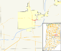
State Road 232 in the U.S. state of Indiana is a short route that connects at the west end with its parent, State Road 32, east of Anderson. It offers access to Mounds State Park.
Route description
The western terminus of SR 232 is at an intersection of SR 32 and State Road 9 in Anderson. SR 232 heads southeast from the intersection. Near the intersection of Rangeline Road, SR 232 turns to the northeast. At the intersection of Donnelly Road, SR 232 turns left heading to Mounds State Park. SR 232 heads northeast until the entrance of Mounds State Park, the entrance is the eastern terminus of SR 232.[2]
History
It is a former routing of State Road 32, before it was routed northward on State Road 9 and then out to the east of the city. SR 32 Continued past Mounds State Park moving south of the anderson Airport into Downtown Chesterfield. The route of SR 232 that heads toward the entrance of Mounds State Park, from Donnelly Road to the north, was always SR 232.
Major intersections
The entire route is in Madison County.
| Location | mi[1] | km | Destinations | Notes | |
|---|---|---|---|---|---|
| Anderson | 0.000 | 0.000 | Western terminus of SR 232 | ||
| Union Township | 1.994 | 3.209 | Mounds Road – Mounds State Park | Eastern terminus of SR 232 | |
| 1.000 mi = 1.609 km; 1.000 km = 0.621 mi | |||||
References
- 1 2 Indiana Department of Transportation (July 2015). Reference Post Book (PDF). Indianapolis: Indiana Department of Transportation. Retrieved October 8, 2016.
- ↑ Google (2011-01-21). "overview map of SR 232" (Map). Google Maps. Google. Retrieved 2011-01-21.