Indaial
| Indaial | |||
|---|---|---|---|
| |||
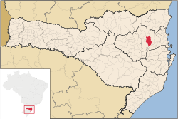 Location of Indaial | |||
 Indaial Location of Indaial | |||
| Coordinates: 26°53′52″S 49°13′55″W / 26.89778°S 49.23194°WCoordinates: 26°53′52″S 49°13′55″W / 26.89778°S 49.23194°W | |||
| Country |
| ||
| Region | South | ||
| State |
| ||
| Founded | February 28, 1934 | ||
| Government | |||
| • Mayor | Sérgio Almir dos Santos (PMDB) | ||
| Area | |||
| • Total | 430.534 km2 (166.230 sq mi) | ||
| Elevation | 64 m (210 ft) | ||
| Population (2011) | |||
| • Total | 55.979 | ||
| • Density | 110.6/km2 (286/sq mi) | ||
| Time zone | UTC-3 (UTC-3) | ||
| • Summer (DST) | UTC-2 (UTC-2) | ||
| HDI (2000) | 0.825 | ||
| Website | www.indaial.sc.gov.br | ||


Indaial is a city in the state of Santa Catarina, Brazil. It is located on the left bank of [Itajai River], and 160 km from the capital of the state, Florianópolis.
The city is of European origin, with many textiles industries and strong agricultural activity. It was colonized about 1860 by Germans, Italians and Poles. Before the colonization it was populated by Tapajós and Carijós Indians, that are now names of two big neighborhoods in Indaial.
| |
| Blumenau | |
| Itajaí | |
| Ituporanga | |
| Rio do Sul | |
This article is issued from Wikipedia - version of the 7/27/2016. The text is available under the Creative Commons Attribution/Share Alike but additional terms may apply for the media files.