In Guezzam
| In Guezzam عين قزام / Gezzam | |
|---|---|
| Town and commune | |
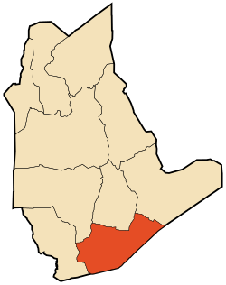 Location of In Guezzam commune within Tamanrasset Province | |
 In Guezzam Location of In Guezzam within Algeria | |
| Coordinates: 19°34′7″N 5°46′20″E / 19.56861°N 5.77222°ECoordinates: 19°34′7″N 5°46′20″E / 19.56861°N 5.77222°E | |
| Country |
|
| Province | Tamanrasset |
| District | In Guezzam (coextensive) |
| Government | |
| • PMA Seats | 7 |
| Area | |
| • Total | 46,813 km2 (18,075 sq mi) |
| Elevation | 400 m (1,300 ft) |
| Population (2008)[1] | |
| • Total | 7,045 |
| • Density | 0.15/km2 (0.39/sq mi) |
| Time zone | CET (UTC+01) |
| Postal code | 11130 |
| ONS code | 1104 |
In Guezzam (Arabic: عين قزام, lit. springs of Guezzam; Berber spelling: Gezzam) is a town and commune, and coextensive with In Guezzam District, in Tamanrasset Province, Algeria, on the border with Niger. The border town on the Niger side is Assamaka. According to the 2008 census it has a population of 7,045,[1] up from 4,938 in 1998,[2] with an annual growth rate of 3.7%, the second highest in the province.[1]
Geography
In Guezzam lies in the barren Tanezrouft region of far southern Algeria. The landscape is sandy, with frequent sand dunes interspersed with sandstone outcrops.
Climate
In Guezzam has a hot desert climate (Köppen climate classification BWh), with long, extremely hot summers and short, very warm winters. Despite an extremely dry climate, some occasional rainfall occur during the months of August and September due to the influence of the far northern edge of the West African Monsoon, unlike most of the Algerian Desert. Averages high temperatures soar during the height of the long summer season, with daytime highs always over 40 °C (104 °F) during nearly 4 months and even above 45 °C (113 °F).
| Climate data for In Guezzam | |||||||||||||
|---|---|---|---|---|---|---|---|---|---|---|---|---|---|
| Month | Jan | Feb | Mar | Apr | May | Jun | Jul | Aug | Sep | Oct | Nov | Dec | Year |
| Average high °C (°F) | 26.5 (79.7) |
29.3 (84.7) |
33.7 (92.7) |
38.3 (100.9) |
41.0 (105.8) |
41.6 (106.9) |
40.1 (104.2) |
39.0 (102.2) |
38.9 (102) |
37.0 (98.6) |
32.6 (90.7) |
28.4 (83.1) |
35.53 (95.96) |
| Daily mean °C (°F) | 18.6 (65.5) |
21.1 (70) |
25.3 (77.5) |
30.1 (86.2) |
33.3 (91.9) |
34.6 (94.3) |
33.3 (91.9) |
32.4 (90.3) |
31.8 (89.2) |
29.3 (84.7) |
24.6 (76.3) |
20.6 (69.1) |
27.92 (82.24) |
| Average low °C (°F) | 10.7 (51.3) |
13.0 (55.4) |
17.0 (62.6) |
22.0 (71.6) |
25.6 (78.1) |
27.6 (81.7) |
26.5 (79.7) |
25.9 (78.6) |
24.8 (76.6) |
21.6 (70.9) |
16.6 (61.9) |
12.8 (55) |
20.34 (68.62) |
| Average rainfall mm (inches) | 0 (0) |
0 (0) |
0 (0) |
0 (0) |
1 (0.04) |
3 (0.12) |
7 (0.28) |
23 (0.91) |
9 (0.35) |
0 (0) |
0 (0) |
0 (0) |
43 (1.7) |
| Source: Climate-data.org | |||||||||||||
Transportation
In Guezzam lies on the Trans-Sahara Highway, at the end of the N1 Algerian national highway, which leads north to Tamanrasset and eventually Algiers. The road continues southeast to Arlit in Niger. In Guezzam is also served by In Guezzam Airport, which is, however, closed for public usage.[3]
Education
1.7% of the population has a tertiary education (the equal lowest rate in the province), and another 4.9% has completed secondary education.[4] The overall literacy rate is 39.4%, and is 50.7% among males and 29.1% among females; all three rates are the lowest in the province.[5]
Localities
The commune is composed of six localities:[6]
- In Guezzam
- In Azaoua
- Laouni
- In Ataye
- Garet Nous
- Hassi In Tafouk
References
- 1 2 3 "Population: Wilaya de Tamanrasset" (PDF) (in French). Office National des Statistiques Algérie. Retrieved 30 May 2013.
- ↑ "Algeria Communes". Statoids. Retrieved 8 March 2013.
- ↑ "In Guezzam Airport". OurAirports. Retrieved 11 June 2013.
- ↑ "Structure relative de la population résidente des ménages ordinaires et collectifs âgée de 6 ans et plus selon le niveau d'instruction et la commune de résidence." (PDF) (in French). Office National des Statistiques Algérie. Retrieved 30 May 2013.
- ↑ "Taux d'analphabétisme et taux d'alphabétisation de la population âgée de 15 ans et plus, selon le sexe et la commune de résidence ." (PDF) (in French). Office National des Statistiques Algérie. Retrieved 30 May 2013.
- ↑ "Décret n° 84-365, fixant la composition, la consistance et les limites territoriale des communes. Wilaya de Tamanghasset" (PDF) (in French). Journal officiel de la République Algérienne,. 19 December 1984. p. 1496. Archived from the original (PDF) on 2 March 2013 or before. Retrieved 2 March 2013. Check date values in:
|archive-date=(help)
 |
Adrar In Salah |
Tamanrasset Amsel |
Djanet (Illizi) | |
| Tin Zaouatine | |
Iferouane (Niger) | ||
| ||||
| | ||||
| Ménaka (Mali) | Tahoua Tamanrasset |
Assamaka (Niger) Arlit (Niger) |
| Tamanrasset District |  | |||||||
|---|---|---|---|---|---|---|---|---|
| In Salah District | ||||||||
| Tazrouk District | ||||||||
| Abalessa District | ||||||||
| In Ghar District | ||||||||
| Tin Zaouatine District | ||||||||
| In Guezzam District | ||||||||