In Salah
| In Salah إن صالح Aïn Salah; I-n-Salah; 'Ayn Şalih | |
|---|---|
| Commune and town | |
|
City gate of In Salah. | |
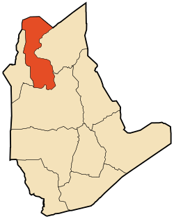 Location of In Salah commune within Tamanrasset Province | |
 In Salah Location of In Salah commune within Tamanrasset Province | |
| Coordinates: 27°11′42″N 2°29′0″E / 27.19500°N 2.48333°ECoordinates: 27°11′42″N 2°29′0″E / 27.19500°N 2.48333°E | |
| Country |
|
| Province | Tamanrasset Province |
| District | In Salah District |
| Area | |
| • Total | 32,518 km2 (12,555 sq mi) |
| Elevation | 293 m (961 ft) |
| Population (2008)[1] | |
| • Total | 32,518 |
| • Density | 1.0/km2 (2.6/sq mi) |
| Time zone | CET (UTC+1) |
| PMA seats (as of 2007) | 11 |
| ONS code | 1108 |
| Postal code | 11220 |
.jpg)
In Salah or Ain Salah (Arabic: عين صالح) is an oasis town in central Algeria. It was once an important trade link of the trans-Saharan caravan route. As of the 2008 census it has a population of 32,518,[1] up from 28,022 in 1998,[2] with an annual growth rate of 1.5%, the lowest in the province.[1] The village is located in the heart of the Sahara Desert region of northern Africa. The name In Salah comes from the term "good well"[3] although the water is known for its rather unpleasant, salty taste.
Geography
A creeping sand dune on the western edge of town is advancing on the city and cuts In Salah in half. The dune is moving at a speed of approximately one meter (three feet) every five years. As buildings are covered by its leading edge, structures at the back of the dune are being gradually uncovered. When a formerly covered location at the back of the dune once again becomes free, it is established who the past owners were and the building is restored and moved into by relatives. Four red or violet clay brick ksour (walled villages) are found in the oasis, each having its own citadel.[3]
Climate
In Salah has a hot desert climate (Köppen climate classification BWh), with long, hot summers and short, warm winters, and averages just 16 millimetres (0.63 in) of rainfall per year. Summer temperatures are consistently high as they commonly approach 50 °C (122 °F) but temperatures at night fall low enough to around 30 °C (86 °F). Even in early May or in late September, daytime temperatures can easily soar to 45 °C (113 °F). In Salah experiences the same kind of desert heat as Death Valley, California during summertime. Winter nights can be chilly and frost is by no means unknown but the days are pleasantly warm, sunny and dry.[4] During the summer, the Sahara region of Algeria is the source of a scorching, sometimes dusty and southerly wind called the Sirocco. These winds parch the plateaus of northern Algeria up to 40 days and reach the Tell coastal region for as many as 20 days.[5] In Salah has recorded at least 35 °C (95 °F) in every month of the year including January and December as the absolute records high temperatures are respectively 35 °C (95 °F) and 36 °C (96.8 °F) for these two months.[6] The absolute records low temperatures are below the freezing point, with - 4 °C (24.8 °F) recorded in January and - 1 °C (30.2 °F) recorded in both February and December, although freezing temperatures are very rare and don't occur each year[6] Average annual relative humidity is low with only 24%. The sky is clear all year and cloudy days are very rare. Thereby, the solar irradiation is among the highest found on the planet and the annual sunshine duration is estimated between 3,700 h and 4,000 h. In Salah is often quoted as one of the hottest spots worldwide. With Adrar and Reggane, In Salah forms the "Triangle of Fire" as local inhabitants say due to the extreme desert heat that bakes the region from May to September.[7]
| Climate data for In Salah (2000 - 2015) | |||||||||||||
|---|---|---|---|---|---|---|---|---|---|---|---|---|---|
| Month | Jan | Feb | Mar | Apr | May | Jun | Jul | Aug | Sep | Oct | Nov | Dec | Year |
| Average high °C (°F) | 22.3 (72.1) |
25.1 (77.2) |
30.5 (86.9) |
35.2 (95.4) |
39.6 (103.3) |
43.8 (110.8) |
46.4 (115.5) |
45.2 (113.4) |
41.9 (107.4) |
36.2 (97.2) |
28.0 (82.4) |
23.2 (73.8) |
34.64 (94.35) |
| Daily mean °C (°F) | 14.7 (58.5) |
17.2 (63) |
22.4 (72.3) |
26.6 (79.9) |
31.4 (88.5) |
35.7 (96.3) |
38.5 (101.3) |
37.6 (99.7) |
34.3 (93.7) |
28.8 (83.8) |
20.6 (69.1) |
16.0 (60.8) |
26.84 (80.31) |
| Average low °C (°F) | 7.3 (45.1) |
9.6 (49.3) |
14.1 (57.4) |
18.2 (64.8) |
23.2 (73.8) |
27.5 (81.5) |
30.7 (87.3) |
30.1 (86.2) |
26.7 (80.1) |
21.3 (70.3) |
13.2 (55.8) |
8.8 (47.8) |
19.06 (66.31) |
| Average precipitation mm (inches) | 3.7 (0.146) |
3.5 (0.138) |
1.2 (0.047) |
1.6 (0.063) |
0.5 (0.02) |
0.1 (0.004) |
0.0 (0) |
0.5 (0.02) |
0.2 (0.008) |
1.2 (0.047) |
0.5 (0.02) |
2.7 (0.106) |
15.7 (0.619) |
| Average relative humidity (%) | 41.3 | 35.0 | 27.2 | 22.8 | 17.9 | 13.1 | 11.9 | 12.4 | 16.2 | 23.5 | 30.9 | 41.9 | 24.51 |
| Mean daily sunshine hours | 8.9 | 9.4 | 10.6 | 11.1 | 11.4 | 11.6 | 12.2 | 11.9 | 10.9 | 9.9 | 9.3 | 8.5 | 10.48 |
| Percent possible sunshine | 83 | 84 | 86 | 88 | 89 | 90 | 91 | 90 | 89 | 86 | 88 | 82 | 87.2 |
| Source #1: Arab Meteorology Book[8] | |||||||||||||
| Source #2: Global climatology for In Salah, Algeria (2000 - 2015)[9] | |||||||||||||
Transport
Air flights via In Salah Airport connect the town with the capital Algiers and other major cities in Algeria.[10] The Bus station of In Salah hosts buses going to the north and south. There is a hotel, a restaurant, an internet cafe and two camping sites located in the city and surrounding area. The town lies at the junction of the Trans-Sahara Highway (also known as the N1 national highway), which leads north to Ghardaïa and Algiers and south to Tamanrasset, and the N52, which leads west to In Ghar and Reggane.
Economy

Aside from oil and gas reserves, the primary economic activities of In Salah are agricultural in nature with irrigation being supplied by artesian wells. The oasis has over 200,000 date palms. The chief produce are dates, fruits and vegetables. Fruit and vegetable gardens and Palm groves flank the village on its southern and western edges. These groves are protected from the always advancing sand by hedges.[3] In Salah is also a centre for nomadic Tuareg.[11] The In Salah oil and gas fields are home to the In Salah Project, a major component of which includes a facility to remove CO2 from the gas produced. The CO2 is then re-injected into an underground formation.[12]
Historically, In Salah was formerly a trading town which dealt in slaves, ivory and gold from the south. These goods were exchanged with European goods from the north.
Education
6.7% of the population has a tertiary education (the highest rate in the province), and another 20.1% has completed secondary education.[13] The overall literacy rate is 80.1%, and is 88.7% among males and 71.4% among females.[14]
Localities
The commune is composed of 11 localities:[15]
- In Salah
- Ksar Laarab
- Ksar Lemrabtine
- Deghamcha
- El Barka
- Igostène
- Hassi Lahdjar
- Ez Zaouia H. Sidi Belkacem
- Sahla Tahtania
- Sahla Fougania
- Tadjemout
External links
- Google Maps World Gazateer
- http://www.tutiempo.net/en/Climate/IN-SALAH/606300.htm Historical weather records for In Salah
| Wikimedia Commons has media related to In Salah. |
References
- 1 2 3 "Population: Wilaya de Tamanrasset" (PDF) (in French). Office National des Statistiques Algérie. Retrieved 30 May 2013.
- ↑ "Algeria Communes". Statoids. Retrieved 8 March 2013.
- 1 2 3 "I-n-Salah." Encyclopædia Britannica. 2008. Encyclopædia Britannica Online. 13 Dec. 2008
- ↑ The Times Books World Weather Guide, E.A Pearce and C.G. Smith, TIMES BOOKS, The New York Times Book Co., Inc.
- ↑ The World Book Encyclopedia. Chicago: Scott Fetzer Co., 2007.
- 1 2 http://www.atmosphere-climat.com/algerie/in-salah/insalah.html
- ↑ http://www.3emegroupedetransport.com/Regganesouffredechaleur.htm
- ↑ "Meteorological Data" (PDF). Retrieved 31 May 2013.
- ↑ "In-Salah, Algeria". Infoclimat. Retrieved 31 May 2013.
- ↑ "Routes to/from In Salah Airport". OurAirports. Retrieved 31 May 2013.
- ↑ http://lexicorient.com/e.o/in_salah.htm Lixi
- ↑ http://www.co2captureandstorage.info/project_specific.php?project_id=71
- ↑ "Structure relative de la population résidente des ménages ordinaires et collectifs âgée de 6 ans et plus selon le niveau d'instruction et la commune de résidence." (PDF) (in French). Office National des Statistiques Algérie. Retrieved 30 May 2013.
- ↑ "Taux d'analphabétisme et taux d'alphabétisation de la population âgée de 15 ans et plus, selon le sexe et la commune de résidence ." (PDF) (in French). Office National des Statistiques Algérie. Retrieved 30 May 2013.
- ↑ "Décret n° 84-365, fixant la composition, la consistance et les limites territoriale des communes. Wilaya de Tamanghasset" (PDF) (in French). Journal officiel de la République Algérienne,. 19 December 1984. p. 1496. Archived from the original (PDF) on 2 March 2013 or before. Retrieved 2 March 2013. Check date values in:
|archive-date=(help)

| Tamanrasset District |  | |||||||
|---|---|---|---|---|---|---|---|---|
| In Salah District | ||||||||
| Tazrouk District | ||||||||
| Abalessa District | ||||||||
| In Ghar District | ||||||||
| Tin Zaouatine District | ||||||||
| In Guezzam District | ||||||||