IGN FI
|
| |
| Public limited company | |
| Industry | Geographic information |
| Founded | 1986 |
| Headquarters | Paris, France |
Key people | Christophe DEKEYNE, General Manager |
Number of employees | 27 |
| Website | www.ignfi.com |
Founded in 1986, IGN FI has since become a leader in the design and implementation of international geomatic projects. IGN FI offers its expertise in the following areas: geodesy, metrology, mapping/national spatial data infrastructures, databases, geographic information systems, portals.
IGN FI, part of Groupe FIT, works in partnership with IGN France (National institute of geographical and forestry information ) on its projects abroad.
Fields of expertise
IGN FI offers its expertise and works on developing projects, from the simplest to the most complex. Thanks to its vast network of partners, the company proposes a full range of services in the following areas:
- Geodesy: construction of geodesic networks, permanent stations, levelling work, geodic calculations, surveillance of civil engineering structures, metrology
- Data acquisition: aerial photography, satellite images, LiDAR, drones, land surveys, data conversion (scanning, georeferencing, vectorisation)
- Data processing: orthophotographs, digital or elevation land models, 2D or 3D photogrammetric recovery, data bases (modelling, structuration), 3D models
- Spatial data infrastructures: implementation and supervision
- Mapping and remote detection: mapping at different scales, land occupation maps and diachronic analyses
- Development of geographic portals, themed GIS or sectorial applications
- Land management information system: analysis, design, development, data integration, deployment
- Supply of equipment and software: installation and supervision of production lines
- Training and skills transfer
- Advisory services and preliminary studies
Clients and methods of intervention
IGN FI supports its clients (national mapping agencies, foreign technical ministries, local authorities, large companies that are active abroad...) in getting the most out of their geographical information, right from the definition of strategies and public policies up to implementing the projects themselves by transferring skills.
Project design and management
IGN FI covers projects in all their stages, offering a complete range of services including data production and processing, systems development, technologies and know-how transfers, providing turnkey solutions, ensuring the testing and implementations stages, communication and change management activities …
Technical and operational support
IGN FI provides technical support from the strategy definition phase up to the actual implementation of actions ( background studies, functional needs analysis, expertise, auditing, quality controls, search for financing, monitoring, steering and assistance for project execution…)
Feasibility studies/ supervision
IGN FI studies project feasibility, creates master plans in the field of geographical information, schedules investments and supervises projects.
IGN FI is registered with multilateral banks and entities working in bilateral public funding and is referenced with numerous public and private entities in the countries where the company operates.
Sectors of application
The geographic information and reference data which are an intrinsic part of all major projects, are a key element in decision-making at the highest levels. As a major player in the field of geomatics, IGN FI offers its services in several fields:
- Mapping & spatial data infrastructure
- Geodesy & metrology
- Cadastre/ land registry / land valuation
- Agriculture & forests
- Environment & risk management
- Defence / civil security / borders
Mapping - Spatial Data Infrastructure (SDI)
_%C3%A0_partir_d%E2%80%99images_satellites%2C_cr%C3%A9ation_de_produits_d%C3%A9riv%C3%A9s_et_modernisation_de_l%E2%80%99IGM_Extrait_Sikasso_-_Copie.jpg)
IGN FI offers to accompany its clients throughout all the phases of their SDI and mapping projects: the current situation on data already available, technical aspects (from the initial collection of data to its update) and organizational issues (transfer of technology, coordination, etc.)
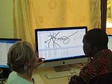
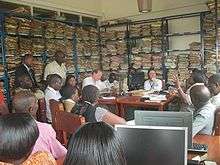
MALI • Updating mapping at a scale of 1:200,000 and modernization of the National Mapping Institute[1]
Creation of a database and a new topographic map to a scale of 1:200,000 using SPOT 6 satellite images with national coverage in order to produce a common and coherent reference framework for mapping. A 1:1,000,000 derived map, a geoportal, a database for land use as well as maps for the country’s 28 main towns were also created. All this work was carried out at the Geographical Institute in Mali with technical assistance from IGN FI.
IGN FI has also worked on projects to update national maps and build on the capacities of the Geographical Institutes in Senegal and Burkina Faso[2] and a project on updating the cartography at a scale of 1:50.000, 1:200.000 and 1:600.000 has been carried out in Benin.[3]
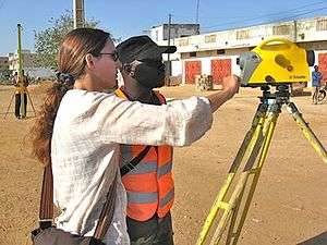
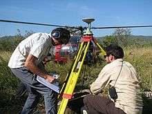
Geodesy – Metrology
With support from the Geodesy and Levelling department at IGN (National Institute of Geographic and Forest Information) which is internationally recognized for its scientific knowledge and practical experience, IGN FI offers its services in the fields of geodesy and metrology.[4]
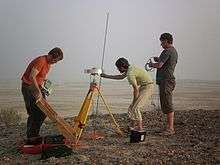
SUDAN • Installation of a materialized geodetic network for the creation of dams along the Nile
The Dams Implementation Unit conferred IGN FI with the task of calculating 14 reference points along the 1,500 km section of the Nile running through Sudan, all linked to international geodetic references with more than 1,000 detailed points. These points were calculated using GPS and level indicator devices as well as gravimetry for some and resulted in a set of identified points with centimetre accuracy as well as a geoid model, also of centimetre accuracy for the entire area covered by the project.
Land Surveying - Land registry - Land evaluation
IGN FI has developed expertise in this field which is recognized worldwide and offers individual solutions adapted to each issue encountered.
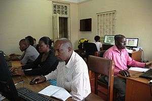
UGANDA • Implementation and roll-out of a national land information system[5]
Between 2010 and 2014, IGN FI was responsible for the design, supply and implementation of a land information system (LIS) for 6 decentralized ministry offices in charge of issues concerning land as well as the creation of a National land information centre.
The World Bank chose IGN FI in 2015 to roll out an efficient, reliable and transparent information system on a national scale.
All in all, 21 districts were involved with over 600,000 deeds and plots to be vectorised, indexed and updated, as well as 90,000 maps existing in paper format only to be scanned and vectorised. Training on the new tools and procedures (information technology, GIS and LIS) was also given to more than 300 people. The project will come to an end in 2018.
Environment - Risk management - Environmental accounting
IGN FI can assist any type of entity wishing to obtain coherent and integrated environmental data and the tools enabling them to use the data as well as to improve its skills via specific, tailored training.
.jpg)
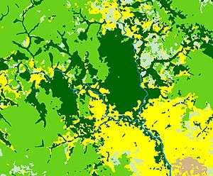
CENTRAL AND WESTERN AFRICA • Monitoring land cover dynamics using satellite images[6]
With the support of IGN, the CNES (National Spatial Studies Centre) and the French Research and Development Institute (IRD), IGN FI coordinated a vast spatial observation programme funded by the AFD (French Agency for Development). The first phase (OSFT,[7] from 2011 to 2015) enabled IGN FI to collect recent SPOT satellite images covering over 3 million km² around the Congo Basin and to distribute them to over a hundred developers working on projects for the sustainable management of forests. The programme also created forest maps in line with the IPCC (Intergovernmental panel on climate change) recommendations and contributed to reinforcing the skills of teams in the recipient countries.[8]
The next phase started in 2016 (OSFACO[9]) and continues to acquire and disseminate images of the Congo basin but has also extended the project to Guinea, the Ivory Coast and Benin. The programme also aims to provide support to the local production of land cover maps as well as reinforce skills and build up funding for micro-projects.
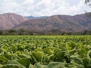
Agriculture - Forests
IGN FI offers its services to produce and update a country’s geographical data, develop information systems per trade and decision-making tools. The organization can also help countries to perform the same work themselves by providing assistance in project management.
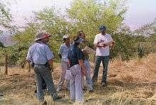
CENTRAL AMERICA AND THE CARIBBEAN • Hydrological and environmental monitoring[10]
IGN FI led a project for the French ministry of the Environment which aimed to improve awareness of the importance of the European CORINE project (COoRdination of INformation on the Environment). The project ran from 1993 to 2003 and was aimed at the Central American and Caribbean Isthmus countries. A feasibility study on the Rio-Lempa basin was carried out as part of the project in order to adapt the CORINE Land Cover classification to the region’s specific characteristics and launch environmental applications from the database. Funding was then obtained to extend the database to cover the whole territory of El Salvador.
Defence - Civil security
IGN FI offers technical solutions, adapted and reliable tools which take into consideration the complete set of data concerning each territory.[11][12]
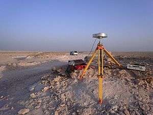
QATAR / SAUDI ARABIA • Marking out the international border and determining borders[13]
A political agreement based on the demarcation of the two countries common border was signed by Saudi Arabia and Qatar.
Mindful of the importance of working with an independent entity, both countries’ governments confided IGN FI with the job of marking out the exact position on the ground of the 6 main border points, the actual demarcation of the border and creating detailed maps on various scales of the whole border area.
IGN FI's structure
IGN FI is based in Paris and is made up of around 27 employees.
Local branches are also set up punctually to accompany the projects that it leads abroad. In addition to the technical skills that it possesses internally, IGN FI can also count on the IGN experts that are often called upon for its projects, as well as its network of institutional or private partners.
Notes and references
- ↑ "Reportage sur le projet concernant la nouvelle cartographie du Mali". JT ORTM, The Office of Radio and Television of Mali.
- ↑ "New maps for a new millennium- 28/07/2016". Geoconnexion.
- ↑ "La cartographie de base numérique, un outil d'aide à la décision et à usages multiples" (in French).
- ↑ "One continent, one representation". October 2016.
- ↑ "National Land Information System (NLIS) Uganda".
- ↑ "Afrique centrale : photographier les forêts par satellite pour mieux les protéger". Le monde (in French).
- ↑ "Description de l'initiative OSFT" (in French). AFD.
- ↑ "New French Satellite Imagery to Help Forest Management in the Congo Basin". World Resource Institute. July 30, 2014.
- ↑ "OSFACO" (in French).
- ↑ "HYDROLOGICAL AND ENVIRONMENTAL STUDY (SHERPA) – CENTRAL AMERICA AND CARIBBEAN" (PDF).
- ↑ "Ship shape". Geoconnexion.
- ↑ "Over the borderline". Geoconnexion.
- ↑ "DEMARCATION OF THE LAND BORDERS AND DETERMINATION OF OFFSHORE BORDER LINES – SAUDI ARABIA/QATAR" (PDF).